Manabí Mangroves
The roots arc above the tidal mud like architectural ribs, grey and woven, clearing salt from the sea and holding the coastline in place against storm surges that would otherwise scour the land. For millions of years the mangroves of coastal Ecuador did this work quietly, turning seawater into fresh breeze and providing nurseries for shrimp, fish, and the migratory birds that move up and down the Pacific flyway. Then in the 1970s and 1980s, the shrimp farms came, and the forests fell. The Manabi mangroves now carry the designation Critical/Endangered from the World Wide Fund for Nature. Thirty-eight percent of what remains is in critical condition.
Two Sub-Regions on One Coast
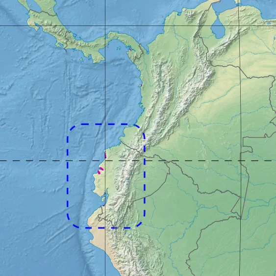
The ecoregion covers about 400 square miles along Ecuador's Pacific coast, split into two sub-regions separated by a stretch of dry coast where no mangroves grow. The northern Cojimies sub-region stretches through Esmeraldas Province between the Muisne River and the town of Pedernales, with additional pockets around the Mache River estuary. The southern Chone sub-region sits in Manabi Province itself, running from Bahia de Caraquez and the Chone River south to the Portoviejo River. Both sub-regions are fed by freshwater rivers: the Muisne delivers 22 cubic meters per second, the Chone 31 cubic meters per second. That freshwater mixing with salt is what the mangroves need.
The Shrimp Farm Catastrophe
Ecuador's shrimp industry built its early success on mangrove destruction. Through the 1970s and 1980s, farmers cleared vast tracts of mangrove forest to build the shallow coastal ponds where Pacific white shrimp would be raised for export. The ecological damage was enormous. In 1985, the Ecuadorian government banned the construction of new shrimp farms in or near mangroves, but the damage to the Cojimies sub-region was already done. As of 1999, the northern mangroves had lost 1,162 hectares to farming, with shrimp farms then covering 668 hectares of former forest. Then came the irony: a viral disease swept through the shrimp industry in the late 1990s, killing stock and bankrupting farmers. Many of the people who depended on the farms lost their livelihoods. In the Chone sub-region, the abandoned farms have allowed some mangroves to recover, with 903 hectares of forest expanding while shrimp farm area shrank by 285 hectares.
Six Species and a Tea Mangrove
The forest here is not diverse by rainforest standards, but each species plays a specific role. Black mangrove, red mangrove, and mangle caballero dominate the wettest zones where tidal flooding is constant. Further inland, where the soil is firmer, button mangrove, white mangrove, and tea mangrove take over. That last species, known scientifically as Pelliciera rhizophorae, is endemic to the Chone sub-region. It grows nowhere else in the world. Above the canopy, orchids and bromeliads cling to the branches, pulling moisture from the humid air. Cacti, improbably, cling to the drier edges. Red algae and mosses finish out the community. The trees appear repetitive from a boat, but each leaf is part of a system that took evolution several million years to balance.
A Corridor for Jaguars
The fauna of the mangroves runs the full vertical column. In the mud, nematodes and polychaete worms break down mangrove detritus into protein that feeds crabs and small fish. Larger fish and shrimp migrate through the roots during their reproductive cycles, using the tangled roots as nursery protection from predators. The crab-eating raccoon hunts at the waterline. Green iguanas drape themselves across low branches. Howler monkeys and white-headed capuchins move through the canopy where the mangroves meet drier forest. The jaguar occasionally passes through, moving between forest fragments along the coast. Above, 42 bird species use the mangroves, including brown pelicans and magnificent frigatebirds. Migratory shorebirds rest in the root systems during their long flights along the Pacific flyway, and seriously threatened species depend on what fragments of this coastline remain intact.
Conservation Without Protection
Despite their ecological importance, the Manabi mangroves sit in an unusual legal limbo. In 1989, the National System of Protected Areas declared them a priority, but no protected area formally covers them. Enforcement of the 1985 shrimp farm ban has been uneven. Sedimentation caused by overgrazing in the upland watersheds continues to damage the Chone sub-region. Urbanization, highway and port construction, and waste disposal add further pressure. The work of conservation has largely fallen to non-governmental organizations. The Congal Biomarine Station, a 210-hectare private reserve near the Muisne River estuary, is one of the bright spots, protecting mangrove wetlands while developing community-based sustainable use models. It is an experiment in what conservation can look like when the government cannot or will not provide it. The trees themselves, when left alone, do the rest.
From the Air
The Manabi mangroves are centered at approximately 0.65 degrees south, 80.37 degrees west, along Ecuador's Pacific coast. The two sub-regions extend through Esmeraldas and Manabi provinces. Eloy Alfaro International Airport (ICAO: SEMT) at Manta lies about 70 kilometers south of the Chone sub-region. From altitude the mangroves appear as dark green estuarine forests with characteristic tangled water channels, contrasting with the lighter rectangular patterns of former and current shrimp farms. Recommended viewing altitude 5,000 to 10,000 feet.
Nearby Stories
- Portoviejo 24 km away
- Western Ecuador Moist Forests 31 km away
- Jama-Coaque Ecological Reserve 35 km away
- Buena Fe Canton 47 km away
- Jatun Sacha Foundation 78 km away
- Salinas (Ecuador) 178 km away
- Malpelo Plate 401 km away