Salinas (Ecuador)
La Chocolatera is the westernmost point of mainland Ecuador, a rocky headland where the Pacific meets the continent in a way that looks designed by someone who wanted drama. Waves crash against cliffs. Sea lions laze on rocks below. The Humboldt Current, which swept up from Antarctica, runs into warmer equatorial water here, and the collision produces some of the most consistent surf on the continent. Salinas is the city that grew up around this point, a resort for Guayaquileños escaping the sticky heat of the inland summer. From December through May, the city doubles in population on weekends. The rest of the year, it quiets down, though the waves and the whales keep arriving on their own schedule.
The Air Force Base and the Point
La Chocolatera sits on Ecuadorian Navy property, inside the Base Naval de Salinas, but tourists are allowed in with nothing more than an ID check at the gate. The base was strategically important during the twentieth century, guarding the northwestern approach to the country, and it still is, but the navy has learned to coexist with the tourism economy that has grown around its perimeter. The headland itself offers a panorama that goes on forever: open ocean to the west, sea lions on the rocks below, pelicans skimming the waves. Surfers arrive at low tide for the left-breaking waves that form here, which are excellent but experienced-only. The bluff is not a swimming beach. The currents are dangerous and the rocks unforgiving. What it is instead is a viewpoint, the continental edge, the place where South America gives up and lets the Pacific do what the Pacific does.
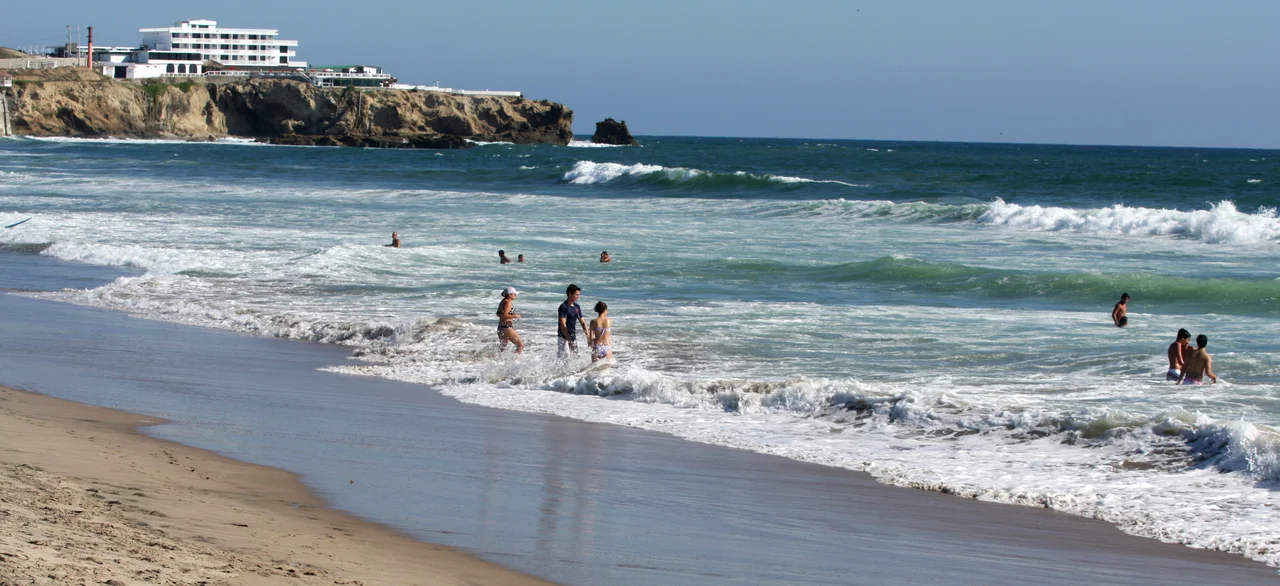
Punta Carnero and the Surfers
Punta Carnero, a ten-minute drive from Salinas, is where the surfers actually go to surf. The beach runs 2.6 kilometers of fine sand between a rocky headland at its southeastern end, and the waves are remarkably consistent year-round. Water temperatures average 24 degrees Celsius. Other nearby surf breaks include Chulluype and Mar Bravo, and Punta Carnero has hosted international surf competitions multiple times. The waves here are strong enough to be challenging and consistent enough to be reliable, which is a rare combination. The sun is intense; SPF 50 is not optional. The wind comes off the ocean in the afternoon and sometimes sand-blasts the less prepared. Surfers love it for those same conditions. The sunset from Punta Carnero, when the sky fills with orange and pink and the waves keep rolling in unchanged, is among the best on the Ecuadorian coast.
The Humpback Season
From June through October, humpback whales gather in the warm waters off the coast of Ecuador for their annual mating and calving. Whale-watching boats leave from Salinas and other coastal towns throughout the season, and tours often run up toward Machalilla National Park, the protected marine area centered around Puerto Lopez and Isla de la Plata. Songs of the males, which can last twenty minutes, carry through the hulls of the boats, a sound that no amount of description quite prepares you for. Mothers with newborn calves swim close to the surface. Acrobatic breaches are common; pairs or small pods rise almost entirely out of the water before crashing back down in explosions of foam. Expert guides accompany most tours, and the whale season is the single most distinctive experience the central Ecuadorian coast offers. Bird watching is a natural companion, with Punta Carnero supporting a varied population of seabirds and shorebirds.
Ceviche and the Malecon
The Malecon, Salinas's beachfront promenade, is where the city assembles at night. Cevicheria after cevicheria serves shrimp ceviche and arroz marinero, the seafood-and-rice dish that defines coastal Ecuadorian cooking. Mar y Tierra is among the most established restaurants in town, a name that locals cite when asked where to eat. Cevichelandia and la Lojanita, on the street one block back from the Malecon, compete for the title of best cheap ceviche. Carloncho on the main promenade serves one of the better arroz con menestra, the rice-and-lentils combination that turns up on every coastal menu. Pilsener and Pilsener Light flow through the evening. Artisans selling jewelry made from shells and other local materials line the Malecon, and the nightclubs open late. In 2023, reports of motorcycle-based crime targeting tourists increased, and travelers are advised to take normal precautions after dark.
From the Air
Located at 2.22 degrees south, 80.95 degrees west, on the westernmost point of continental Ecuador in Santa Elena province. From altitude Salinas appears as an urban beachfront on a curved bay, with La Chocolatera headland projecting west and the La Puntilla peninsula enclosing the harbor. General Ulpiano Paez Airport (SESA) serves Salinas, though commercial flights are limited. Most visitors fly into Jose Joaquin de Olmedo International (SEGU) in Guayaquil, about 124 kilometers to the east, and drive or take the Via a la Costa road. The climate is semi-arid with limited rainfall year-round. Best visibility is reliably consistent throughout the dry season from May through December.
Nearby Stories
- Pedro Carbo Canton 33 km away
- Montañita 34 km away
- Pedro Carbo 52 km away
- 2023 Guayas earthquake 90 km away
- Battle of Punta Malpelo 130 km away
- Malpelo Island 660 km away
- San Cristóbal (Galápagos) 885 km away
- Easter Island: The Mystery of Rise and Collapse 4032 km away