.jpg)
Mato Grosso Tropical Dry Forests
The map gives it a code - NT0140 - as if it were a file number, but on the ground it is one of the largest forest ecosystems on Earth most people have never heard of. The Mato Grosso tropical dry forests spread across 41.3 million hectares of central Brazil, roughly the size of California and Florida combined. This is the forest that stops being Amazon and is not quite Cerrado; a transitional belt where the great rainforest shades into the dry savanna of the Brazilian highlands. It is a boundary with its own ecology, its own creatures, and since the 1970s, its own long emergency.
Where the Amazon Gives Way
Fly south from the Amazon basin and the canopy below begins to open. Trees shorten, gaps widen, and patches of grassland appear between the forest stands. This is the Mato Grosso dry forest in its native logic. It is not one continuous cover but a mosaic - dry forest, gallery forest along the rivers, savanna patches on the ridges, dense thicket in the lowlands. The ecoregion reaches mostly across northern Mato Grosso state and spills into southern Amazonas, southern Para, and parts of Tocantins and Maranhao. In the northwest it meets the Madeira-Tapajos and Tapajos-Xingu moist forests; in the south and east it hands off to the Cerrado proper.
Three Ranges and a River's Source
The terrain is not flat. The Serra do Cachimbo cradles the northeastern edge, the Serra dos Caiabis and Serra Formosa break the eastern horizon. All three are well-drained savanna ridges that sit higher than the surrounding plain. This is where the Xingu River begins - the Alto-Xingu, the upper drainage that will travel 2,000 kilometers north before it meets the Amazon. The central and western reaches of the ecoregion drain between the Serra do Roncador and the Serra do Formosa, and during the wet season from December to May whole stretches flood. In the dry months the porous soils drain the water off fast, leaving wetlands shrunken to pools and the dry forests crunching underfoot.
A Census of Life
In 1967 and 1968 the British Royal Society and Royal Geographical Society mounted an expedition to the upper Xingu. What they found helped define what this ecoregion meant ecologically. They recorded 46 genera of rodents, including the capybara, the world's largest. They cataloged 52 genera of bats, with Artibeus and Molossus most common, plus marsupials and edentates. They logged 161 species of birds - 60 only in the cerrado patches, 33 only in the gallery forests, 25 only in the dry forest. The Serra do Cachimbo turned out to harbor an isolated population of the caatinga antwren, a species more usually associated with northeastern Brazil. The white-cheeked spider monkey, white-nosed saki, black bearded saki, and giant otter all live here, all of them endangered, all of them tied to a habitat that is shrinking.
The Road Opens the Door
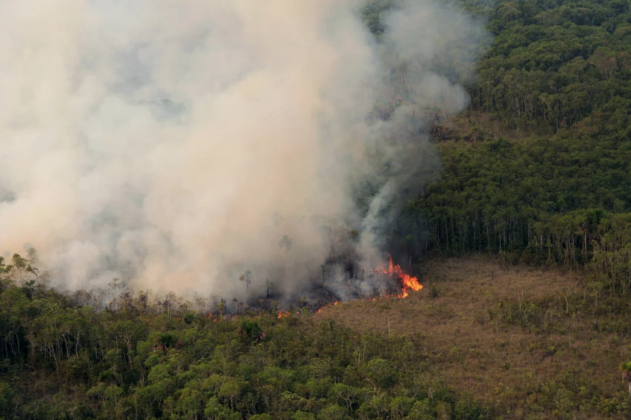
The transformation began with pavement. The BR-070 and BR-364 highways, linking Brasilia to the state of Acre, cut through the region in the 1970s and 1980s. The BR-163, running from Cuiaba north to Santarem on the Amazon, followed. Each road was both a promise and a wound. They brought ranchers, farmers, loggers, and gold prospectors. Pasture replaced forest. Soy fields replaced pasture. A gold rush in some areas left mercury in the rivers. Between 2004 and 2011 the ecoregion lost 0.76 percent of its remaining habitat each year - a rate that compounds into a quiet calamity. The World Wildlife Fund lists the status as Vulnerable, a diplomatic word for a forest being dismantled in real time.
The Xingu Refuge
Not all of it is gone, and the reason is human as much as ecological. The Xingu Indigenous Park, created in 1961 by the brothers Villas Boas, sits at the heart of the ecoregion and protects both forest and the several indigenous peoples who live within it. The park is not a fortress - it faces its own pressures from encroachment, illegal logging, and fire - but it remains one of the larger islands of intact habitat in central Brazil. Around it the highways still hum. Global warming will push tropical species uphill in search of suitable temperatures, but the deforested corridors now stand between them and the places they need to go. A forest without migration routes is a forest with a countdown. The Mato Grosso dry forests are counting.
From the Air
Centered near 11.77 S, 53.53 W in northern Mato Grosso state, Brazil. The ecoregion spans approximately 41 million hectares across northern Mato Grosso, southern Amazonas, southern Para, and parts of Tocantins and Maranhao. From cruising altitude the patchwork of forest, cleared pasture, and soy fields is visible - a mosaic that tracks recent land use as much as ecology. Nearest airports include Cuiaba (SBCY) to the south and Sinop (SBSI) within the region. Best visibility in the dry season (May-September).
Nearby Stories
- Percy Fawcett 48 km away
- Xingu Indigenous Park 51 km away
- Kuhikugu 87 km away
- Querência 96 km away
- Varig Flight 254 119 km away
- Serra do Cachimbo 143 km away
- Chapada dos Guimarães 427 km away