
Mingo Oak
The tree was already two hundred years old when Columbus made landfall. It had sprouted from an acorn around 1356, give or take a quarter century, in a cove at the base of Trace Mountain in what is now Mingo County, West Virginia. By 1931, when John Keadle and Leonard Bradshaw of Williamson finally measured it, the Mingo Oak stood more than 200 feet tall with a trunk nearly ten feet across (9 feet 10 inches in diameter) and a crown 130 feet wide. The Smithsonian Institution confirmed what the locals had long suspected: this was the oldest and largest living white oak tree in the world. It had seven years left to live.
A Cove That Was Never Cut
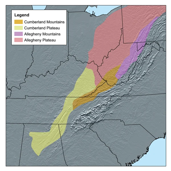
The Allegheny Plateau, west of the Appalachian crest, was carpeted with old-growth oak and chestnut forest for roughly 300 million years before European settlers reached it. Cove topography — small protected valleys closed at one or both ends — held the deepest soils and the steadiest moisture, and the white oak Quercus alba grew there to dimensions that are difficult to credit now. The Mingo Oak stood in such a cove near the headwaters of the Trace Fork of Pigeon Creek, a tributary of the Tug Fork, near the Mingo-Logan county line. By the time anyone bothered to measure it, the timber companies had cleared everything around it. The oak towered alone over secondary forest, a survivor surrounded by stumps.
Saved for Its Lifetime
The Island Creek Coal Company, the North East Lumber Company, and the Cole and Crane Real Estate Trust jointly owned the land where the tree stood. In an unusually generous gesture for the era, the three companies leased 1.5 acres around the oak to the West Virginia Game, Fish, and Forestry Commission to manage as a state park for the natural life of the tree. The Commission cleared the immediate surroundings, built picnic tables and benches, and tens of thousands of visitors came to stand under a crown that had been forming for six centuries. State forester D. B. Griffin and Emmett Keadle of the Mingo County Fish and Game Protective Association used an increment borer in September 1932 to fix the tree's birth year at roughly 1356. Boring samples went to the Smithsonian in Washington and to the West Virginia State Museum in Charleston.
What Killed It
In the summer of 1937, leaves emerged on only a few branches. In February 1938, biologist Earl M. Vanscoy wrote in the journal Castanea that the tree was almost dead. Nearby, in Trace Gap, a coal spoil tip belonging to the Island Creek Coal Company had been burning. Sulfur fumes and other gases from the smoldering waste pile drifted into the cove and poisoned the tree that had survived everything else the centuries had thrown at it. By spring 1938 no leaves appeared at all. On September 23, 1938 — a date the local papers reported with the gravity of a funeral notice — a team of woodchoppers and sawyers from the Kelly Ax and Tool Works Company felled the Mingo Oak with fanfare. The estimated weight at felling was about 5,500 tons. With the exception of West Virginia's box huckleberries, it had been the oldest living plant in the state.
What Remains
The Smithsonian received a cross-section of the trunk. So did the West Virginia State Museum. Under the terms of the lease, the land around the former tree reverted to the Island Creek Coal Company the day after the felling, and the small state park ceased to exist. The West Virginia Division of Culture and History put up a roadside historical marker; the marker has since gone missing. The cove itself is still there. The Trace Fork of Pigeon Creek still cuts its narrow channel. The stump is long gone. If you stand in that hollow today and try to picture the canopy that once filled it — 130 feet across, 60 feet deep, fed by acorns that had been falling for 582 autumns — you are trying to picture a forest that even Wikipedia struggles to describe. It is gone. The coal company stopped burning the spoil. The cove grew back to secondary forest. But there is only one Mingo Oak.
From the Air
Site coordinates: 37.82N, 82.06W, elevation roughly 1,000 feet (300 m) in a cove south of Holden, West Virginia. The Trace Fork of Pigeon Creek runs through the small valley. Recommended viewing altitude 4,500-6,000 feet MSL. From the air, the cove is one of many narrow fingers of the Trace Mountain drainage; identifying the exact site without local guidance is difficult. Nearest airports: Logan County (6L4) about 12 nm north, Williamson-Mingo (6L4) west. Mountain VFR with morning valley fog typical.
Nearby Stories
- Big Sandy Expedition 5.5 km away
- Upper Big Branch Mine Disaster 6.5 km away
- Malden Historic District 17 km away
- Paintsville, Kentucky 18 km away
- Beech Fork State Park 29 km away
- 1993 East Carter High School Shooting 34 km away
- 2002 Appalachian School of Law shooting 38 km away
- Bluefield, Virginia 48 km away