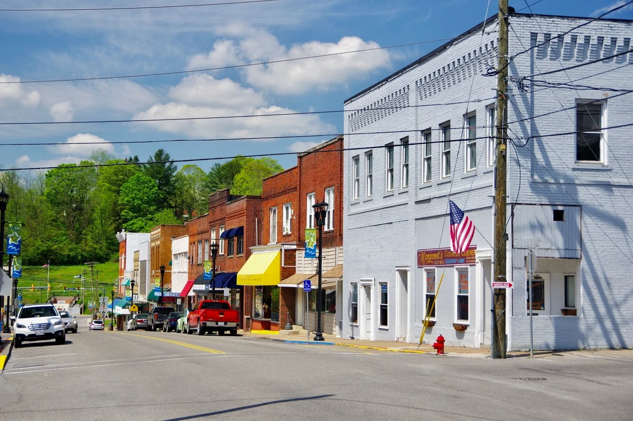

Bluefield, Virginia
On June 10, 1924, the town of Graham, Virginia, voted 287 to 223 to change its name. The new name, Bluefield, was the name of the bigger town across the state line in West Virginia — the Norfolk and Western Railway division point that had outgrown Graham by a factor of four in roughly forty years. A few days after the vote, officials of the two towns held a mock wedding ceremony in the city park. Bluefield, Virginia, married Bluefield, West Virginia. The cities still share a baseball stadium, an airport, and the name. They are still separated by a state line that runs roughly along the Bluestone River and the ridge above it.
Pin Hook, Harman, Graham
The settlement on the Virginia side started as a post office named Pin Hook in the 1860s, taking its name from a small creek. It was briefly called Harman, for a Confederate captain killed at the Battle of Cloyd's Mountain in Pulaski County in 1864. When coal was discovered in the Pocahontas field and capitalists organized to build a railroad in, the town was renamed Graham, after Colonel Thomas Graham, a Philadelphia investor. The Commonwealth of Virginia chartered Graham in 1884. The Norfolk and Western then made the decisive choice: it put its regional headquarters and main coal-classification yards on the West Virginia side, at the place that became Bluefield, West Virginia. Graham, Virginia, was left as the smaller sibling, and the growth that might have come to the Virginia side flowed across the state line.
The Wedding of the Bluefields
By 1924 Graham had about 5,000 residents and Bluefield, West Virginia, had grown to about 22,000. The Graham town leaders proposed adopting the bigger neighbor's name to capture some of its identity and its commercial gravity. The referendum passed 287 to 223 — narrow, but decisive. The mock wedding that followed was the kind of civic pageantry small American towns staged in the 1920s, with officials standing in for groom and bride and the city park acting as cathedral. The point was practical: from then on, mail, freight, and business directories would associate Graham's Virginia merchants with the larger Bluefield economy. The merger of names did not change the state line. It changed the address.
Floods, Walmart, and the Sanders House
Through the twentieth century Bluefield, Virginia, remained the smaller twin. It annexed the small town of West Graham in the 1950s. It began developing south of the historic downtown, at the foot of East River Mountain, after repeated 21st-century floods drove the town council chambers and police department out of the old flood-prone center. The new commercial belt along U.S. Route 460 includes a Walmart, the headquarters of First Community Bank, and a medical center. The historic downtown still holds the Walter McDonald Sanders House and the Alexander St. Clair House, both on the National Register of Historic Places. The Sanders house, considered one of the most significant historic homes in the city, sits below a hill where the widow of actor Lorne Greene, of Bonanza, lived for many years.
Bill Dudley, Ahmad Bradshaw, and Bowen Field
Bluefield's most famous athlete is Bill Dudley, the Pro Football Hall of Famer who played in the 1940s and 50s and remains one of the smallest players ever inducted at Canton. Ahmad Bradshaw, a two-time Super Bowl champion running back with the New York Giants, also came from Bluefield. The two cities share Bowen Field, a baseball stadium in the city park that physically sits inside Virginia but is operated by the West Virginia city. The Bluefield Blue Jays played minor league baseball here for decades before the 2021 contraction of the minors reorganized the Appalachian League into a collegiate summer league. The new franchise still plays at Bowen Field. Graham High School won its sixth state football championship in 2024, beating Strasburg 31-8. The 2020 census counted 5,096 people in Bluefield, Virginia. The micropolitan area on both sides of the line totals 106,363.
From the Air
Coordinates: 37.25N, 81.27W, elevation roughly 2,600 feet (790 m). Bluefield, Virginia, sits on the Virginia side of the West Virginia-Virginia state line, separated from its larger West Virginia twin by the Bluestone River and ridge. Recommended viewing altitude 4,500-6,500 feet MSL. East River Mountain dominates the southern horizon. Nearest airport: Mercer County Airport (KBLF), which serves both cities, is on the West Virginia side, about 4 nm north.
Nearby Stories
- Buchanan County, Virginia 15 km away
- Pulaski County, Virginia 19 km away
- Washington County, Virginia 22 km away
- Matewan Historic District 30 km away
- Monroe County, West Virginia 31 km away
- Beckley, West Virginia 42 km away
- Emory and Henry University 43 km away
- Chang and Eng Bunker 55 km away