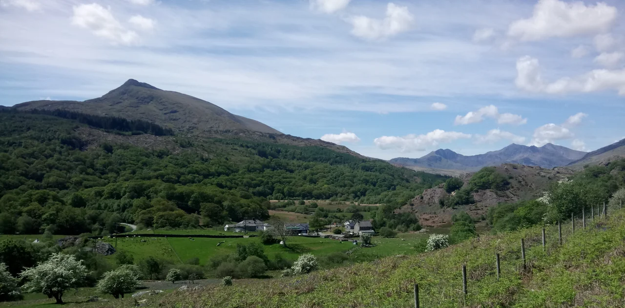

Moel Siabod
On a clear day, the summit of Moel Siabod offers a particular boast: thirteen of the fifteen highest peaks in Wales are visible at once, without the climber having to turn their head. They line up across the western sky like teeth in a granite jaw - Snowdon and the Glyderau, the Carneddau rolling north, Tryfan unmistakable in the centre. Siabod itself is not part of that elite club. At 872 metres it stands just below the threshold, isolated above the village of Dolwyddelan, the highest peak in the Moelwynion range and one of the most distinctive shapes in Snowdonia. The mountain is what comes between the climber and a clean view of everything else.
A Name in Argument
Even the name is disputed. The folk translation - shapely hill - has been disowned by Welsh scholars for over a century. In 1802 William Williams proposed siadod, meaning bare hill whose head or crown is covered in new-fallen snow, which fits the mountain's winter character. In 1928 J. Lloyd-Jones of Dublin University took a different route, suggesting a Middle English origin: shabbed, scabbed, scarred. A scabby mountain, in other words, with rocky outcrops and slate-stained slopes. Neither etymology is fully accepted. Siabod is a place whose own meaning has gone missing somewhere between Welsh and English, and the mountain keeps the secret.
The Hidden Lake
The summit forms a long, rocky ridge running roughly southwest to northeast, about 800 metres of bare rock that climbers walk along like a backbone. To the south-east of the main ridge, the ground drops away in cliffs to a hanging valley five hundred metres above sea level. In that valley lies Llyn-y-foel, Welsh for lake of the mountain. It is a cold, dark pool, fenced in on two sides by the main ridge and the steep eastern ridge that branches off the summit. The ground around it is boggy. In wet weather, the path up from Pont Cyfyng turns into a flowing stream. Walkers reach the summit by climbing out of this hidden cwm, often using their hands on the rougher sections.
Three Routes Up
There are three common ways onto the mountain. From the south, the path leaves Dolwyddelan through Forestry Commission plantations, then breaks onto open ground and follows a stream up to the lake. From Pont Cyfyng, a steep tarmacked side road climbs out of the village and gives onto a footpath that splits - one branch makes a sharp ascent of the main ridge, the other contours through an abandoned slate working to reach Llyn-y-foel. The most popular route, and the only one marked on the Ordnance Survey map, starts at Plas-y-Brenin in Capel Curig, the UK's National Mountain Centre. From there the path crosses the Nant Gwryd via the ancient Pont-y-Bala and climbs the grassy northern slopes, a gentler line that draws guided parties and beginners.
A Mountain That Teaches
Plas-y-Brenin has stood at the foot of Moel Siabod since 1955, and successive generations of British mountaineers have learned their navigation, rope-work and snow-craft on these slopes. The mountain is famously honest. Its eastern ridge - the Daear Ddu scramble - is a grade-one route that climbers use to learn how to move on exposed rock. The boggy approach to Llyn-y-foel teaches respect for Welsh weather. And the summit panorama teaches a kind of geography by force: stand here in clearing cloud and the architecture of Snowdonia opens up in a single sweep, every peak a name you can attach to a shape.
Standing on the Ridge
There is a trig point at the summit, a low concrete pillar that holds the highest stones in place. Around it the rock is pale and lichen-streaked, fractured into platy slabs that ring underfoot. On a clear afternoon the views shift slowly as cloud shadows cross the Glyderau and Carneddau and Snowdon itself. On a cloudy day - more common - the climber gets nothing but wet rock and the dull rush of wind over the ridge. Either way, the mountain has obliged. It has lifted the visitor 872 metres into the sky of Eryri, where the proper view of Wales begins.
From the Air
Moel Siabod sits at 53.073 degrees north, 3.932 degrees west, an isolated peak in central Snowdonia about 4 nm northeast of Yr Wyddfa (Snowdon). The summit reaches 872 m (2,861 ft). From cruising altitude the mountain shows as a single high spur east of the Snowdon massif, with the dark pool of Llyn-y-foel visible in the hanging valley on its south-east side in clear weather. Nearest airports: Caernarfon (EGCK) 16 nm west, RAF Valley (EGOV) 27 nm northwest. Maintain conservative terrain clearance; mountain cloud forms quickly here.
Nearby Stories
- Barmouth 1.6 km away
- Beaumaris Castle 3.1 km away
- Trearddur Bay Lifeboat Station 3.9 km away
- Rhuddlan Castle 4.6 km away
- Tudweiliog 12 km away
- Battle of Maes Moydog 16 km away
- Ruthin Castle 19 km away
- HMS Whirlwind (R87) 51 km away