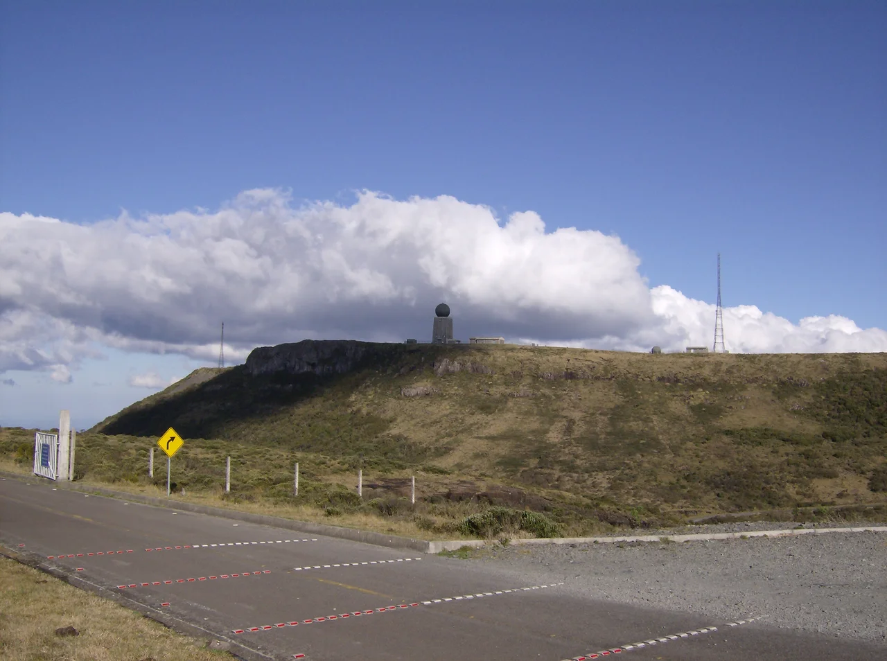

Morro da Igreja
On the morning of June 29, 1996, a thermometer near the top of this mountain read minus 17.8 degrees Celsius, zero on the Fahrenheit scale — the lowest temperature ever unofficially recorded in Brazil. No official weather station has logged a colder reading anywhere in the country. The country that the world pictures as endless beaches and tropical heat keeps its deep freeze here, on a wind-scoured summit above the town of Urubici in the Santa Catarina highlands. They call it the Brazilian Siberia, and in winter, when frost glazes the grass and snow sometimes powders the rocks, tourists drive up specifically to feel cold in a nation that rarely offers it.
The Coldest Address in the Country
Morro da Igreja, the Hill of the Church, rises to 1,822 meters, making it the highest inhabited point in Santa Catarina and the second-highest summit in the state. Altitude is everything here. A weather station run by Epagri and Ciram sits at 1,810 meters, logging the brutal numbers the mountain produces. On August 21, 2020, a two-centimeter snowfall came with a low of minus 8.6 degrees and a high that never climbed past minus 1.2, one of the coldest full days the station has measured. The absolute lowest daytime maximum on record, minus 2.3 degrees, fell on July 23, 2013. These are not the temperatures of a postcard Brazil, and that contradiction is exactly why people come.
The Stone with a Window
Look out from the summit and your eye snags on something strange in the cliffs: a window of empty sky punched clean through solid basalt. This is the Pedra Furada, the Drilled Stone, a rock formation roughly 13 meters tall with an opening some 6 meters across, framed like a natural portal in the mountainside. It has become the signature image of the whole region, photographed in every light, half-hidden when the clouds boil up over the escarpment and sharply outlined on the rare crystalline days. Wind and water did the carving over an immensity of time, but the effect is almost architectural, as though the mountain had built itself a doorway.
Eyes on the Southern Sky
The same height that makes Morro da Igreja so cold makes it valuable to the Brazilian Air Force. On the summit stands a military installation bristling with radar and radio-relay equipment, part of CINDACTA, the integrated air-traffic-control system that watches over the skies of southern Brazil. From this frozen perch the country tracks the aircraft crossing its lower latitudes, the highland weather that torments visitors serving instead as an unobstructed vantage for the antennas. It is a fitting use for a place defined by altitude: the highest livable ground in the state, turned into a lookout over everything that flies above it.
A Town That Trades in Winter
Down in Urubici, the seasons have rewired the local economy. Across most of Brazil, winter is the off-season; here it is the main event. When the forecast threatens frost or, better yet, snow, the roads up to Morro da Igreja fill with families from warmer states who have never seen ice form on a leaf. The mountain obliges with frozen waterfalls, white meadows, and air sharp enough to fog every breath. For a country that measures its summers in heat waves, the chance to shiver beneath a stone window at nearly 1,800 meters is its own kind of luxury, and Urubici has learned to sell the cold it once simply endured.
From the Air
Morro da Igreja stands at roughly 28.13°S, 49.47°W, summiting at 1,822 m (5,977 ft) MSL above Urubici in the Santa Catarina highlands. It is one of the most prominent terrain features in the region and hosts a CINDACTA air-traffic radar and relay site, so it is both a navigational landmark and a controlled installation. Expect severe mountain weather: frost, freezing temperatures, snow in winter, dense cloud, and rapid visibility changes; the nearby Pedra Furada rock window is a distinctive visual marker when conditions allow. Nearest fields include Jaguaruna Regional Airport (ICAO SBJA) on the coast to the southeast and Diomício Freitas Airport near Criciúma, with Florianópolis Hercílio Luz International (ICAO SBFL) to the northeast. Maintain ample terrain clearance and anticipate orographic turbulence and icing in cold, moist conditions. Clear, cold mornings after a front offer the best chance of an unobstructed view from a safe altitude.
Nearby Stories
- Laguna, Santa Catarina 8.5 km away
- Criciúma 23 km away
- Juliana Republic 30 km away
- Florianópolis 48 km away
- Cambará do Sul 67 km away
- Hercílio Luz Bridge 91 km away
- Serra Geral National Park 103 km away
- Vila Velha State Park 302 km away