.jpg)
Serra Geral National Park
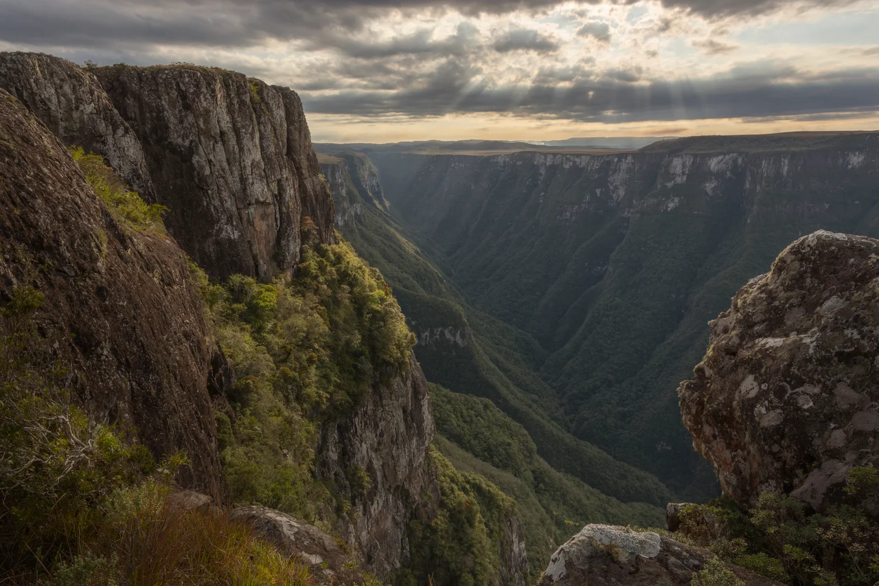
From the lip of Fortaleza, the world drops nine hundred meters in a single breathtaking step. On a clear morning the view from the Mirante reaches past the forested gorge, past the green coastal plain, all the way to the distant glint of the Atlantic. This is the heart of Serra Geral National Park, where the southern Brazilian highlands fracture along a colossal cliff and the land falls toward the sea in walls that dwarf anything built by human hands.
A Park in Two Pieces
Serra Geral National Park is an unusual shape: two separate sections, created by decree on 21 May 1992 and tucked up against the older Aparados da Serra National Park. Together they cover 17,302 hectares spanning the border of two states, taking in parts of Cambará do Sul in Rio Grande do Sul and Jacinto Machado and Praia Grande in Santa Catarina. The park protects the southeastern corner of the Campos Gerais plateau and, crucially, the escarpment itself, the steep transition between highland and coastal lowland where the most dramatic scenery lives. It is administered by the Chico Mendes Institute for Biodiversity Conservation and classified as an IUCN category II national park.
The Walls of Fortaleza
The park's signature is Cânion Fortaleza, the fortress, and the name fits the architecture. Its walls rise as much as 900 meters, running some seven and a half kilometers with the rim reaching 1,240 meters above sea level. Two trails lead out along the plateau to the edge. The Pedra do Segredo trail passes a balancing rock perched at the brink, while the Mirante trail delivers the larger payoff: a panorama of the entire canyon and, on clear days, the ocean far below. The cliffs here are not granite but stacked basalt, layer upon layer of ancient lava flows, the same Serra Geral Formation that armors the whole highland edge and resurfaces, far to the south, as the sea towers of Torres. The best light comes in the dry season, roughly April to September, when the cloud that so often pours up from the warm coast holds off long enough to reveal the drop. Where the rock gives way, the land does not slope; it simply stops.
Cloud Forest and Cold Grassland
The escarpment creates a ladder of climates, and the life on it changes with every rung. Altitudes within the park range from the lowland forest near 100 meters to the cool plateau grassland above 900, with average annual rainfall around 1,800 millimeters and temperatures that can drop to freezing. Vegetation shifts from dry highland meadows and peat fields to cloud forest, mixed araucaria woodland, and dense Atlantic rainforest on the slopes below. This is one of the last refuges of the Atlantic Forest biome, a once-vast forest now reduced to fragments, and the isolation has bred rarities, a long list of endemic plants and amphibians found here and almost nowhere else.
What the Cliffs Shelter
Inaccessibility is its own kind of protection, and the canyon walls guard creatures that have vanished from easier country. Cougars still move through the forest below, alongside the small spotted cats of the region, the southern tigrina and the margay. Overhead, parrots that have become rare across Brazil persist here, including the red-spectacled amazon and the vinaceous-breasted amazon, and the powerful Chaco eagle hunts the open grassland of the rim. The amphibians are stranger still: tiny toads of the genus Melanophryniscus and other frogs found in this corner of the highlands and almost nowhere else on Earth, marooned by the isolation of the plateau like life on a series of islands in the sky. The park's stated mission is plain: to preserve ecosystems of great ecological relevance and scenic beauty, and to make room for research, education, and the quiet kind of tourism that leaves the cliffs as it found them. The Chico Mendes Institute, which manages it, carries the name of the rubber-tapper and activist whose murder in 1988 turned Brazilian conservation into a cause the world watched.
From the Air
Serra Geral National Park centers near 29.13°S, 49.99°W, straddling the Rio Grande do Sul / Santa Catarina border along the great Serra Geral escarpment. The standout landmark for aviators is Cânion Fortaleza, whose ~900-meter basalt walls and 1,240-meter rim mark the abrupt edge of the plateau just east of Cambará do Sul; the park lies adjacent to Aparados da Serra and its Itaimbezinho canyon. Morning offers the clearest views before cloud rises off the warm coastal plain and pours up the canyon walls. Nearest major airport is Porto Alegre / Salgado Filho (SBPA) roughly 190 km south; Caxias do Sul (SBCX) is a closer regional field, and the Santa Catarina coast is served by Florianópolis / Hercílio Luz (SBFL) to the northeast. Expect strong orographic effects and rapidly changing visibility along the escarpment.
Nearby Stories
- Canela, Rio Grande do Sul 19 km away
- Criciúma 26 km away
- Caracol State Park 33 km away
- Serra do Rio do Rastro 71 km away
- 2024 Gramado Piper PA-42 crash 74 km away
- São Joaquim National Park 102 km away
- Passo Fundo 185 km away
- Battle of the River Plate 519 km away