
Nafplio
Ioannis Kapodistrias chose Nafplio as the capital of newly independent Greece in 1829, and the choice was obvious. The city had everything: a protected harbor, walls built by the Venetians over centuries, a rock crowned by a fortress so formidable it had never been taken by storm, and a history long enough to include Mycenaeans, Byzantines, Crusaders, and Ottomans. His mansion — the Palataki, the 'Little Palace' — stood on the square in front of what is now the town hall. In 1833, the capital moved to Athens. Nafplio kept the elegance.
A City on a Peninsula
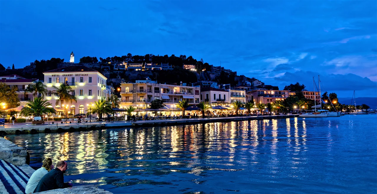
Nafplio occupies a rocky peninsula that juts north into the Argolic Gulf, its old town packed onto the narrow promontory in a dense grid of paved lanes. The sea is everywhere — visible at the end of nearly every street, glimpsed between the ochre and terracotta facades of neoclassical houses built after independence. At first glance, the architecture reads as Italian, and for good reason: Venice held Nafplio for long stretches between 1388 and 1540, and again after 1686, leaving behind Venetian-style buildings around Syntagma Square, the Lion of Saint Mark carved into fortress walls, and a sensibility of civic grandeur in a small space. Byzantine and Ottoman layers sit underneath and alongside: a mosque converted to a cinema, a hammam repurposed, Ottoman fountains in quiet corners. The city is small enough to walk end to end in fifteen minutes, but dense enough that each block holds something worth stopping for.
Palamidi and the Island Castle
Two fortifications define Nafplio's skyline in ways no visitor can ignore. Palamidi — built by the Venetians between 1711 and 1714 — crowns the 216-meter hill behind the old town in a complex of eight interconnected bastions. The climb by the main staircase takes some effort: the steps number in the hundreds (accounts differ on how many). From the top, the Argolic Gulf stretches south, the plain of Argos opens to the northwest, and the outline of the Tiryns citadel is visible across the flat farmland. Below in the bay, a few hundred meters from the waterfront promenade, sits the Bourtzi: a small castle on an islet, built by the Venetians in 1473 to guard the harbor entrance. At certain times of year, small boats carry visitors across. Its silhouette against the water — compact, round-towered, improbable — is the image most people carry away from Nafplio. Between the two fortresses, Akronauplia rises directly above the old town: the oldest fortified part of the city, its walls bearing the carved relief of the Venetian Lion of Saint Mark that watches over the harbor.
First Capital, Lasting Character
The years when Nafplio served as Greece's capital, from 1829 to 1833, left a permanent mark on its character. The first Greek gymnasium under the new state opened here in 1833. Neoclassical mansions built for the government and its officials line the streets — the Alevras-Lambiris building from 1830, the house of the Viceroy, the old train station of 1890 that now anchors a park where the rail tracks once ran. Kapodistrias was assassinated in Nafplio in 1831, shot outside the church of Saint Spyridon. His funerary monument stands in the old town; so does the monument to Dimitrios Ypsilantis, the military hero of the independence war who died here in 1832. The city's short tenure as capital compressed the entire drama of the early Greek state into four years and a few city blocks.
The Life of the Old Town
Nafplio works best on foot and without a plan. The neighborhood of Psaromachalas — 'the fishermonger's quarter' — spreads under the cliff of Akronauplia in a tangle of narrow lanes, white houses with flower-filled courtyards, and stairways where cats hold court. It has the feel of a Greek island transplanted to the mainland. Syntagma Square, the main civic space, is ringed by Venetian-era buildings and filled at all hours with the particular mix of tourists and locals that prosperous historic cities generate. The promenade along the northern waterfront faces the Bourtzi and the gulf; cafes and bars there have the best view in the city. In the last week of June, the Nafplio Festival brings classical music into the historic sites and fortress bastions — concerts in spaces that have witnessed everything from Mycenaean occupation to Venetian rule to the birth of the Greek state. It is, by most accounts, worth attending.
Gateway to the Argolid
Nafplio's other function — which it has performed for as long as there have been roads in the Peloponnese — is as a base for reaching the ancient sites that surround it. Tiryns is 4 kilometers north, its Cyclopean walls visible from the road. Mycenae is 20 kilometers beyond that. The ancient theater of Epidaurus, still used for performances each summer, is about 30 kilometers to the east. All are reachable by the local bus network that radiates from the station at the edge of the old town — the same spot where horse carriages once waited. The proximity of three UNESCO World Heritage Sites (Mycenae, Tiryns, and Epidaurus) within an hour's drive makes Nafplio the natural anchor for any serious exploration of the Bronze Age Argolid. The city earns this role without trying: it is genuinely beautiful, genuinely historic, and genuinely alive in a way that purely archaeological destinations rarely are.
From the Air
Nafplio sits at approximately 37.57°N, 22.80°E on a distinctive peninsula visible from the air as a narrow finger of land extending north into the Argolic Gulf. The Palamidi fortress crowns the hill directly behind the town and is unmistakable from altitude — a multi-bastion complex high above the waterline. The Bourtzi islet appears as a tiny fortified speck in the bay west of the peninsula. The town itself is compact and dense on the promontory, with the newer districts expanding inland. Nearest major airport is LGAV (Athens International), approximately 110 km northeast. Approach from the Argolic Gulf at 1,500–3,000 feet AGL for best views of the peninsula, fortress, and island castle. Visibility is typically excellent in this region except during summer haze.
Nearby Stories
- Kastanitsa 2.3 km away
- Heroon at Nemea 3.4 km away
- Psari, Trikolonoi, Arcadia 4.2 km away
- Siege of Gardiki-Arcadia 8 km away
- Cleitor 12 km away
- Troezen 15 km away
- Cave of Euripides 24 km away
- SS Heraklion 94 km away