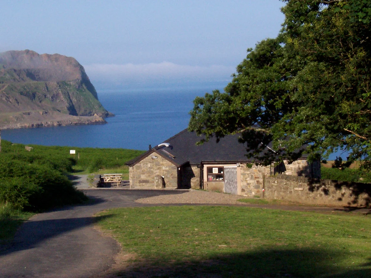

Nant Gwrtheyrn
The road down is called Screw Hill. It used to be unpaved, single-track, with six hairpin corners, no passing places, no crash barriers and a maximum gradient of one-in-two-and-a-half. British Pathe sent a film crew here in the mid-twentieth century and produced a short newsreel called Climbing the Unclimbable, in which a car -- driven, with visible terror, by a brave man -- successfully ascends the road for the camera. At the bottom of Screw Hill, in a steep valley by the Irish Sea, sat a village called Porth y Nant. Its people quarried granite for the cobblestones of Liverpool and Manchester. When the quarry closed in the Second World War, the village emptied. For thirty years the cottages stood roofless, occupied briefly by hippies in the 1960s. Then, in 1978, a Welsh doctor saw something else in the ruins.
Vortigern's Valley
The name Nant Gwrtheyrn means Vortigern's stream. Gwrtheyrn is the Welsh form of Vortigern, the fifth-century British king who -- according to Bede, Gildas and Geoffrey of Monmouth -- invited the Saxons Hengist and Horsa to Britain as mercenaries and then watched as they turned on him. The chroniclers say Vortigern fled to a remote valley by the sea on the Llyn Peninsula and died there, either burned in his fortress or struck down by divine punishment. Whether or not any of that is history rather than legend, the valley took his name. It still feels like a place to disappear into. Yr Eifl rises 1,800 feet directly behind the village, three peaks crowding out the sky inland; the only outlook is across the Irish Sea toward Anglesey. On a clear day you can see the South Stack lighthouse. On any other day you can see nothing but water and weather coming in.
Setts and Silence
The quarry called Nant Gwrtheyrn opened in 1861, producing setts -- the small stone blocks used to surface Victorian city streets. A village called Porth y Nant grew up alongside it, two terraces of workmen's cottages named Trem y Mor (Sea View) and Trem y Mynydd (Mountain View). Because of the road, almost everything moved in and out by boat across the Irish Sea. The community lived an isolated existence; for the children of the quarrymen, the outside world was a rumour. Demand for granite setts collapsed in the interwar years as cities switched to tarmac, and transport difficulties did the rest. The quarry closed in the early years of the Second World War, and the village dispersed. The cottages fell into disrepair. The hillsides still carry the scars of quarrying and the ruins of the engine sheds; the village itself stood as a ghost settlement for decades.
Dr Clowes and the Welsh Centre
In the 1970s a local trust led by Dr Carl Clowes, a Manchester-born GP who had moved to the Llyn and become a passionate Welsh-speaker, acquired the site. Clowes had a specific idea: turn the abandoned village into a residential centre where adults could come to learn Welsh by immersion -- live in the cottages, eat together, speak only Welsh for a week or two at a time. The Nant opened as a language centre in 1978. A subsequent five-million-pound redevelopment, including 3.8 million in European and Welsh government grants, expanded it into a heritage centre, conference venue and four-star accommodation. First Minister Carwyn Jones officially reopened the renovated village in March 2011. Clowes lived to see the project realised; he died in December 2021. The trust he founded is the reason there is anything here at all besides ruins and gulls.
The New Road and the Old Walks
Screw Hill was realigned and improved in 2007. It is paved now, and the gradient has eased to one-in-four. There are passing places and crash barriers, and the hairpins have been reduced from six to two. It is still single-track. It is still steep enough that a hire car will smell hot at the bottom. Most students at the language centre arrive by car; the nearest railway stations are at Pwllheli and Bangor. From the village a path drops to the beach, accessible only on foot. Other paths climb the slopes of Yr Eifl behind the cottages. Walkers from the top of the valley take more than forty minutes to walk down and an hour and more to walk back up. The remoteness is the point. A week spent here, with the Irish Sea below and the mountain above and a teacher who speaks only Welsh, is a different way of learning a language than evening classes in Cardiff.
From the Air
Located at 52.98N, 4.46W in a steep coastal valley on the northern shore of the Llyn Peninsula, at the foot of the Yr Eifl massif. Caernarfon Airport (EGCK) lies 12nm north-east. Best viewed at 1,500-3,000ft AGL on a coast-following track from Caernarfon Bay. The valley is unmistakable: a deep cleft between Yr Eifl's three peaks, the abandoned-then-restored cluster of grey cottages by the sea, and the single hairpin road carved into the mountainside.
Nearby Stories
- GeoMôn 1.9 km away
- Battle of the Conwy 3.2 km away
- Irish Sea Bridge 5.2 km away
- Ysbyty Ifan 10 km away
- Machynlleth 16 km away
- Barmouth Lifeboat Station 23 km away
- Irish Sea 27 km away
- HMS Tyler 32 km away