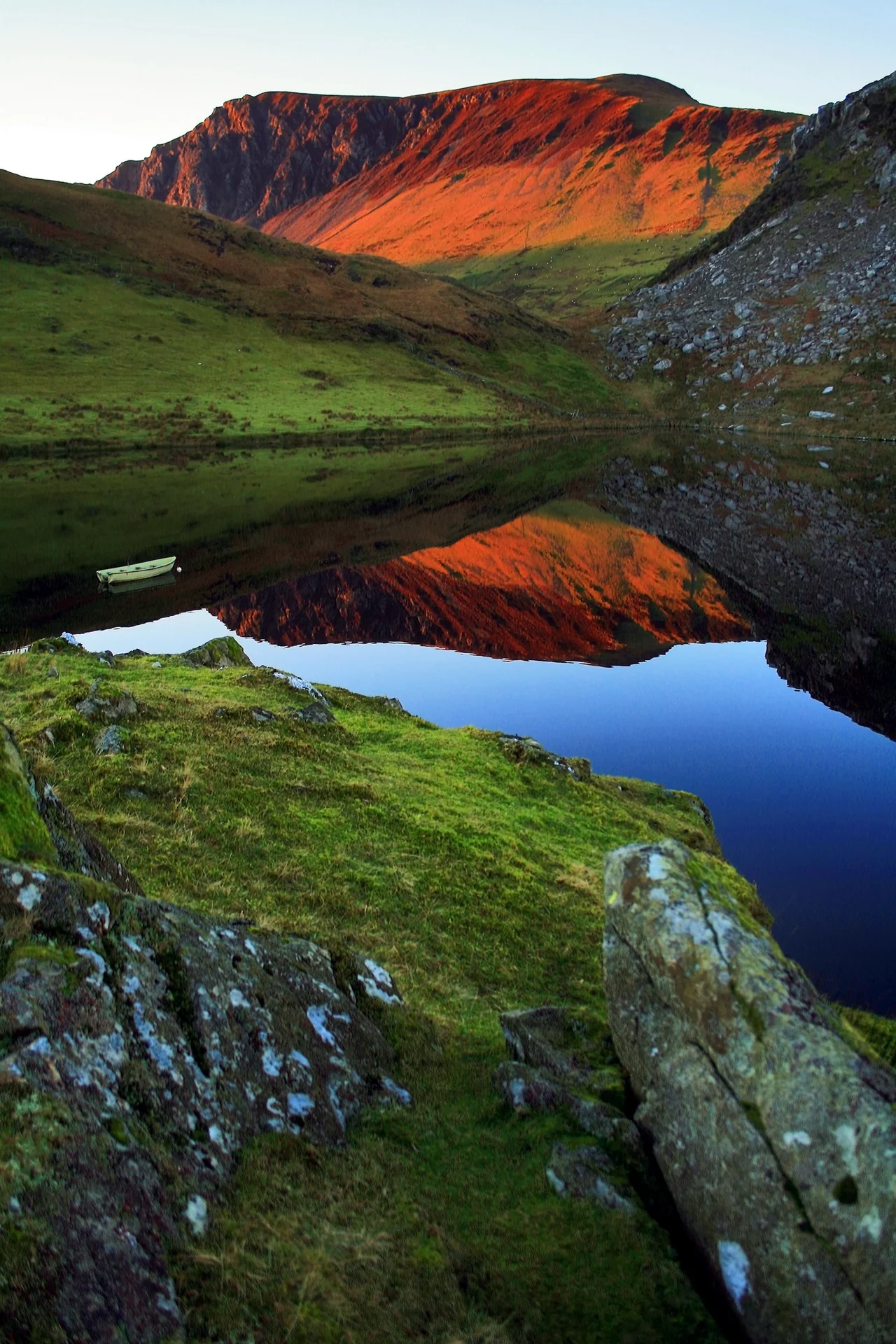

Nantlle Valley
The mountains here look hand-carved because they are. The Nantlle Valley runs west from Snowdon's foothills to the sea, and its sides have been quarried for slate for two and a half centuries. Vast staircased pits open into the earth where whole mountains used to be. The biggest of them, Dorothea, flooded in the 1970s and now holds a turquoise lake hundreds of feet deep, with the original winding gear and quarry galleries still intact underwater. Divers come from across Europe to descend into it. Between 1994 and 2004, twenty-one of them did not come back up.
Math, Lleu and the Eagle in the Oak
Long before the quarries, the valley was already legendary. The Fourth Branch of the Mabinogi -- the medieval Welsh prose cycle written down in the eleventh century but drawing on much older material -- is set largely here. This is where the magician Gwydion finds his nephew Lleu Llaw Gyffes, treacherously transformed into an eagle by his unfaithful wife Blodeuwedd (herself made from flowers), perched dying in an oak tree at Baladeulyn. Gwydion sings the eagle down, restores Lleu to human form, and Lleu eventually kills the lover and turns Blodeuwedd into an owl. Baladeulyn was the land that lay between two lakes -- Llyn Nantlle Uchaf and Llyn Nantlle Isaf -- before slate workings reshaped the ground. The Mabinogi stories are tied to specific places along this valley as firmly as ordnance survey waypoints. The eagle in the oak, the maiden of flowers, the magician's island in the lake; they are all here, more or less, and you can drive past them in twenty minutes.
Edward's Tournament and the Hewn Pass
When Edward I completed his conquest of Wales in 1282 by killing the last native Prince of Wales, his army moved across the peninsula celebrating. One of the first recorded jousts in Britain was held on the fields of Baladeulyn near Nantlle village, as the royal entourage made its way back from Nefyn after the war. Rules drawn up at that 1284 tournament reportedly became the basis of the Statute of Arms which Edward issued in 1292 to regulate jousting across his kingdom. The pass through the mountains at the eastern end of the valley is called Drws-y-Coed, the door of the trees, and tradition holds that it was hewn by Edward's men after the conquest. In this part of the valley you can still see old copper mining shafts and a memorial to a chapel that was demolished when a boulder rolled down the mountainside and crashed into it. Edward's conquest paved roads, suppressed Welsh princes, and named the tournament rules. Slate did the rest.
Halley and the Floating Island
At the top of the valley sits Llyn y Dywarchen, a small mountain lake with an unusual feature first written about in 1188 by Giraldus Cambrensis, the Welsh-Norman chronicler who toured Wales recruiting for the Third Crusade. Giraldus described a floating island in the lake that drifted from side to side at the wind's discretion. He offered a perfectly rational explanation -- a chunk of bank held together by willow roots, broken off and never re-attached. Five hundred years later, in 1698, the astronomer Edmund Halley swam out to verify the phenomenon for himself. Halley, who would later have a comet named after him, confirmed that the island did indeed float. The naturalist Thomas Pennant saw it again in 1784 and reported that cattle which strayed onto the island when it was near shore could be marooned when the wind pushed it back into the middle of the lake. The lake is still here. The island still drifts, smaller now but recognisable.
Where Welsh Writers Came From
Between 85 and 90 percent of the valley's population speaks Welsh as their first language, one of the highest percentages anywhere in Wales. The valley produced an extraordinary share of twentieth-century Welsh literature: the poets T.H. Parry-Williams from Rhyd Ddu and R. Williams Parry from Talysarn, the novelist Kate Roberts from Rhosgadfan, the dramatist John Gwilym Jones from Y Groeslon. The opera bass-baritone Bryn Terfel grew up in Pant Glas on the valley's edge and attended Ysgol Dyffryn Nantlle in Penygroes; he sang at the 2012 Olympics opening ceremony in London. The Nantlle Ridge, the chain of summits that forms the valley's southern wall, is regularly voted one of the best ridge walks in Britain. Its high point, Craig Cwm Silyn, reaches 2,408 feet -- modest by Snowdonia standards, but the views are some of the finest in North Wales. The slate has been worked out. The mountains, the language and the literature remain.
From the Air
Located at 53.02N, 4.28W, the valley runs roughly east-west from the foot of Snowdon to the coastal plain near Caernarfon. Caernarfon Airport (EGCK) lies 4nm north-west. Best viewed at 2,000-4,000ft AGL. The flooded Dorothea Quarry pit (turquoise water) and the long staircased terraces of Pen-yr-Orsedd are unmistakable from the air. The Nantlle Ridge runs along the south side, with Craig Cwm Silyn (2,408ft) as its high point. Mynydd Mawr (Elephant Mountain) sits to the north.
Nearby Stories
- GeoMôn 1.9 km away
- Battle of the Conwy 3.2 km away
- Irish Sea Bridge 5.2 km away
- Ysbyty Ifan 10 km away
- Machynlleth 16 km away
- Barmouth Lifeboat Station 23 km away
- Irish Sea 27 km away
- HMS Tyler 32 km away