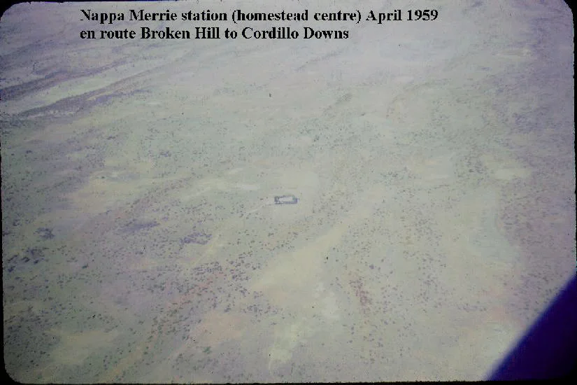

Nappa Merrie
On the evening of 21 April 1861, three starving men staggered into a camp on Cooper Creek and found it deserted. Carved into a coolibah tree beside the waterhole was a single word - DIG - and beneath it, buried rations left by a relief party that had ridden out that very morning, hours before. Robert O'Hara Burke, William Wills and John King had walked to the Gulf of Carpentaria and back, and they had missed rescue by a matter of hours. That tree still stands today on Nappa Merrie, a cattle station spread along the Cooper in the far southwest corner of Queensland, where the land runs flat to the South Australian border and the creek is the only reliable water for a hundred miles in any direction.
The Word on the Tree
The Dig Tree is a coolibah, the kind that lines this stretch of Cooper Creek, and it is believed to be two to three centuries old. On 21 April 1861, William Brahe and his party blazed it before abandoning the depot camp they had held for months, waiting for Burke's group to return from the north. Brahe carved instructions pointing to a cache of flour, oatmeal, sugar and rice buried at the foot of the tree. When Burke, Wills and King arrived that same evening, exhausted and reduced from a larger party by the death of Charley Gray days earlier, the ashes of Brahe's fire were reportedly still warm. They dug up the supplies. But the relief party was already hours gone, and the men were too weak to catch them. Two of the three would die on the Cooper in the weeks that followed.
The People Who Knew How to Live Here
Burke and Wills died in a country that had sustained people for tens of thousands of years. The Yandruwandha, whose lands take in this stretch of the Cooper around Innamincka, watched the explorers struggle and offered what the strangers could not find for themselves - fish, seedcakes, and nardoo, a fern ground into flour. When John King was the last man left alive, it was the Yandruwandha who took him in and kept him fed for roughly three months until a search party found him. The traditional owners of the Nappa Merrie country are recorded as the Wongkumara people, and the station's name carries their language: from ngappa, meaning water, and merri, meaning sandhill. A waterhole among the dunes. The name describes exactly what made survival possible here, and what the explorers failed to grasp.
Conrick's Eleven-Month Drive
In 1873, a colonist named John Conrick brought the first cattle to this country. Barely into his twenties, Conrick set out from Koroit in Victoria with five companions all under the age of 21 and a herd of 1,600 head, guided across the inland by a Wongkumara stockman, Jimmy Bostock. The drive took eleven months. Conrick first built his head station at the Baryulah waterhole, but floods and conflict with the area's many Aboriginal people pushed him to relocate to Bullah Bullah - the very waterhole where Burke and Wills had made their depot a dozen years earlier. He became, by most accounts, the first permanent settler to hold ground on the Cooper. The station he founded has changed hands many times since, passing through the Tancred brothers, the Stanbroke Pastoral Company, and the Kidman empire, before Morella Agriculture bought it in 2016.
Flood, Fire, and Gas
Life on Nappa Merrie has always been dictated by the Cooper's moods. The creek broke its banks in catastrophic floods in 1950, and bushfires swept the property in late 2011, stripping away the feed that stock depended on. When the airmail service to the remote outback stations began in 1949, Nappa Merrie was a stop on a route that read like a roll call of isolation - Mungerannie, Cordillo Downs, Durham Downs, Naryilco. In the latter half of the twentieth century, the land gave up something the early settlers never imagined: gas. The Cooper-Eromanga Basin beneath these plains is Australia's largest onshore oil and gas province, and in 1991 construction began on the large Ballera gas plant near Ballera Creek on Nappa Merrie itself - completed and upgraded by 1997, piping fuel toward the distant east-coast cities.
From the Air
Nappa Merrie sits at 27.60°S, 141.11°E in the Channel Country of far southwest Queensland, hard against the South Australian border, about 40 km northeast of Innamincka and 260 km southeast of Birdsville. From the air the signature is the ribbon of Cooper Creek and its braided channels, dark green with coolibah against pale dune country; the Dig Tree stands near Bullah Bullah waterhole, roughly 6 km from the homestead. The nearest sealed strip with services is Innamincka (just over the SA border); Birdsville Airport (YBDV) lies to the northwest. There is no controlled airspace out here - expect vast, featureless plains, fierce summer heat haze, and excellent winter visibility. Best viewing in the cooler, clearer months from May to September.
Nearby Stories
- Innamincka 11 km away
- Ballera gas plant 18 km away
- Durham Downs Station 29 km away
- Coongie Lakes 45 km away
- Arrabury 54 km away
- Noccundra Hotel 89 km away
- Dingo Fence 137 km away
- Strzelecki Creek 193 km away