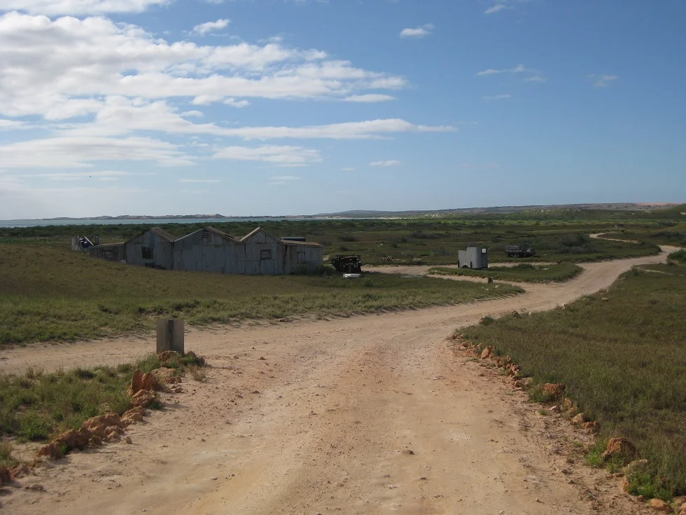

Ningaloo Station
The reef came first, and the word came before that. 'Ningaloo' is an Aboriginal name — recorded in the 1800s as Nyinggulu in the Wajarri language — and it is usually translated as 'promontory,' 'deep water,' or 'high land jutting into the sea.' It belonged to this coast long before any lease was drawn, the Country of the Baiyungu and Yinigudura peoples, whose connection to the Nyinggulu coast reaches back tens of thousands of years. When a pastoral run took the name in the early twentieth century, and when the spectacular fringing reef offshore took it in turn, both were borrowing from a far older naming. Ningaloo Station is the modest sheep run that carried that word into the wider world.
Between the Range and the Reef
Ningaloo Station spreads across roughly 50,000 hectares of the Gascoyne, about 40 kilometres north of Coral Bay, with Cape Range National Park rising along its northern boundary and Gnaraloo and Warroora stations stretching away to the south. To the west lies the reason anyone remembers the name: Ningaloo Reef, a band of living coral that runs close inshore for hundreds of kilometres, close enough to wade out to. The station offers no luxury — just camp-sites for travellers who want the lagoon, the snorkelling, and the silence. It is a thin strip of working country pinned between a desert mountain range and one of the most biologically rich reefs on the planet, and for a hundred years its business has been wool, water, and weather.
The Record Clip
The station has run since at least 1919, when it turned out a modest 33 bales of wool, worked as a partnership between Herbert William Cope and the brothers Douglas and Leslie Black. Good rains in 1923 — 16.5 inches by June — brought heavy lambing and a banner year. A new machine shearing shed and quarters went up that season, built from timber landed off the schooner Geraldton, and although a fire broke out in November it was caught before it could do real harm. Then came the record: more than 9,000 sheep shorn and 215 bales produced by a team of just seven men in three weeks. The Geraldton carried the wool away to Perth. For a remote run with no road to speak of, it was a triumph measured in fleece.
Twenty-Five Days to Carnarvon
Getting stock to market from this coast was its own ordeal. In 1924 Mr Cope droved more than 1,200 sheep overland to the port at Carnarvon, a journey of twenty-five days across country where water could be found only every second day. That a mob could walk that far, that thirsty, and arrive with only a dozen head lost says as much about the drovers' skill as the animals' endurance. Cope retired and dissolved the partnership that June, leaving the Black brothers as sole owners. Drought, good seasons, and disaster traded places over the decades: the remnants of a cyclone flooded the station in 1945, and in 1953 it was deluged overnight. The Blacks sold to F. Lefroy and M. McBolt in 1937, and the Lefroy name would stay tied to this coast for generations.
The Rally on the Beach
By 2008 the fight here was not about wool but about who controlled the shore. The state's Department of Environment and Conservation moved to take over management of the camp-sites strung along the station's coastline, and the Lefroy family — by then holding the lease for more than seventy years — said they were given just five days to hand it over. More than 300 people rallied in protest, tourists and locals alike, unwilling to see the easygoing, low-cost camping they loved swept into bureaucratic control. The government also planned to strip a further 22 kilometres of coastline, some 22,000 hectares, from the station. It was the same argument echoing all along the Ningaloo coast: how to protect a place this precious without erasing the people and the easy access that had long been part of its character.
From the Air
Ningaloo Station lies at 22.98°S, 113.82°E on the Ningaloo coast of Western Australia, about 40 km north of Coral Bay, with Cape Range National Park forming its northern edge. From the air the scene is unmistakable: the jagged limestone ridges of Cape Range to the north, the broad red coastal plain, and the long turquoise Ningaloo lagoon held behind a white line of fringing reef just offshore. The reef runs close to the beach here, making the colour banding — beach, lagoon, reef break, deep ocean — especially crisp. The nearest airport with scheduled service is Learmonth (ICAO YPLM) near Exmouth, to the north past Cape Range; Carnarvon (ICAO YCAR) lies well to the south, and Coral Bay has a charter airstrip nearby. Conditions are usually clear with strong afternoon southerlies. Recommended sightseeing altitude is 1,500–3,000 ft to follow the reef line and the camp-dotted coast; the lagoon reads most vividly with the sun high and behind the aircraft.
Nearby Stories
- Warroora 15 km away
- Ningaloo Marine Park (Commonwealth Waters) 20 km away
- Kennedy Range National Park 173 km away
- Bernier Island 185 km away
- Dorre Island 236 km away
- Barrow Island (Western Australia) 239 km away
- Gascoyne Junction 254 km away
- The Silent Wave: Java's 1994 Tsunami Earthquake 1357 km away