North Nicosia
A United Nations officer drew the line in green pencil across a map of Nicosia in 1963, and that color became the name of a wound that has not closed. The Green Line still runs through the city, threading between Sarayonu Square in the north and Eleftheria Square in the south, separating the Selimiye Mosque from the cathedral that became the mosque, dividing one capital into two. North Nicosia sits on the northern side, the de facto capital of the Turkish Republic of Northern Cyprus, a state recognized only by Turkey. To walk its streets is to walk through a city that has been answering the same question for sixty years: what does it mean to belong somewhere when half your neighbors had to leave?
The Walled City
Venetian engineers built the circular fortifications in the 1560s, eleven heart-shaped bastions ringing the old city in a defensive geometry that proved insufficient against the Ottoman siege of 1570. The walls survive, and inside them North Nicosia keeps its richest historical layer. The Selimiye Mosque dominates the skyline, but it began life as the Cathedral of Saint Sophia, built between 1209 and 1228 by the Latin Church of Cyprus in a Gothic style borrowed from northern France. Lusignan kings were crowned beneath its vaults. After the Ottoman conquest in 1571, two minarets rose from the western towers and the cathedral became a mosque. The columns are older still, Roman, suggesting an earlier Byzantine church on the same spot. Stratigraphy as autobiography: the building is a city in miniature, each ruler converting what the previous one built rather than starting fresh.
Nineteen Seventy-Four
On 15 July 1974, officers of the Greek military junta backed a coup against President Makarios in pursuit of enosis, union with Greece. Five days later the Turkish army landed at Kyrenia. By August, after a second offensive, Turkish forces controlled the northern 37 percent of the island, including the northern half of Nicosia. The displacement was vast and went both directions. Greek Cypriots fled south from homes their families had occupied for generations. Turkish Cypriots eventually moved north, many from villages where they had lived alongside Greek neighbors all their lives. In the city itself, roughly 4,700 Greek Cypriots left the northern quarters in 1974, and around 7,000 Turkish Cypriots had already been displaced from southern neighborhoods during the violence of 1963 and 1964. The Gocmenkoy quarter in north Nicosia, whose name translates as village of the displaced, was built to house some of them. Both communities lost places they considered home. Both communities still hold keys, deeds, and memories that no longer match the addresses they describe.
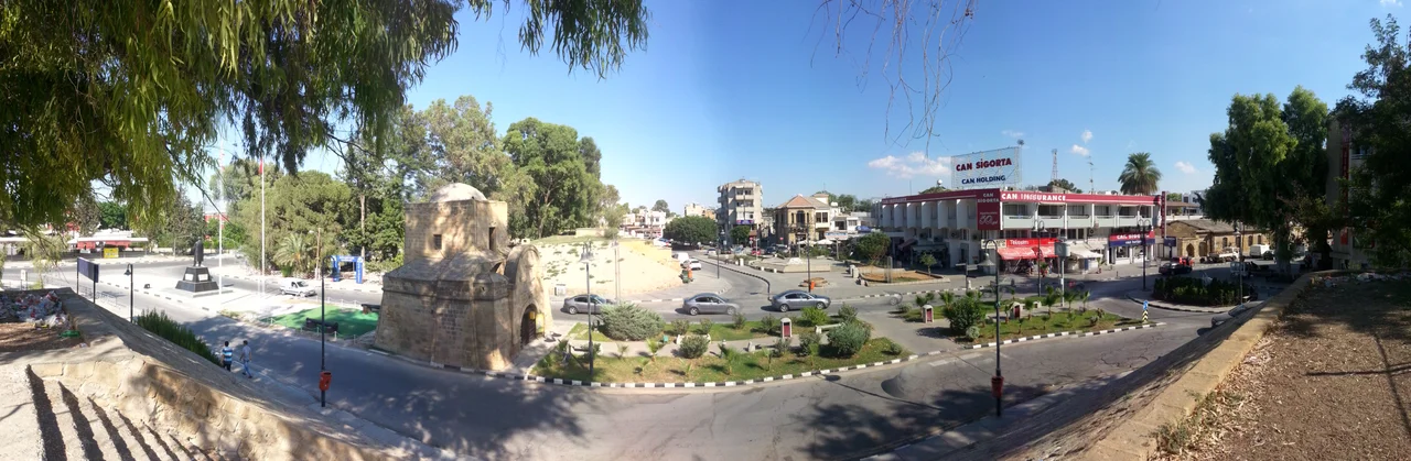
Buyuk Han and the Caravanserai City
Of all the buildings inside the walls, the Buyuk Han may be the most quietly beautiful. The Ottomans built it in 1572, the year after the conquest, as the largest caravanserai on the island. Sixty-eight rooms arranged around a central courtyard, with a small octagonal mosque in the middle. Travelers slept on the upper floor while their animals stabled below, and merchants traded in the arcades. The building fell into use as a prison under the British, then into disrepair, then into the careful restoration that has made it one of the most beloved cultural spaces in Cyprus. Today it holds craft shops, cafes, and occasional opera concerts in the courtyard. Across the road, the smaller Kumarcilar Hani, the Gamblers' Inn, dates from the seventeenth century. The two together preserve a working memory of how the city did business before highways and shipping containers.
The Crossings
For nearly thirty years, no one crossed. The Green Line was closed, the buffer zone patrolled by UN peacekeepers, and the two halves of Nicosia developed in parallel solitude. On 23 April 2003, the Ledra Palace crossing opened. Greek Cypriots walked north for the first time since 1974 to look for the houses they remembered, the lemon trees they had planted, the graves of their parents. Turkish Cypriots walked south to do the same. There were tears at the checkpoints, embraces between people who had not seen each other in decades, awkward conversations in three languages between the new owners and the original families. The Ledra Street crossing in the heart of the old city followed in 2008. The crossings have not solved the political dispute. They have not returned anyone's house. But they have made it possible, for the first time in a generation, to grieve and remember in the same physical space.
Living City
Beyond the walls, North Nicosia is a working modern capital. Four universities, the largest being Near East University, host more than 26,000 students from across the world. The Dereboyu district has filled with restaurants, hotels, and the kind of high-rises that change a skyline. Around 146,000 tourists visited in 2012, and the numbers have grown since. The Mevlevi Tekke, once headquarters of the Whirling Dervishes, now functions as a museum dedicated to the Sufi order's distinctive practice. The Dervish Pasha Mansion, built in late Ottoman style, holds an ethnographic collection. Mehmet Harmanci, the current mayor, was elected in 2014 from the small Communal Democracy Party in what local media called a surprise victory. North Nicosia continues, in other words, to do what cities do, even when the ones who built them and the ones who left them disagree about what comes next.
From the Air
North Nicosia sits at 35.190 N, 33.364 E on the central Mesaoria plain of Cyprus, with the Kyrenia mountain range visible to the north. The Green Line buffer zone runs east-west through the city. Best viewed from 5,000-7,000 ft AGL; the circular Venetian walls are clearly visible from altitude. Nearest airport for travel to the north: Ercan International Airport (LCEN / ECN), 13 km east. Travelers entering from the south generally use Larnaca International Airport (LCLK / LCA), 50 km south, and cross at one of nine checkpoints. The airspace over the buffer zone is restricted.
Nearby Stories
- Battle of Salamis (306 BC) 17 km away
- Stavrovouni Monastery 22 km away
- Agios Neophytos Monastery 27 km away
- Paphos Castle 61 km away
- 1983 US Embassy Bombing in Beirut 199 km away
- Sahyun Castle 209 km away
- Antalya 236 km away
- Adana 251 km away