Ntumbachushi Falls
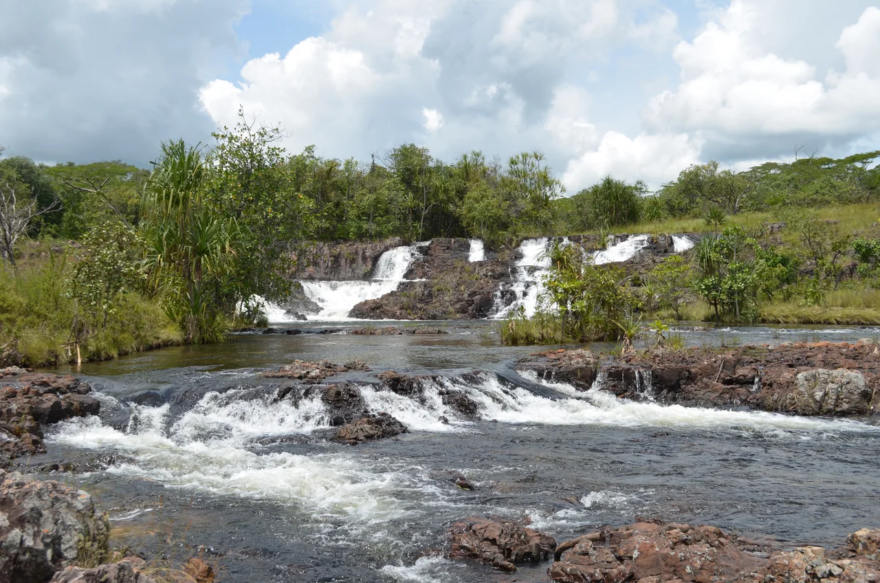
The Ngona River does something strange just before it drops off the edge of the world. It splits. Two channels, each about ten meters wide, peel apart and race to the escarpment, where they plunge side by side in parallel 30-meter falls, 50 meters between them. This is Ntumbachushi, in the Luapula Province of northern Zambia - spelled Ntumbacusi or Ntumbacushi on older maps, depending on which missionary or surveyor was writing. In the rainy season the cataracts are thunderous, a meter deep at the lip. In the dry months, they shrink to the bridal veil the locals call them. Either way, the pools below hold water as clear as anything in central Africa, and visitors swim in them. Some would say it is the best river swimming in Zambia.
The Twin Falls and the Beauty Spot
The main pair of falls is only the opening act. A path - steep, twenty meters north of the main plunge - climbs the rocky cliff and continues half a kilometer upriver to a place locals call simply 'the beauty spot,' two pools lying below a second falls six meters high and 25 meters wide, split into two sections of its own. Above that, the Ngona tumbles over two more cascades of five meters each. The whole sequence stretches more than two kilometers, a cascading staircase of pools and ledges and mossy rock, and by the time you reach the top you have climbed out of the Luapula Valley and back onto the Zambian plateau. The landscape has been described by many visitors as among the most beautiful in central Africa. That is easy to agree with on the walk down.
Water Out of the Dambos
The Ngona River doesn't rise from a single spring. It drains out of the dambos - the broad, grassy wetlands that occupy shallow valleys across the Zambian plateau and hold water like sponges through the dry season. That wetland filter is why the water below Ntumbachushi runs so clear. Rivers draining from dambos are naturally low in sediment, the peaty soils trapping silt before it reaches the channel. A small patch of relict rainforest clings to the spray zone at the base of the falls - a humidity-loving remnant of older, wetter times, surviving because the mist never fails even when the rest of the hillside bakes. You notice the temperature drop as you approach. The air changes before the ground does.
Shrines at the Water
Close to the main falls stand two shrines, places where local traditional leaders and healers have long performed rituals. The specifics vary by family and clan, but the broader pattern is familiar across Bantu-speaking Africa: powerful water sites hold spiritual significance, and the spirits of ancestors and the forces of the land are honored where the river speaks loudest. These shrines are not museum artifacts. They are in active use. Visitors are asked to approach with respect - not to disturb offerings, not to treat the space as merely picturesque. The falls were sacred before they were a tourist attraction, and they remain both at once.
Getting There
From the tarred Kawambwa road, 22 kilometers from the small town of Mbereshi, a one-kilometer spur turns off at the foot of the escarpment and ends at the base of the main falls. The road has been upgraded in recent years - it used to be a harder trip - but Ntumbachushi still feels remote, a place where you can spend a whole afternoon without seeing another visitor. The rainy season, November through April, brings the most water; the early dry season brings the best combination of flow and clear skies; by late dry season, the bridal-veil effect takes over. Whatever month you come, bring a swimsuit. The pools are why most people stay as long as they do.
From the Air
Located at 9.85 degrees south, 28.93 degrees east on the escarpment between the Zambian plateau and the Luapula Valley. The falls lie 22 km from Mbereshi on the Kawambwa road. From altitude, look for the dramatic step in terrain between the high miombo plateau (around 1,400 m) and the lower Luapula valley floor, with the Ngona River visible as a thin silver line incising the escarpment edge.
Nearby Stories
- Luapula River 60 km away
- Dikulushi Mine 89 km away
- Lake Bangweulu 102 km away
- Central Zambezian miombo woodlands 109 km away
- Lake Mweru Wantipa 111 km away
- Nsumbu National Park 162 km away
- Mwadingusha Hydroelectric Power Station 163 km away
- Bangweulu Wetlands 196 km away