Lake Bangweulu
The name means 'where the water meets the sky,' and on the Bangweulu floodplain you understand why. The lake is shallow - four meters on average, ten at its deepest - and its permanent open water sprawls across about 3,000 square kilometers, expanding to 15,000 when the rains come. That is an almost completely flat freshwater system roughly the size of Connecticut, and for long hours of the day there is no visual difference between the water and the air above it. Straddling Zambia's Luapula and Northern Provinces at an elevation of 1,140 meters, Bangweulu is fed by seventeen rivers and drained by one, and it feeds the largest river basin in Africa.
A Congo That Starts Here
The Congo River is the second longest in Africa and has the second largest discharge of any river on Earth. Its headwater stream is not in the Congo at all. The Chambeshi River rises in the highlands of northern Zambia, pours into the Bangweulu system, and leaves again as the Luapula. From there the water makes its long run north and west toward the Atlantic. So when you stand on the beach at Samfya looking out at still, pale water, you are looking at the upper reaches of the Congo - thousands of kilometers from Banana, where it finally spills into the ocean. Bangweulu was partially surveyed in 1883 by the French traveller Victor Giraud. It was first circumnavigated in 1896, by an Englishman named Poulett Weatherley. The Livingstone Memorial marks the spot where the explorer David Livingstone died in 1873, still searching for the Nile.
The Pedicle King Leopold Drew
Take a map of the DRC and Zambia and look at the strange tongue of Congolese territory that juts south into Zambia - the Congo Pedicle. That shape is an artifact of one man's appetite. King Leopold II of Belgium wanted Bangweulu's game-rich floodplain and fisheries badly enough to insist, during border negotiations between his Congo Free State and British Northern Rhodesia, on a corridor of land reaching from Katanga toward the lake. He got the corridor. It turned out not to reach far enough to be worth what it cost. The pedicle still sits there today, a piece of continental geometry bent by one European's ambition. Catholic White Fathers under Bishop Joseph Dupont, based north of Kasama, founded the first Christian missions in the Bangweulu basin in the early 1900s.
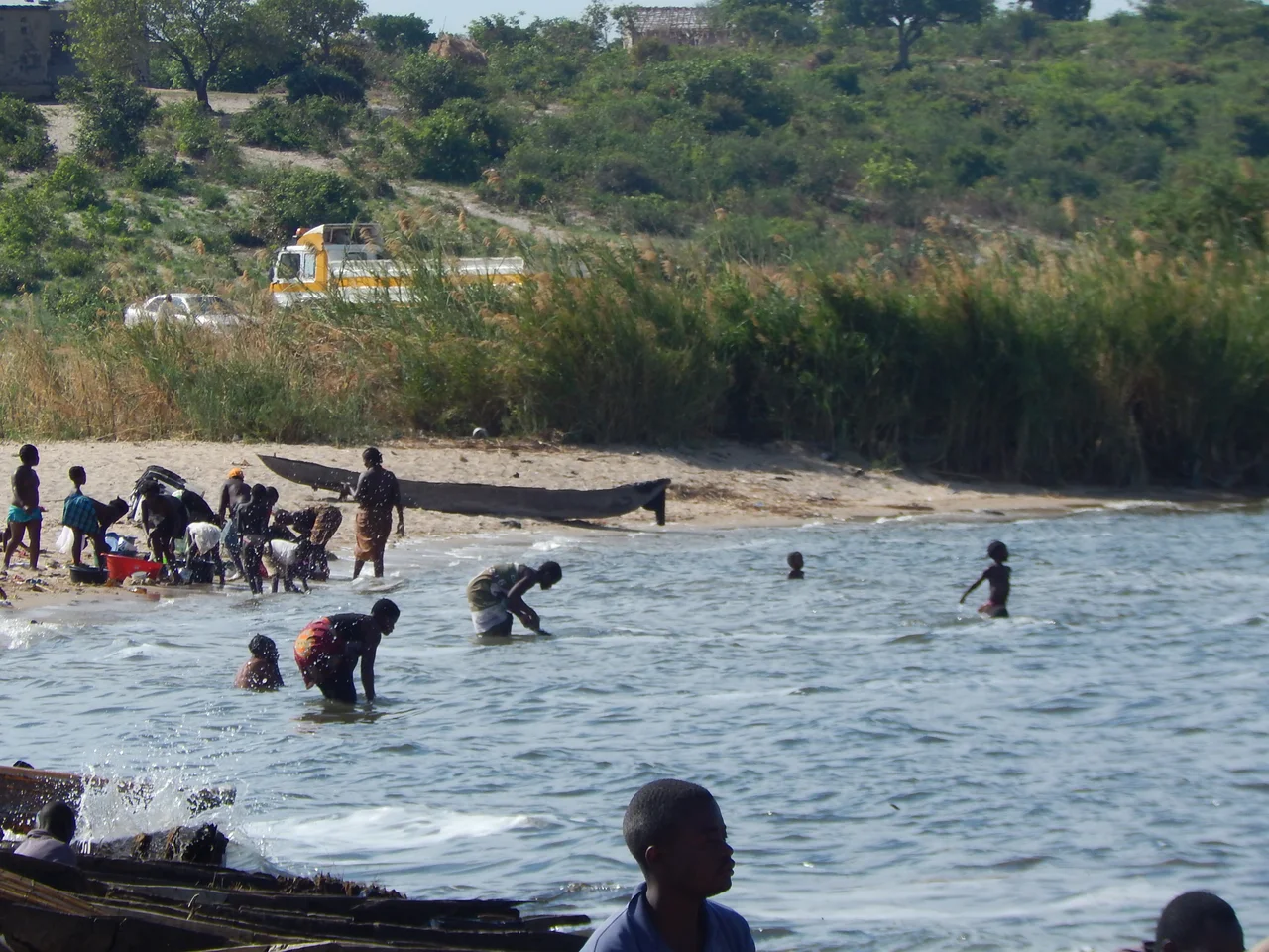
Canoes And Catch
The people around Bangweulu are mostly Bemba-speaking - Bisa in Chilubi and Mpika, Bemba in Luwingu, Unga in Lunga, Kabende in Samfya, Ngumbo in Lubwe, BenaMukulu in Chungu. Their heartland is the Paramount Chief Chitimukulu's seat northeast of the lake, around Kasama. And their livelihood is fish. In 1989 a single year's catch was estimated at 11,900 tonnes, hauled in by 10,300 people working from 5,305 dugout canoes, 114 plank or fibreglass boats, and only 54 outboard motors. By 2000 the catch had grown to 13,500 tonnes. When the season opens the population of some lakeside villages balloons as fishermen come in from elsewhere. They lantern-fish at night and haul bream and catfish at dawn.
Sandy Ridges And Flooded Islands
From space Bangweulu's most striking feature is a set of parallel sandy ridges running southwest to northeast, dividing the lake into three long sections. One ridge pinches off Lake Chifunabuli - fifty kilometers long, only five kilometers wide, entered through a 250-meter gap at the end of the Lifunge Peninsula. Another, formed by Mbabala Island, separates off Lake Walilupe. South of that lies Lake Kampolombo, connected by a seven-kilometer channel. In the Bangweulu Swamps, larger than the lake itself, dozens of islands host villages that become islands only during the flood and merge with the mainland in the dry season. A natural gas pipeline was proposed through the southeast in 2004, complete with a partial drainage plan. Local people and environmental groups pushed back hard. The company rerouted the pipeline through the surrounding province instead.
From the Air
Located near 11.08°S, 29.75°E in northern Zambia. Nearest significant airport is Kasama (ICAO: FLKS) to the northeast; Mansa (FLMA) lies to the west. Elevation 1,140 m. From the air in the dry season the permanent lake shows as a pale bluish sheet with the sandy ridges picked out as faint parallel lines; in the flood season (May) the system swells to nearly five times that area and the ridges emerge as narrow green spines through silvered water.
Nearby Stories
- Bangweulu Wetlands 45 km away
- Chambeshi Monument 96 km away
- Lavushi Manda National Park 113 km away
- Congo Pedicle 116 km away
- Ntumbachushi Falls 120 km away
- Mwela Rock Paintings 134 km away
- Central Zambezian miombo woodlands 165 km away
- Dambo 166 km away