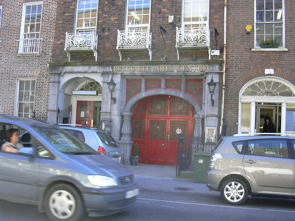

O'Connell Street, Limerick
Walk south down O'Connell Street and at the end of it, where the avenue curves into the Crescent, Daniel O'Connell himself stands on a pedestal looking back at you. The Liberator - the man who won Catholic Emancipation in 1829 - watches over the street that took his name when George's Street was deemed too colonial. The mile of pavement between is the spine of Limerick: Georgian brick, contemporary glass, banks where the old houses used to be, a coffee shop named for what was here before.
Pery's Grid
In 1765, Edmund Sexton Pery commissioned an engineer named Davis Ducart to lay out a new town south of medieval Limerick. Ducart drew a grid - rare in Ireland, rarer still in a city this old - and the centerpiece was a broad thoroughfare running northeast to southwest, parallel to the River Shannon. They called it George's Street, after the king. The plan was Continental in its discipline: long blocks, straight lines, brick townhouses rising three and four stories with fanlights above the doors.
The street prospered. By the early nineteenth century, the wealthy merchants had quit the cramped Dutch-gabled lanes of Englishtown and moved into Newtown Pery. The northern end of George's Street became the commercial core; the southern end held grand residences. After Catholic Emancipation, the street was renamed for O'Connell, and the Daniel O'Connell monument went up at the Crescent in 1857.
Todd's Fire
On 25 August 1959, smoke began drifting from the William Street side of Todd's department store at eleven in the morning. By 12:30 the entire city block was a blazing inferno. Todd's was Limerick's largest and best-known store, occupying a hulk of building that fronted onto O'Connell Street. The cause was an electrical fault. The fire became the most destructive in the city's history, gutting the whole block.
Brown Thomas now stands where Todd's burned. Across the street, the Cannock's clock tower - a beloved landmark - was demolished in later decades, replaced by the Penneys store that occupies the site today. From the 1950s onward, a combination of fire, neglect, and indifferent planning thinned the Georgian fabric of the northern end. The southern stretch fared better, preserving some of the finest Georgian townhouses in Ireland.
Civil War on the Pavement
In July 1922, the Irish Civil War came to O'Connell Street. Anti-Treaty forces held four military barracks and most of the city. Free State soldiers held Cruises Hotel on O'Connell Street, along with the Customs House, the Jail, and the Courthouse - a thin perimeter of strongholds inside enemy territory. For three days the two sides shot at each other across the Georgian facades.
Fifteen people were killed, eight of them Free State soldiers and seven of them civilians who had nowhere safer to be. Another eighty-seven were wounded. The fighting on O'Connell Street was part of the Irish Free State offensive that ended in the anti-Treaty forces withdrawing south. The bullet marks were eventually patched, the windows reglazed. The street kept being a street.
Revitalisation
In November 2021 the diggers arrived for what was meant to be a ten-month rebuild - wider footpaths, new street furniture, cycle lanes, a bus priority lane, on-street parking moved off to side streets. The original deadline was September 2022. Then it slipped to November 2022. Then January, March, and late-May 2023. Work finally finished in June 2023, at a cost of around nine million euros.
The street that emerged is recognisable but transformed. The International Rugby Experience building, designed by architect Niall McLaughlin, brought modern stone and timber to the Georgian skyline. The Copper Rooms wine bar turned old coal bunkers into a tasting room. The 101 took over a Georgian building and became a speakeasy. Brown Thomas, Penneys, Bank of Ireland, and AIB still occupy the commercial core. Each March, the St Patrick's Day parade and the Limerick International Marching Band Competition fill the new footpaths and spill into the old.
From the Air
O'Connell Street runs roughly northeast-southwest at 52.66 N, 8.63 W, parallel to the River Shannon and bisecting the centre of Limerick. The street is about 1.6 km long, terminating at the Crescent in the south. Shannon Airport (EINN) is 20 km west; Cork (EICK) is roughly 100 km south. Recommended viewing altitude is 1,500 to 3,000 feet AGL to read the Georgian grid of Newtown Pery as a distinct rectangular pattern against the older curving streets to the north. Look for the river bend and King John's Castle to the north for orientation. Visibility in Limerick averages moderate to poor - 977 mm of annual rainfall, cloud bases often below 2,500 feet, and only 3.5 hours of sunshine on an average day.
Nearby Stories
- Cloughjordan 4.8 km away
- Charleville 5.6 km away
- Kilfenora Cathedral 10 km away
- Shanbally Castle 10 km away
- Abbeyfeale 11 km away
- Holy Cross Abbey 15 km away
- 2003 Derrybrien Landslide 20 km away
- Kilrush 23 km away