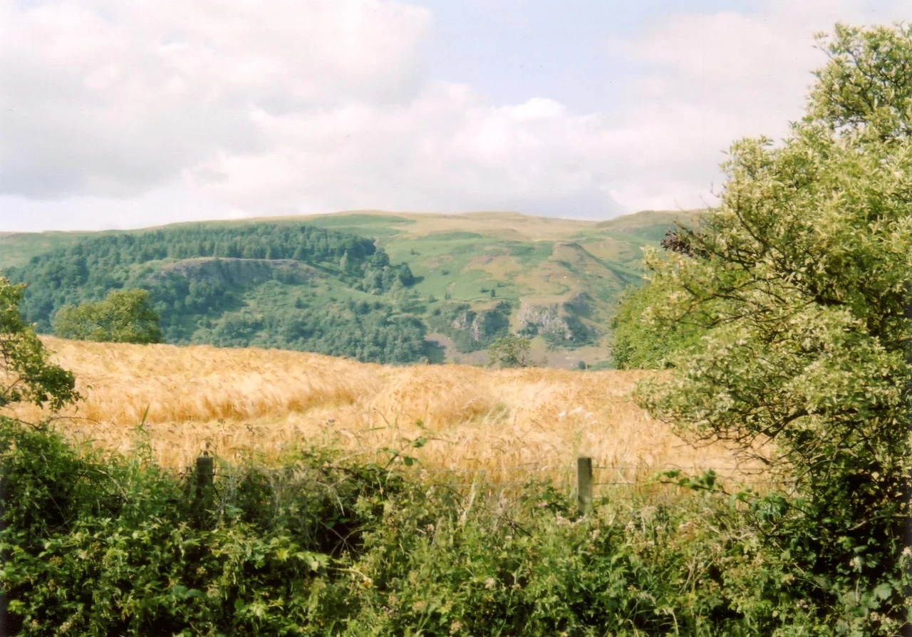

Ochil Hills
Stand at Stirling Castle and look north, and the Ochil Hills rear up across the Forth valley like a wall. The escarpment is sudden, almost theatrical, four hundred metres of green and grey rising directly out of farmland with no foothills to soften the approach. That cliff face is the work of the Ochil Fault, one of the cleanest geological lines in Britain, where 400-million-year-old Devonian lavas were tilted up and the softer Old Red Sandstone to the south was dropped down. The Ochils are not high by Scottish standards. Ben Cleuch tops out at 721 metres. But they punch above their weight because they punch so suddenly, marking the edge of the Highlands almost as crisply as a drawn line.
An Ancient Volcano
The hills are made of basaltic andesite and trachyandesite lavas erupted during the Early Devonian, when this part of what would become Scotland was a series of volcanoes. The Ochil Volcanic Formation, a sub-unit of the Arbuthnott-Garvock Group, piled up thick layers of lava and ash. Around Blackford and Auchterarder, on the northern slopes, you can still see volcanic conglomerate where chunks of older rock got cemented into the flows. The whole massif is heavily faulted, intruded by dykes of microdiorite from the Silurian-Devonian Calc-alkaline Dyke Suite that runs across northern Britain. Glaciers later did the polishing, scouring out the corries on the south face and gouging deep glens that hold burns rushing down to the Forth. Dollar Glen, Silver Glen, Alva Glen: all narrow, all dark, all impassable in places without wooden walkways.
Pictish Ghosts
The Ochils were once Pictish country. Castle Craig, a hill fort above Mill Glen, was described by local historian William Gibson in 1883 as a round Pictish fortress whose traces could still be distinctly seen. Industrial quarrying has since erased it. Local lore claimed that some of its stones were carried west to build Stirling Castle, an oral tradition that may or may not be accurate but speaks to the way the Picts felt close even in the 19th century. Higher up at the eastern edge of the range, the great crags of Dumyat are credited with holding the last Pictish stronghold in the area, an old hill fort whose name survives even though its walls do not. Pictish researcher Ronald Henderson has argued that Katie Thirsty's Well, an unexplained sacred spring in the hills, takes its name from a corruption of St Katherine of Alexandria and the Pictish king Drust. Whether or not that etymology holds up, the Ochils are full of names whose origins have been forgotten by everyone except the wind.
Walking the Plateau
From the top, the Ochils feel less like a range than a great undulating tableland. Ben Cleuch at 721 metres is the highest point, but the plateau rolls on with no commanding summit, just a long series of rounded tops separated by peaty hollows. Ben Buck reaches 679 metres, Andrew Gannel Hill 670, King's Seat Hill 648. Walkers climbing from the towns at the foot of the scarp, from Tillicoultry or Alva or Dollar, get the dramatic ascent. Walkers approaching from the gentler north, from Auchterarder or Blackford, hardly know they are gaining height until they look back and realise the country below has dropped away. The Ochils Mountain Rescue Team, founded in 1971 and based at the foot of the hills, fields 35 volunteers who pull people off this deceptively friendly plateau when weather closes in. A Cessna 152 crashed between Andrew Gannel Hill and The Law in 2006. The pilot walked away.
Wind on the Ridge
Twenty-first century use of the Ochils has added a new layer to the older economy of sheep and hill walking. An 18-turbine wind farm was approved in June 2006 at Green Knowes, south of Auchterarder, just north of the Ben Thrush summit. A second wind farm at Burnfoot Hill, north of Tillicoultry and south of the Upper Glendevon Reservoir, was completed after 2007. Burnfoot Hill carries fifteen 2 megawatt turbines and six 2.05 megawatt turbines with tip heights of 100 metres. EDF Renewables, which owns the site, supports the Ochils Mountain Rescue Team through the Burnfoot Hill Community Fund with a guaranteed annual donation of 5,000 pounds running until 2039. The turbines have changed the skyline that walkers see from the south, but they have also made the old plateau pay for itself in a way that the Pictish hill fort builders would have understood: a high place, a strong wind, a way of turning landscape into something useful.
From the Air
The Ochil Hills run roughly east-west across central Scotland between 56.2 and 56.4 degrees N, 3.5 to 3.9 degrees W. Ben Cleuch summit lies at 56.18 degrees N, 3.79 degrees W. Recommended viewing altitude 5,000 to 7,000 feet AGL. The southern escarpment is the dramatic feature, dropping cleanly from the plateau down to the Forth valley and the Hillfoots towns of Tillicoultry, Alva, Menstrie, and Dollar. Stirling Castle and the Wallace Monument sit just to the southwest with classic views of the Ochil face. Nearest airports are Perth/Scone (EGPT) about 18 nm northeast and Dundee (EGPN) about 40 nm east. The hills can generate sudden mountain weather; expect mechanical turbulence on the lee side in strong winds. Wind turbines at Green Knowes and Burnfoot Hill stand prominently on the higher plateau.
Nearby Stories
- Culross Abbey 4.5 km away
- Inner Tay Estuary 5.8 km away
- Airlie Castle 6.1 km away
- Lochearnhead 6.8 km away
- Pitlochry Festival Theatre 11 km away
- Union Canal (Scotland) 12 km away
- Mugdock Castle 14 km away
- Rannoch Railway Station 24 km away