.jpg)
Operation Bold Mariner
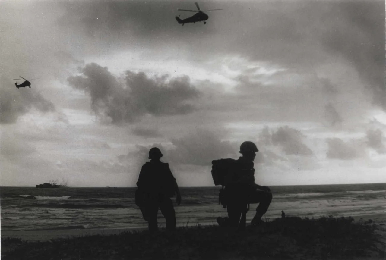
The assault ships gathered offshore in the dark hours before dawn on 13 January 1969. Marines from the 2nd and 3rd Battalions of the 26th Marine Regiment were at their stations — some aboard landing craft, others in helicopters waiting for first light. Twenty kilometers to the south, Task Force Cooksey had sealed the land approach. The Batangan Peninsula, which the Vietnamese called Ba Làng An — the Three Villages of Peace — was about to become the target of the largest amphibious operation the Marine Corps had mounted since the Korean War.
The Stronghold That Wouldn't Fall
By January 1969, the Ba Làng An Peninsula had been a contested zone for the better part of a decade. The Viet Cong had turned its naturally defensible geography — a narrow land bridge connecting it to the mainland, open water on three sides — into an interlocking system of fortifications, tunnels, and defensive positions. The 38th Main Force Viet Cong Regiment, the 48th Local Force Battalion, the P-31st Local Force Company, and the C-95th Sapper Company were all assessed to be operating in or through the peninsula, posing a direct threat to Quảng Ngãi city and to Allied forces in the region.
Previous operations had swept through. The Marines had landed here in 1965 during Operation Piranha; Korean and then Americal Division forces had patrolled here for years after. The peninsula remained a VC stronghold despite all of it. Operation Bold Mariner was designed to be different: not a sweep, but a seal — closing off the peninsula simultaneously from sea and land, trapping and destroying the forces inside.
The Landing
The operation opened with a feint. On 12 January, Marines staged a demonstration against Mộ Đức District, twenty kilometers south of the actual objective, attempting to draw attention away from the Batangan Peninsula. Whether the deception succeeded or the defenders simply chose not to contest the landing, the Marines came ashore at 07:00 on 13 January meeting negligible resistance.
Once on the beach, the battalions linked up with Task Force Cooksey — Americal Division elements from the 46th Infantry Regiment, the 1st Cavalry Regiment, and the South Vietnamese Army's 2nd Division — who had sealed the southern approaches. The Marines pushed east from their landing beaches, driving toward the sea, trying to compress the VC into an ever-shrinking pocket. What they found was not a conventional defensive line but a landscape honeycombed with mines, booby-traps, and fortifications. Encounters with armed fighters were minimal. The real opposition was the ground itself.
11,900 People
The civilian cost of the operation is its most significant measure. By 1969, years of sustained American bombardment had already altered how the peninsula's inhabitants lived: most families had moved underground, sheltering in bunkers and caves, emerging to tend crops between bombardments. The presence of 11,900 people in this active military zone — people who had lived on this peninsula for generations, who had farmed its flat land and fished its waters — was both a complication and an indictment of what the war had done to the landscape they called home.
The Marines evacuated all of them for screening, loading civilians onto UH-34 helicopters and moving them to a relocation facility near Quảng Ngãi City. On 19 January, the 2nd Battalion, 26th Marines captured 56 Vietnamese men of military age; under interrogation, they identified themselves as members of the C-95th Sapper Company. When the assault phase concluded on 24 January — the 2/26 Marines returning to their amphibious ships — the peninsula held no civilian population and no confirmed large-scale military force. Operation Russell Beach, involving Marine combined action teams and ARVN units, continued the work of clearing what remained.
Aftermath and Return
The operation concluded on 7 February 1969. The peninsula had been swept, its population removed, its VC infrastructure degraded. New roads were constructed and new hamlets built. In April 1969, the civilian population was allowed to return, together with South Vietnamese government institutions — the process that US military doctrine called pacification, the attempt to build a government presence where the VC had built a military one.
Whether it succeeded in any durable sense was a different question. The VC 48th Battalion would return during the 1972 Easter Offensive, destroying 23 villages around the peninsula and displacing 30,000 people. The peninsula that Bold Mariner had temporarily cleared would be contested again. But in January 1969, nearly 12,000 civilians were moved out of an active combat zone and the largest amphibious Marine assault in sixteen years had been executed. The operation stands as a technical military achievement whose human dimensions — the displacement of an entire civilian population from their homes — are impossible to separate from its tactical record.
From the Air
Located at 15.22°N, 108.91°E, the Batangan Peninsula (Ba Làng An) lies southeast of Quảng Ngãi city along the central Vietnamese coast. The peninsula is clearly visible from the air as it projects eastward into the South China Sea, with Chu Lai approximately 32 km to the north along the coast. The nearest airfield is Chu Lai (VVCA); Quảng Ngãi Airport (VVQN) lies approximately 15–20 km to the southwest. Recommended viewing altitude is 3,000–5,000 feet to appreciate the peninsula's geography and its natural military significance — the narrow land connection to the mainland and the open coast on three sides that made it both a stronghold and an amphibious objective.
Nearby Stories
- War of the Flags 16 km away
- Battle of FSB Mary Ann 22 km away
- Tam Kỳ 37 km away
- Operation Hawthorne 43 km away
- Operation Masher / White Wing 51 km away
- Vũng Rô Bay 231 km away
- Vũng Rô Bay Incident 260 km away
- Battle of the Paracel Islands 271 km away