
Operation Harling
The plan called for the attack to begin at 23:00. It did not go as planned. By the time the charges finally went off — at 1:30 in the morning, then again at 2:21 — the British demolition party had been improvising for hours in the dark beneath a railway bridge guarded by an Italian garrison, cutting apart their own explosive charges and reassembling them because the steel girders turned out to be the wrong shape. Twelve British officers and soldiers, 86 fighters from the communist-led ELAS, and 52 fighters from the republican EDES had come together in the mountains above the Gorgopotamos gorge to blow a hole in the supply line running from occupied Greece to Rommel's army in North Africa. They did it. Four men were wounded. No one died.
Why This Bridge, in This Gorge
Operation Harling was conceived in Cairo in the summer of 1942 by the British Special Operations Executive. The goal was to disrupt the railway connecting Athens and Thessaloniki — the main artery carrying supplies south toward the Mediterranean and onward to German forces in North Africa. Three bridges in the Brallos area were considered as targets: the Gorgopotamos, the Asopos, and the Papadia. The Asopos viaduct would have been harder to rebuild and was nominally the preferred target, but the mission's leader, Lieutenant Colonel Eddie Myers of the Royal Engineers, was given final authority to choose based on conditions on the ground. Myers, described by his second-in-command Major Chris Woodhouse as "the only parachute-trained professional sapper officer in the Middle East," chose Gorgopotamos: the Italian garrison there numbered about 80 men — manageable — and the bridge offered good cover, access, and a clear line of retreat into the mountains.
The Drop and the Long Weeks in Hiding
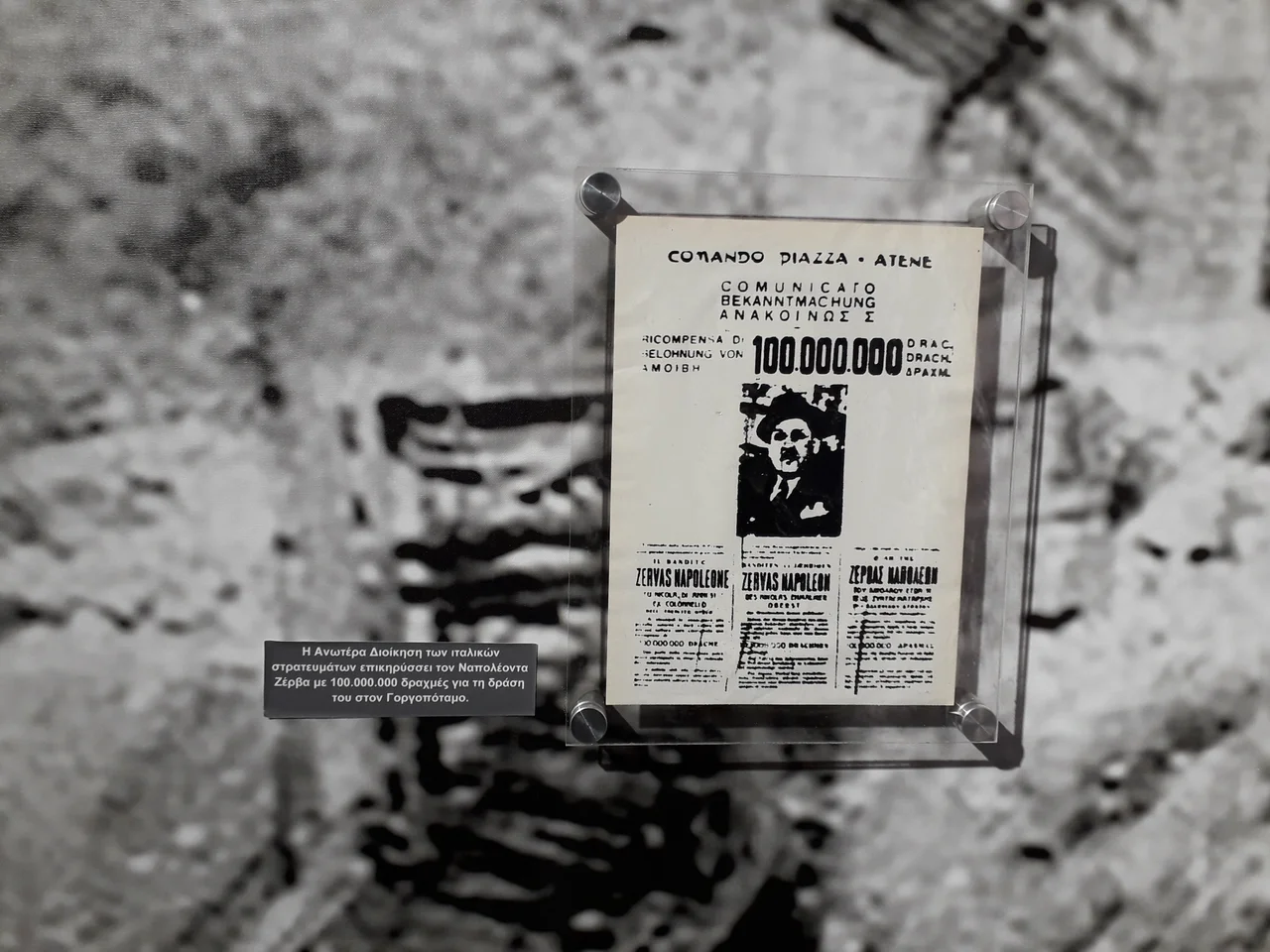
The SOE team numbered thirteen men, divided into three groups carried in three B-24 Liberator aircraft. A first drop attempt on 28 September 1942 failed when the pre-arranged signal fires were not lit on the ground. On 30 September the second attempt succeeded — two of the three planes located the fires and dropped their teams near Mount Giona. The third plane found nothing. Major John Cooke's group jumped blind near the heavily garrisoned town of Karpenissi; one man landed inside the town and was sheltered by local Greeks. They all eventually made their way into the mountains and found the guerrilla forces of ELAS commander Aris Velouchiotis. In the weeks that followed, the British teams were hidden and moved constantly by local Greek villagers, evading Italian search parties. Woodhouse traveled to Amfissa to establish radio contact with Cairo. Myers and his interpreter, Captain Denys Hamson, led by a local guide named Yiannis, scouted all three prospective bridge targets in person. The Greek resistance commanders were brought into the planning: Colonel Napoleon Zervas of EDES arrived with 45 fighters and was enthusiastic from the start. Velouchiotis of ELAS was initially reluctant — EAM's Athens leadership still doubted the value of rural armed action. Velouchiotis participated anyway, on his own authority.
The Night of 25 November
The combined force that assembled that November night totaled 150 men. The British twelve formed the demolition party. One hundred guerrillas — ELAS and EDES combined — were assigned to neutralize the garrison and hold the perimeter. Two eight-man teams cut the railway and telephone lines in both directions from the bridge. The attack on the garrison outposts at both ends of the viaduct began on schedule at 23:00. It went on far longer than anyone planned — the fighting was hard and the garrison did not collapse quickly. Myers made the call to send the demolition teams in while the fight continued above. Then came the problem with the girders. The shaped charges that the sappers had prepared did not fit the actual profile of the steel. They improvised: cut the plastic explosive apart, reformed the charges to fit what was actually in front of them. The first detonation at 01:30 brought down two spans and heavily damaged the central pier. The second, at 02:21, took the remaining span. A guerrilla outpost had stopped a train carrying Italian reinforcements from reaching the scene. By 04:30, the entire force had withdrawn.
What the Mission Left Behind
By the time the Gorgopotamos bridge fell, the Allied victory at El Alamein had already ended Rommel's North African campaign. The original military rationale for the operation had been overtaken by events. This did not diminish what the mission demonstrated. The sabotage showed Allied planners that coordinated guerrilla action in occupied Greece was feasible and could achieve significant results. The British Military Mission, which had been intended to disband after the bridge was blown, was instead ordered to remain — and Woodhouse stayed on to build what became a permanent SOE presence in Greece. For occupied Greece, the operation mattered in ways that extended beyond the military calculus. The ability of resistance fighters — regardless of their political differences — to accomplish something visible and dramatic against the occupiers carried a weight that is difficult to reduce to strategic terms. The bridge was rebuilt. The memory of the night it fell has not required rebuilding.
From the Air
The Gorgopotamos viaduct lies at approximately 38.83°N, 22.39°E, where the Gorgopotamos river cuts through the eastern slopes of Mount Oeta before joining the Spercheios. The gorge is identifiable from altitude as a deep, narrow cleft in the forested terrain; the river is visible in the gorge floor. The Spercheios valley runs east–west immediately to the north; Thermopylae lies approximately 8 km to the northeast. Nearest major airport: LGBL (Nea Anchialos / Volos), approximately 65 km northeast. Athens LGAV lies roughly 180 km to the south. The gorge terrain is steep and the river valley narrow — maintain safe altitude when transiting this area, particularly in poor visibility or when northerly winds create downdrafts off the Oeta massif.
Nearby Stories
- Boeotia 6.7 km away
- Prousou Monastery 12 km away
- Crissa 13 km away
- Abae 14 km away
- Amaliapolis 16 km away
- Agrafa 18 km away
- Rio–Antirrio Bridge 20 km away
- The 1954 Sofades Earthquake 27 km away