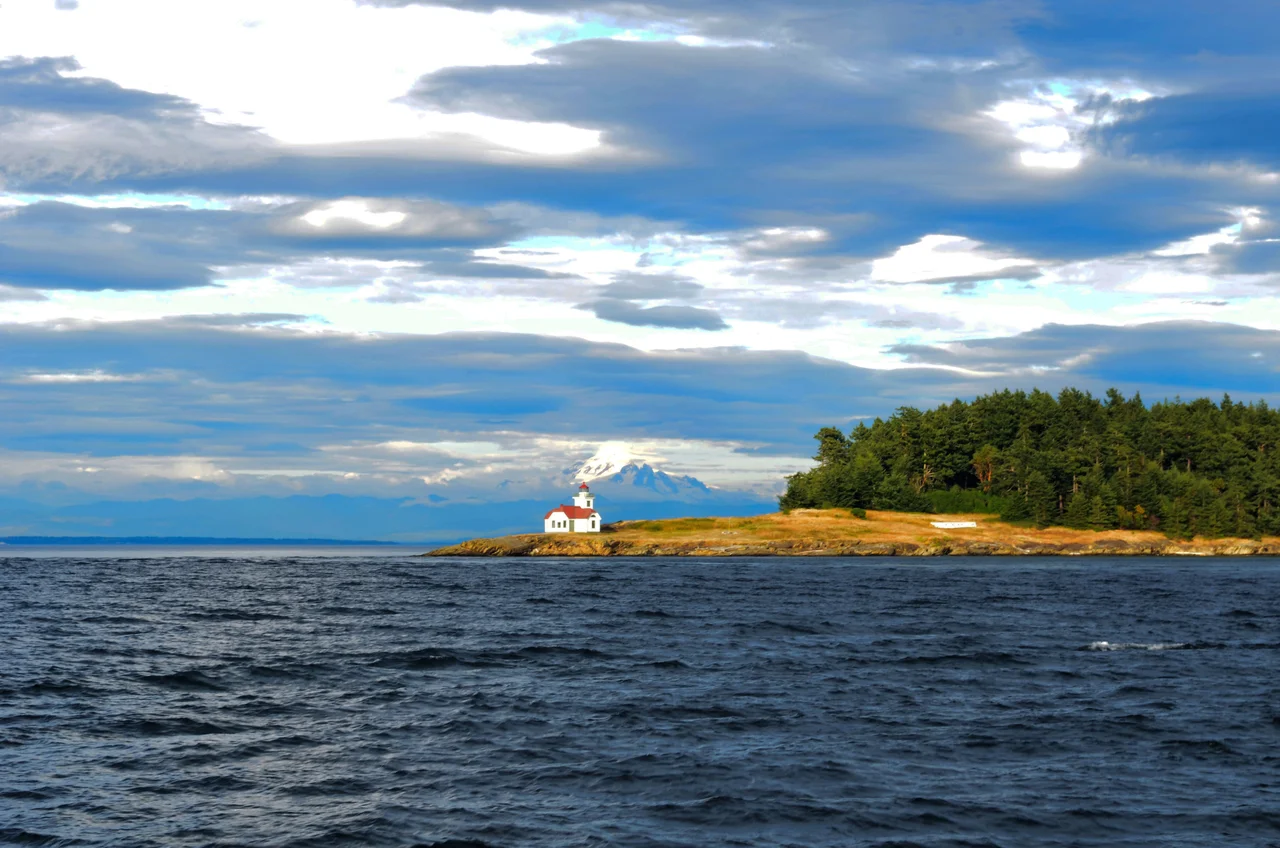

Patos Island Light
In 1905 Edward Durgan took the keeper's job at Patos Island and moved his wife and most of his thirteen children onto it. The island is a couple of hundred acres of rock and fir at the far northern edge of the San Juan archipelago, with no store, no school, no neighbours, and a fog signal that had to be answered at any hour of the night. They stayed until the early 1910s. Decades later one of those children, Helene Durgan Glidden, published The Light on the Island, a memoir of that childhood that has stayed in print ever since - a book about boredom, weather, boats, danger, and the specific experience of growing up somewhere that only had one building and an enormous amount of water.
Isla de Patos
The name arrived more than a century before the light did. In 1791 the Spanish expedition under Francisco de Eliza was charting the Strait of Georgia and the Strait of Juan de Fuca, and the first pilot, Juan Pantoja y Arriaga, noted the astonishing number of waterfowl around this particular island. He wrote down Isla de Patos - Island of the Ducks - and the name outlasted the Spanish claim entirely. The birds are still the reason. Patos sits where the Strait of Georgia opens toward the archipelago, with tidal currents and upwelling that concentrate food, and the seabirds concentrate accordingly.
Twelve Thousand Dollars
On 3 March 1891 the United States Congress appropriated $12,000 for a fog signal station at Patos. What it bought was modest: a post light and a third-class Daboll trumpet, a reed-driven fog horn that produced a sound loud enough to be heard through weather that hid everything else. The station began operating on 30 November 1893. The traffic it served was substantial - steamships running to Vancouver and other Strait of Georgia ports, and vessels heading north up the Inside Passage toward Alaska during the years when that route carried prospectors, freight, and everyone chasing the Klondike. In 1908 the station was upgraded with a new fog signal and a 38-foot tower carrying a fourth-order Fresnel lens, and it is that structure, small and white and square-shouldered at Alden Point, that stands today.
Keeping the Light
A keeper's life at a station like this was less romantic than the postcards suggest and more relentless. The lens had to be cleaned and the lamp tended nightly. The fog signal had to be run whenever visibility closed in, which on this coast is often. Supplies came by boat, weather permitting, and when the weather did not permit, they did not come. The Durgans were one family in a succession of keepers who served under the United States Lighthouse Service and later the Coast Guard, right up until the country entered the Second World War. Glidden's account of those years has been described as somewhat embroidered, which is probably fair and beside the point. It is the only sustained first-person record of what daily life was actually like out here.
Still an Aid to Navigation
Patos Island Light was added to the National Register of Historic Places in 1977 and remains an active aid to navigation - not a museum piece with a working replica, but a light that boats still use. In 2008 federal funding through the Bureau of Land Management paid for a thorough renovation: new roof, doors, windows, gutters and downspouts, and fresh paint inside and out. A near-twin from the same 1893 construction period survives at Turn Point Lighthouse on Stuart Island, a short distance southwest, which lets visitors see the standard design the Lighthouse Service was rolling out across these waters at the end of the nineteenth century.
Three Agencies and a Volunteer Group
In 2013 Patos Island became part of the San Juan Islands National Monument, established by President Barack Obama and managed by the Bureau of Land Management. The arrangement on the ground is more collaborative than that implies. Washington State Parks handles the limited development on the island - some maps still label it Patos Island State Park - and the nonprofit Keepers of the Patos Light does much of the practical work, opening the lighthouse to the public during summer months and building interpretive exhibits funded through a Washington State Lighthouse Environmental Program grant. Getting there still requires a boat and reasonable conditions, which means the island remains about as quiet as it was when a keeper's thirteen children had it to themselves.
From the Air
Patos Island Light stands at 48.789 N, 122.972 W on Alden Point, the western tip of Patos Island - the northernmost island of the San Juan group in San Juan County, Washington. A viewing altitude of 1,500-3,000 feet MSL shows the island clearly: a small, forested landmass roughly 2 km long with the white lighthouse and its outbuildings on the exposed western point, and Active Cove notching in just east of it. Sucia Island lies immediately southeast with its distinctive hooked, multi-fingered shape, and Orcas Island sits beyond. This is a border area - the Canada-US boundary runs through Boundary Pass just north, with Saturna and Tumbo Islands on the Canadian side, so be certain of your position before drifting north. Orcas Island Airport (KORS) is about 10 nm south, Friday Harbor (KFHR) about 15 nm southwest, and Bellingham International (KBLI) roughly 20 nm east. Strong tidal rips are visible on the water surface around the point. Fog is frequent - it is why the station exists - and summer offers the most reliable visibility.
Nearby Stories
- Abbotsford, British Columbia 1.5 km away
- Lopez Island 4.4 km away
- Lake Whatcom 5.3 km away
- Craigflower Manor and Schoolhouse 7.2 km away
- Salt Spring Island 7.3 km away
- Canadian Forces Station Ladner 11 km away
- Valdes Island 19 km away
- Everett-Pacific Shipbuilding: The Yard That Built a Floating Navy 60 km away