
Valdes Island
Valdes Island is shaped like a blade - sixteen kilometres long, 1.6 wide, walled for most of its length by steep sandstone cliffs dropping straight into deep water. There is almost nowhere to land. That single geographic fact explains nearly everything about the island: why it has so few residents today, why the one usable beach near its southern end mattered so much, and why kayakers who come here talk about it the way climbers talk about a good route. You do not casually arrive at Valdes. The island decides where you may come ashore.
Two Spanish Captains and an English Surveyor
The name honours Cayetano Valdés y Flores, who first saw this coast in 1791 as a lieutenant serving under Alessandro Malaspina aboard the Descubierta. He came back the following year in command of the Mexicana, exploring these waters alongside Dionisio Alcalá Galiano in the Sutil - two tiny vessels probing a labyrinth of channels, and encountering George Vancouver's much larger expedition doing the same thing at the same time. The island did not actually get Valdés's name until 1859, when Captain George Henry Richards, surveying the coast aboard HMS Plumper, assigned it. Richards named an enormous number of features on this coast, and he had a habit of honouring the Spanish who had preceded him - which is why a Gulf Island carries the name of a Spaniard applied by an Englishman sixty-seven years after the fact.
Five Thousand Years at Shingle Point
A third of Valdes Island is held as three reserves belonging to the Lyackson First Nation, a Hul'q'umi'num'-speaking Coast Salish community. At Shingle Point, where one of those reserves sits, archaeologists have documented roughly sixty sites, with evidence of people living here going back at least five thousand years. That is the record of a home, not a stopover - generations of families working a coastline that outsiders find forbidding, because they knew exactly where the landings and the resources were. The Lyackson today are a small nation, fewer than two hundred members, and most now live at Chemainus on Vancouver Island rather than on the island itself. It is a common pattern on this coast and a costly one: a community whose territory remains theirs while daily life happens somewhere with a road, a school, and a clinic.
The Sandstone Galleries
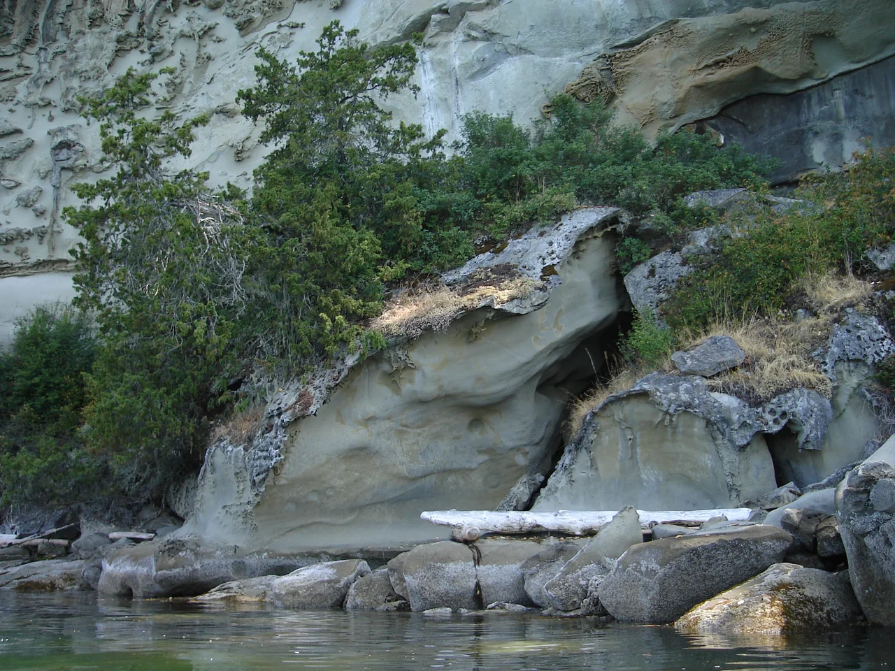
Along the north shore, winter storms have spent thousands of years working on soft sedimentary rock, and the result is extraordinary. The formations known as the Sandstone Galleries are a honeycombed, wind- and wave-sculpted wall of hollows, overhangs, ribs, and small caves - the most dramatic sandstone on a chain of islands already known for it. There is no way to see them properly from land, and no anchorage to speak of. You come by kayak, paddling close under the cliffs on a calm day, reading the shapes as the light moves across them. Orcas are abundant in the surrounding water, which means the trip occasionally offers more than geology.
An Abandoned Well and a Composting Toilet
For an island with so little settlement, Valdes has two well-known places to sleep, and they differ sharply. Wakes Cove, at the southern end near Porlier Pass, is protected water with hiking trails and effectively no facilities - the most notable human trace is an abandoned well on an overgrown road, which tells its own story about how long somebody once tried to stay. The cove takes its name from Baldwin Wake, a retired British naval captain who bought land here in 1876. Blackberry Point, by contrast, is a proper marine campsite: defined cooking and tenting areas, trails leading up from the beach, and a composting toilet. Between the two, a paddler crossing Porlier Pass from Galiano has somewhere to aim for at either standard of comfort.
Porlier Pass
Everything on Valdes is shaped by what happens at its southern tip. Porlier Pass separates the island from Galiano to the southeast, and like all the Gulf Island passes it funnels the enormous tidal exchange between the Strait of Georgia and the sheltered waters inside - which means ripping current, standing waves, and a brief window each cycle when a small boat can go through comfortably. That pass is why this stretch of coast was a travel route for millennia, why the island's one workable beach sits where it does, and why the modern kayaking and boating trade that keeps Valdes on people's itineraries is a matter of timing above all. Read the tables right and the island opens. Read them wrong and you wait.
From the Air
Valdes Island lies at 49.0706°N, 123.6517°W in the Strait of Georgia, part of the northern Gulf Islands chain. It is instantly recognizable from the air: a long, narrow, straight sliver of forested land aligned northwest-southeast, separated from Galiano Island by the narrow gap of Porlier Pass at its southeast end and from Gabriola Island by Gabriola Passage to the northwest. Nanaimo and the Vancouver Island shore lie west across the Strait of Georgia; the mainland and the Coast Mountains fill the eastern horizon. At low sun angles the north shore's sandstone cliffs and the tidal turbulence in Porlier Pass both show clearly. Recommended viewing altitude is 1,500-3,000 ft MSL to trace the cliffs, the Shingle Point and Blackberry Point beaches, and the pass, or 6,000-7,000 ft to frame the whole Gulf Islands archipelago. Nanaimo (CYCD) is roughly 9 nm west with a water aerodrome in Nanaimo Harbour; Victoria International (CYYJ) is about 35 nm southeast. There is no airstrip on the island. Expect summer afternoon northwesterlies down the strait, frequent winter southeasters, and generally good visibility outside frontal passages.
Nearby Stories
- Ganges, British Columbia 4.6 km away
- Burns Bog 5.4 km away
- Mesachie Lake 6.7 km away
- Strait of Georgia 8.5 km away
- Mount Arrowsmith Biosphere Region 12 km away
- Jedediah Island Marine Provincial Park 14 km away
- St. Augustine's Indian Residential School 16 km away
- Lower Mainland 31 km away