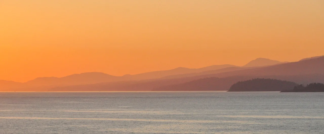

Strait of Georgia
For a short while, this water was called the Gran Canal de Nuestra Senora del Rosario la Marinera - the Great Channel of Our Lady of the Rosary the Mariner. Francisco de Eliza gave it that name in 1791, after Captain Jose Maria Narvaez and pilot Juan Carrasco became the first Europeans to probe it. A year later George Vancouver arrived, decided it was a gulf rather than a channel, and renamed it for his king. Neither man was naming an empty place. Coast Salish peoples had been living around this sea for thousands of years, and their word for it would take another two centuries to reach a map.
Three Names on One Sea
Vancouver called it the Gulf of Georgia in 1792, for George III, and labelled the mainland behind it New Georgia, with New Hanover and New Bremen further north. The Georgian name stuck; the German ones did not. Then in March 2008 the Chemainus First Nation proposed something different - that these waters be called the Salish Sea. An American movement was pushing a broader version of the same idea, applying the name collectively to the Strait of Georgia, the Strait of Juan de Fuca, and Puget Sound together. That is the version that carried. Washington's state board approved it in October 2009, the United States Board on Geographic Names on November 12, 2009, and Canada in 2010. Nothing was erased. The Strait of Georgia is still the Strait of Georgia; it is now also understood as one arm of the Salish Sea.
The Shape of the Water
The strait runs roughly 240 kilometres between Vancouver Island and the mainland of British Columbia and the far northwestern corner of Washington, narrowing to as little as 20 kilometres across. It covers about 6,800 square kilometres with a mean depth of 156 metres, and it is deeper than most people assume - the Ballenas Basin at its centre bottoms out at 420 metres, roughly 15 kilometres north of Nanaimo. Both ends are cluttered with islands. The Gulf Islands and San Juan Islands crowd the southern entrance, with Boundary Pass, Haro Strait, and Rosario Strait threading through toward the Strait of Juan de Fuca; at the northern end the Discovery Islands stand between the strait and Discovery Passage, which leads on into Johnstone Strait. The United States Geological Survey draws the southern boundary as a line from East Point on Saturna Island out across Patos, Sucia, and Matia islands to Point Midgley on Lummi Island.
One River Does Almost All of It
About 80 per cent of the fresh water entering the Strait of Georgia comes down a single river. The Fraser drains an enormous interior watershed and dumps it here, and the consequences reach everywhere. Surface water across much of the strait runs brackish and silt-laden in freshet season, the circulation turns in a broadly counterclockwise pattern, and the nutrient loading supports a food web that has made this some of the most productive inshore water on the coast. It also means the strait's health is not really a coastal question. What happens in the Fraser basin - hundreds of kilometres inland, in places with no view of salt water at all - arrives here within days.
The Busiest Crossings in Canada
This is a working sea. The port of Vancouver sits at its eastern edge, and the strait forms the southern entrance to the Inside Passage, the sheltered inland route running north toward Alaska, which makes it one of the most heavily used navigation channels on the west coast of North America. BC Ferries' two busiest routes both cross it: Tsawwassen to Swartz Bay, linking Vancouver to Victoria, and Horseshoe Bay to Departure Bay at Nanaimo. Duke Point-Tsawwassen and Little River-Westview cross it too, alongside water taxis and small operators serving the islands scattered between. Towns ring the whole basin - Campbell River, Courtenay, Comox, Qualicum Beach, Parksville, Lantzville, and Nanaimo along the island shore; Powell River, Sechelt, Gibsons, and Greater Vancouver on the mainland; Bellingham and its neighbours across the border in Washington.
A Shaking, and a Misspelling
On June 23, 1946, an earthquake centred on Vancouver Island shook the entire Strait of Georgia region hard enough to drop the floor of Deep Bay by at least three metres - a reminder that this basin sits in seismically active country and that the seabed here is not a fixed thing. The strait has also seeded an odd piece of cultural history. In 1967 it gave its name, with a deliberate change of spelling, to The Georgia Straight, Vancouver's alternative newspaper, which has published continuously ever since. And beneath all the ferry wakes and container traffic, the water itself draws people for its own sake: the Strait of Georgia is regarded as one of the premier cold-water diving and whale-watching destinations anywhere on this coast.
From the Air
The Strait of Georgia centres near 48.8314°N, 122.9447°W and stretches roughly 240 km northwest to southeast between Vancouver Island and the British Columbia mainland. It is impossible to miss from altitude - a long inland sea framed by the Vancouver Island Ranges to the west and the Coast Mountains to the east, with the Fraser River's brown sediment plume fanning out from the delta near Vancouver and often visible as a distinct colour boundary on the water. The Gulf Islands and San Juan Islands cluster at the southern end, the Discovery Islands at the northern. Recommended viewing altitude is 8,000-12,000 ft MSL to appreciate the full basin and the mountain walls on either side; lower work at 3,000-5,000 ft gives better detail on ferry routes and island passages. Vancouver International (CYVR) sits on the delta at the eastern shore, Nanaimo (CYCD) and Comox (CYQQ) on the island side, and Bellingham International (KBLI) near the southeastern corner in Washington. Note the international boundary running through the southern approaches and heavy commercial, ferry, and floatplane traffic throughout. Summer afternoons bring strong northwesterly winds funnelled down the strait; winter delivers low cloud, rain, and occasional outflow gales from the mainland inlets.
Nearby Stories
- Abbotsford, British Columbia 1.5 km away
- Lopez Island 4.4 km away
- Lake Whatcom 5.3 km away
- Craigflower Manor and Schoolhouse 7.2 km away
- Salt Spring Island 7.3 km away
- Canadian Forces Station Ladner 11 km away
- Valdes Island 19 km away
- Everett-Pacific Shipbuilding: The Yard That Built a Floating Navy 60 km away