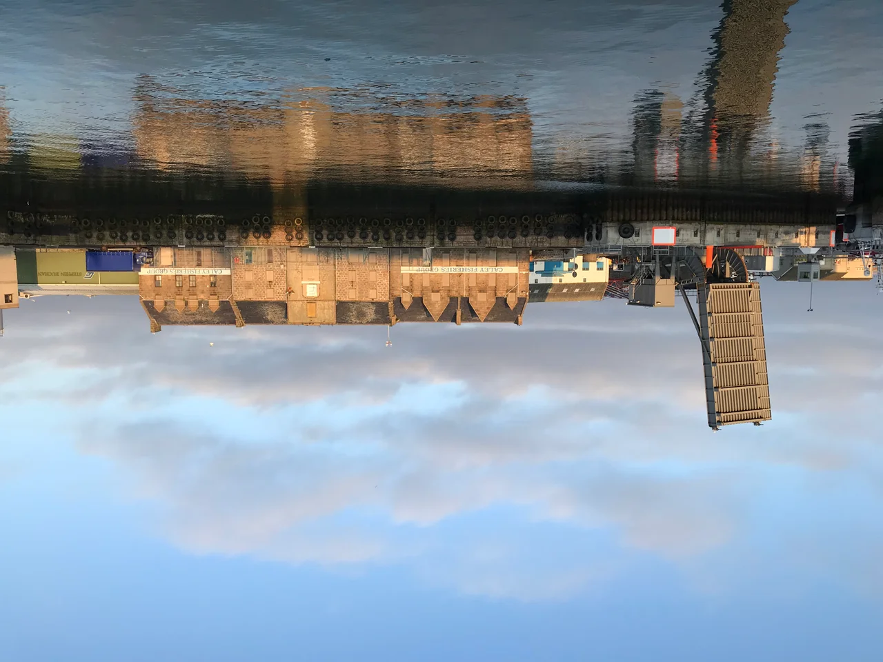

Peterhead Harbour
The south breakwater is two thousand seven hundred feet of granite, dropped block by block into the North Sea between 1892 and 1912. The men who built it were prisoners. They walked down from HM Convict Prison Peterhead each morning in shackled gangs, learned to cut stone, and pieced together one of the largest harbour works in Britain. By 1956 a second breakwater, fifteen hundred feet long, closed the bay from the north. Inside the two walls, three hundred acres of sheltered water became Peterhead Bay. In a normal year now, around a hundred and ninety thousand tonnes of fish cross the quays here. The harbour is the busiest port in the United Kingdom for fish landings, and the prison that built it is a museum.
Three Harbours Stitched Together
Peterhead Harbour was not built; it was assembled, piece by piece, over four centuries. The first protective pier predated 1593, when Peterhead itself was incorporated as the Harbour and Barony of Keith Insche commonly called Peterhead. The water around two former islands - Keith Inch on the east and Greenhill in the middle - was filled in over time, joining them to the mainland and creating the three separate basins still in use today: Port Henry on the south-east, North Harbour on the north, and South Harbour wrapped around the centre. Queenie Bridge crosses between Bridge Street and Greenhill Road, threading between North and South. Standing on any quay you are walking on what was once open water, or possibly on one of two islands that no longer count as islands.
The Best Situate in Scotland
By 1738 the Leith shipmasters - the men whose opinion on Scottish ports was as authoritative as anyone's - put on record that the harbour of Peterhead is in our opinion the best situate of any place in Scotland for all ships trading on the north seas. They were right about the geography. Peterhead sits at the easternmost point of mainland Scotland, the natural haven for vessels crossing to and from Scandinavia and the Baltic. In 1815, before the herring boom, there were seventy-two vessels registered to the port. By 1850 there were over four hundred. The harbour kept rebuilding itself to keep up. North Harbour and the dry dock were laid out by John Rennie and Thomas Telford between 1818 and 1822. The piers were added by David Stevenson - of the famous Stevenson engineering family - in 1855. Middle Harbour came in 1872 from David and his brother Thomas.
The Stones the Prisoners Cut
The Harbour of Refuge, also called the Admiralty Backwaters, was begun in 1886 under the supervision of Sir John Coode. The bulk of the labour, by Admiralty design, came from the new convict prison opening on the hill above the town. Peterhead Prison was built in 1888 partly to provide the workforce. Men sentenced for offences across Scotland served their time cutting granite for the breakwaters and the inner harbour. The south breakwater, twenty-seven hundred feet of dressed stone, took from 1892 to 1912 to complete - twenty years of swinging hammers against the local pink granite. The north breakwater took even longer, 1912 to 1956. The convicts who started it were dead before the men finishing it were born. Both walls still stand, and the prison they walked from is now a museum where visitors can sit briefly in the cells.
Four Lighthouses, One Coast
The harbour is watched by four lighthouses, two of them still active. The South Breakwater lighthouse, designed by Robert Stevenson and built in 1833, is the easternmost lighthouse on mainland Scotland and still warns vessels into the south entrance. The Harbour South lighthouse, built in 1849 by Thomas Stevenson, originally stood on the Albert Quay and was carefully relocated to the junction of the Esplanade and Alexandra Parade in 2015 to give it a public-facing perch. The Harbour North lighthouse, dating from 1908, stands in front of the Port Authority control building on the West Pier. Donald Manson, who served as harbourmaster for roughly forty years and died in the role in 1880, oversaw the harbour through its great Victorian expansion. The Peterhead Port Authority - formed in 2006 by merging two older bodies - now runs the whole basin, where deep-sea trawlers, oil-industry supply boats and the occasional cruise ship all queue for the quays.
From the Air
Peterhead Harbour sits at 57.50 degrees north, 1.77 degrees west, on the easternmost coast of mainland Scotland. From the air the two great breakwaters are unmistakable - long curving granite arms enclosing about three hundred acres of sheltered water around Peterhead Bay. The four lighthouses stand at distinct points: the South Breakwater (active) at the tip of the south arm, the inactive Harbour South on the Esplanade, and the inactive Harbour North on West Pier. Aberdeen Dyce Airport (ICAO EGPD) is about twenty-five nautical miles south-south-west. Best viewed at 1500-3000 feet AGL; the harbour is one of the largest engineered harbours in the UK and is a useful coastal navigation marker.
Nearby Stories
- Mither Tap Hillfort 4.3 km away
- Banff and Macduff Lifeboat Station 11 km away
- SS St Petersburg 12 km away
- River Don, Aberdeenshire 17 km away
- HMS Exmouth (H02) 53 km away
- Piper Alpha 120 km away
- German submarine U-1274 190 km away
- HMS Nottingham (1913) 231 km away