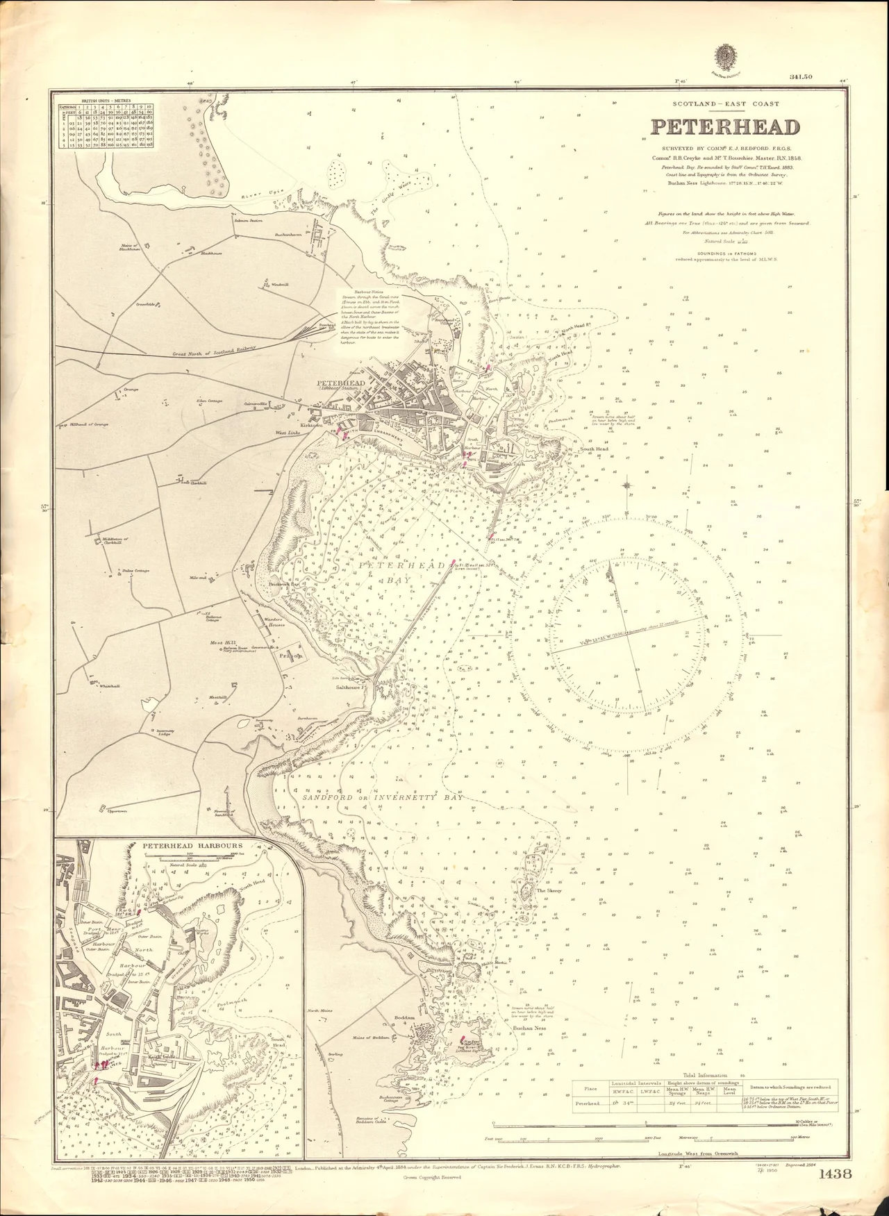

Peterhead
Locals call themselves Bloo Touners, after the blue worsted moggans - stockings - the fishermen used to wear. The town is the Bloo Toon. You will not find that name on the road signs, but you will hear it in every pub and chip shop in Peterhead, which since 1593 has clung to the easternmost rocks of mainland Scotland and worked the sea for whatever the century would bear: whaling, then herring, then whitefish, then offshore oil, then whitefish again. Even now, with the high street battered and the prison turned into a museum, the harbour still lands more fish than any port in the United Kingdom. The fish supper - never call it fish and chips here - usually arrives on your plate the same day it was hauled aboard.
Arriving by the Long Way Round
There is no train to Peterhead. The Beeching cuts took the passenger service in 1965, and the nearest station - Dyce, on the way into Aberdeen - is some thirty miles away with no useful onward bus. So everyone arrives by road. From Aberdeen the A90 runs north for about thirty-five miles, passing Ellon and Cruden Bay, and Stagecoach runs buses every half hour on weekdays for around ten pounds and seventy-five minutes. From Fraserburgh on the north coast, bus 69 takes thirty minutes. From Inverness, the slow A950 makes a useful westward shortcut. The town centre is walkable end to end, and beyond it Stagecoach runs frequent local buses to Boddam, Cruden Bay and Mintlaw. Grey seals turn up in the harbour itself most days, and if you wait an hour somebody will sell you a hot buttery.
What to Look For
The medieval ruin of Old St Peter's Church stands at the north end of the beach - parts may be twelfth century, though the standing tower is later medieval. Peterhead Bay is enclosed by the two great breakwaters and is now home to oil-and-gas service vessels alongside the fishing fleet. South of the bay, Lido Beach stretches a mile along the shore - bracing rather than balmy. North Harbour, Port Henry and South Harbour together form the working fishing port; walk around the old stone quays and watch the grey seals work their territory. Keith Inch, the former island that forms the harbour's east side, is now an industrial peninsula but remains officially the easternmost point of mainland Scotland. South of town the pink granite cliffs run down toward the Bullers of Buchan, a collapsed sea cave that has become a magnificent arch. Puffins nest there from spring.
Slains, Cruden Bay and Dracula
Fifteen minutes' drive south, on the cliffs above the village of Cruden Bay, stands New Slains Castle - the building most people now mean when they say Slains. It is the sixteenth-century replacement for Old Slains Castle, which James VI blew up with gunpowder in 1594 and which now survives as a five-mile-south fragment of corner masonry. Bram Stoker stayed in Cruden Bay during the 1890s and visited New Slains regularly while he was writing Dracula. Its silhouette - cliff-top, roofless, brooding - found its way into Castle Dracula on the Transylvanian crag. The castle is unmaintained and walking it requires real care; the masonry is loose and the cliff edge is closer than it looks. The walk along the bay below, however, is one of the great coastal walks of north-east Scotland.
Fish Suppers, Butteries and a Whisky That No Longer Exists
Two foods are obligatory. The fish supper, ordered from any of the harbourside chippers, will most often be haddock, though lemon sole is the connoisseur's choice. Locals avoid cod. A white pudding supper - seasoned oatmeal battered and fried - is the standard alternative for non-fish eaters. The other must-try is the buttery, called a cookie in Peterhead and called rowies elsewhere in the north-east. It is a flat, dense, lightly croissant-like roll, salty and rich, eaten warm with butter or jam. To drink, the local boast was Glenugie - Scotland's most easterly distillery, on the southern edge of town until it closed in 1983. Bottles of Glenugie single malt still surface in specialist shops and at auction, sometimes for thousands of pounds. The distillery itself is gone. Scottish Week in mid-July includes the Red Arrows aerial display and a famous race of home-made rafts across Peterhead Bay.
From the Air
Peterhead lies at 57.51 degrees north, 1.78 degrees west, at the easternmost point of mainland Scotland. From the air look for the two great granite breakwaters enclosing Peterhead Bay, the long mile of beach running south to the headland at Buchan Ness, and the working harbour with its forest of fishing-boat masts and supply-boat funnels. The Buchan Ness Lighthouse stands south of the town. Aberdeen Dyce Airport, ICAO EGPD, is about twenty-five nautical miles south-south-west. Best viewed at 1500-3000 feet AGL. The pink granite cliffs south of town, including the Bullers of Buchan sea arch, are dramatic from low altitude.
Nearby Stories
- Mither Tap Hillfort 4.3 km away
- Banff and Macduff Lifeboat Station 11 km away
- SS St Petersburg 12 km away
- River Don, Aberdeenshire 17 km away
- HMS Exmouth (H02) 53 km away
- Piper Alpha 120 km away
- German submarine U-1274 190 km away
- HMS Nottingham (1913) 231 km away