Pico do Itambé State Park
The indigenous name said it plainly: Itambé, sharp stone. Long before anyone measured it at 2,002 meters, the peak announced itself to the people who lived in its shadow, a blade of rock cutting the horizon of the Serra do Espinhaço. It is the kind of mountain that demands a name rather than receives one. Stand at its base in Minas Gerais, 357 kilometers northeast of Belo Horizonte, and the word makes sense before you know the language.
Where Rivers Begin
Pico do Itambé is a watershed in the literal sense. From its slopes rise the headwaters of two rivers that run in opposite directions across eastern Brazil: the Jequitinhonha, which drains northeast toward the Bahian coast, and the Doce, which cuts east through Minas Gerais and Espírito Santo to the Atlantic. Spring-fed creeks braid down through rocky fields and cerrado scrub before gathering into the streams that will, hundreds of kilometers later, carry water to two different stretches of ocean. The 4,696-hectare state park, created by state decree in January 1998, protects the springs themselves and the luxuriant rainforest that fills the valleys below. Everything downstream of this quiet place drinks from these mountains.
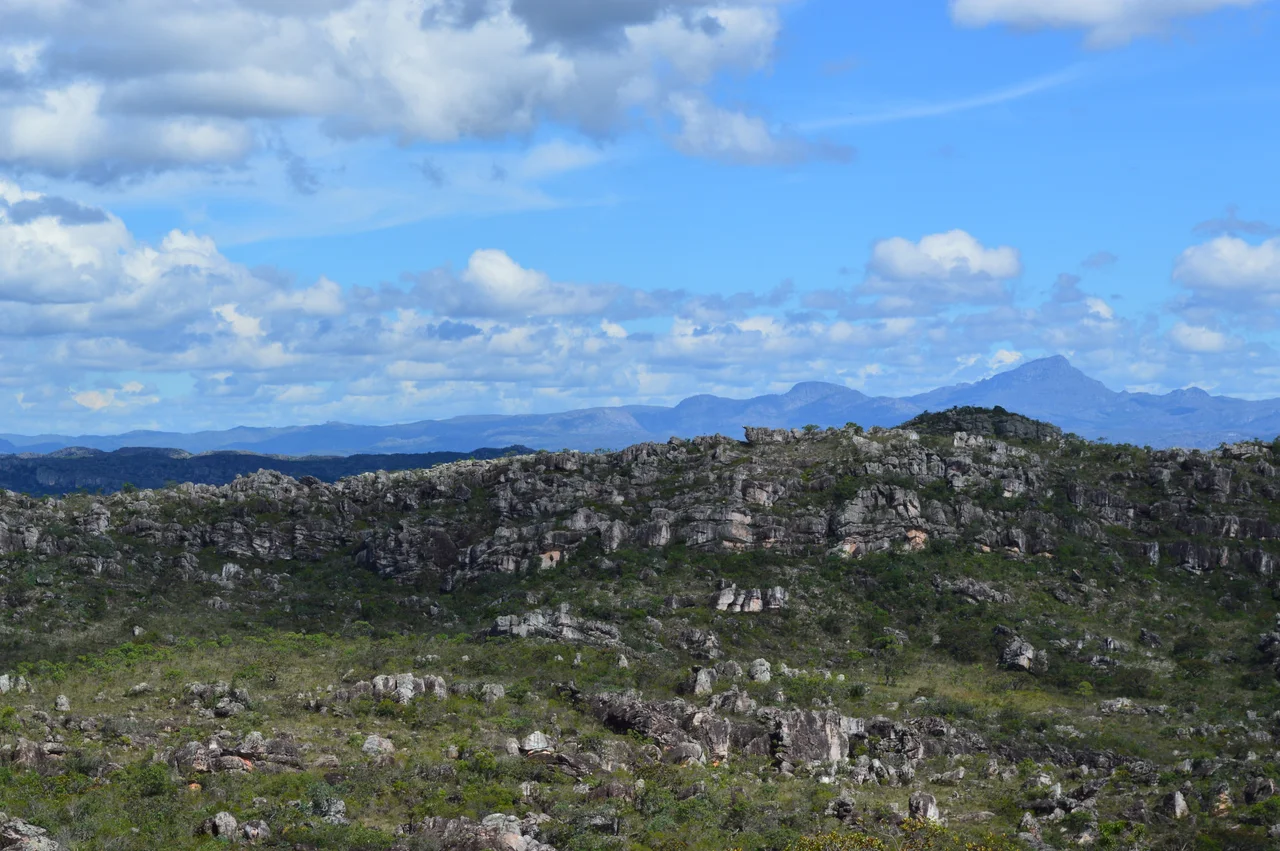
A Park Still Being Discovered
The Espinhaço range is ancient, but science keeps finding new life here. In 2007, botanists clinging to the cliffs beside the Fumaça waterfall identified a previously unknown bromeliad, which they named Orthophytum itambense after the peak itself. In 2011, a new amphibian species, Crossodactylodes itambe, emerged from the rocky streams. A decade later, in 2021, researchers described Waltillia itambana, another bromeliad endemic to these slopes and nowhere else on Earth. The park sits in the transition zone between two great Brazilian biomes, the Atlantic Forest and the cerrado, and the meeting of those worlds produces a biological richness that defies a single classification. Rupestrian rock gardens, highland grasslands, and seasonal forests hold species that exist only here, suspended between climates.
Climate of the Heights
Most of Minas Gerais bakes in tropical heat, but the upper reaches of Itambé stay mild year-round, averaging around 18 degrees Celsius. The dry season runs from June to August; the rains arrive from November through March, and the trails often close on wet days because the rocks turn to glass. Wildlife takes advantage of the seclusion. Maned wolves, those long-legged russet predators of the Brazilian uplands, pass through, along with ocelots, cougars, and the small tree-dwelling southern tamandua. Coimbra Filho's titi, a rare monkey species with a tuft of white on its crown, has been recorded in the park. At dawn, the granite walls throw long shadows across the grasslands, and what sounds like silence turns out to be mostly birdsong.
Waterfalls and Old Roads
The Waterfalls trail gathers four cascades into a single 2.8-kilometer walk. The Rio Vermelho plunges 36 meters; the Fumaça drops 20; the Neném, 8; the Água Santa splits into two shorter falls. The Tropeiros trail runs 12 kilometers along the old mule-driver route that once connected Santo Antônio do Itambé to Capivari, when merchants moved goods across the mountains on the backs of animals. It is gentler walking. The Mountains and Valleys trail, which climbs to the summit itself, is harder, and it requires authorization from park authorities. So does walking the Tropeiros route, because parts of it remain undisturbed and the land is not generous to those who wander unsupervised.
The Diamond Road
The park belongs to the Diamonds and Royal Road tourist circuit, tracing the old colonial routes that once carried precious stones from the interior of Minas Gerais to the Portuguese court. That history lingers in the region, more in the texture of villages like Serro than in any signage at the park. What Itambé offers is the original thing the diamond hunters passed through on their way to riches: the stone mountain, the springs, the fields where two rivers are born on either side of a single summit. The best months to visit are April through October, when the dry air sharpens the views and the trails stay open. The rest of the year the mountain keeps to itself.
From the Air
Coordinates 18.40°S, 43.35°W. Recommended viewing altitude 8,000-10,000 ft AGL to see the Espinhaço ridgeline and the summit pyramid. The peak stands at 2,002 m (6,568 ft) and is a prominent landmark on clear days. Nearest airport: Diamantina Airport (SBDM, JDF), about 60 km northwest. Belo Horizonte's Confins International (SBCF) lies roughly 300 km southwest. Best visibility April through October during the dry season.
Nearby Stories
- Santo Antônio do Rio Abaixo 68 km away
- Minas Gerais 74 km away
- Malacacheta 91 km away
- Serra dos Cocais 94 km away
- Vila Império 112 km away
- Minas Novas 132 km away
- Pirapora 135 km away