Serra dos Cocais
The first settlers who cleared these slopes kept writing down the same observation: coqueiros, coconut palms, everywhere. The name Serra dos Cocais carries that observation forward into the present, even though most of the original palms are gone and the slopes around the villages are now planted with eucalyptus destined for pulp mills. The granite beneath is unchanged. Blocks of it, continuous and unjointed, form the backbone of this range, and radiometric dating places the rock at more than 600 million years old. The peaks rise to 1,200 meters in a landscape where 500 to 800 meters is the average. From a distance the Cocais look like an unusually tall ridge. Up close they are a mountain, and the small villages on its flanks carry a culture the surrounding Steel Valley urbanism has not quite absorbed.
Where Cerrado Meets Doce
The range sits within the municipality of Coronel Fabriciano, about 20 kilometers from the urban center, in the interior of Minas Gerais between the Piracicaba, Doce, and Santo Antônio river basins. The range actually defines their division - water falling on the south flank heads one direction, water on the north heads another, and hundreds of small creeks begin as springs within the forest cover. The Little Cocais Stream drains 129 square kilometers of the range before emptying into the Piracicaba, and its valley forms the heart of the environmentally protected area that was designated in 2002. Geologically, the Cocais are part of the Espinhaço Mountains system, the long granite spine running north through Minas Gerais and Bahia. The protection came because the slopes still hold a significant fragment of Atlantic Forest, rare enough in this part of the country to be worth fighting for.
The Tropeiro's Path
Around 1825, a Brazilian official named Guido Marlière laid out a road connecting the municipality of Antônio Dias to the Santo Antônio River near Naque. The road crossed the Serra dos Cocais at what would later become the village of São José dos Cocais. In the years that followed, tropeiros - the mule train drivers who moved goods, people, salt, and information across the Brazilian interior - used the route regularly. The villages along the path grew by accreting around the needs of the traffic: places to rest, to water the animals, to trade. A Monument to the Tropeiro stands in Santa Vitória dos Cocais today, built from steel plates donated by the Emalto Group in 2016, a visible acknowledgment that these villages exist because the mule trains stopped here. The tropeiros are gone. The cultural memory they left is what still animates the local festivals.
Eucalyptus and the Company Town
The villages have been losing people for decades. Until the 1980s, the economy here revolved around small-scale farming: coffee, cattle, subsistence crops. Then the Cenibra pulp company began paying small landowners to plant eucalyptus on their farms, with the harvested wood shipped to Cenibra's pulp mill in Belo Oriente. The math worked in favor of eucalyptus in the short term - cash payments, less labor, guaranteed buyers - and worked against it in the long term, because eucalyptus plantations do not employ the same number of people as mixed farming. Between the pulp mill and the charcoal needed for the Aperam South America and Usiminas steelworks in the Vale do Aço - the Steel Valley - the whole region became economically dependent on forest monoculture. Farms consolidated. Young people left for Coronel Fabriciano and Ipatinga, the bigger cities downstream. The Serra dos Cocais now holds about two thousand rural residents, a number that has been declining steadily.
The Marujada and the Marching Dancers
What the villages have kept is culture. The Marujada dos Cocais, based in Santa Vitória dos Cocais, is a traditional folk dance ensemble that performs marches and tributes for Our Lady of the Rosary. They appear on the anniversary of Coronel Fabriciano's founding each January 20 and during the Santa Vitória community's patronal celebrations. The handcrafts of the villages - made from materials gathered in the surrounding forest and sold at popular markets - are part of the same continuum. A municipal survey conducted in April 2012 asked residents which site best represented Coronel Fabriciano. The Serra dos Cocais won with 58 percent of the vote. In 2009, the Minas Gerais State Tourism Secretariat included the range in its Atlantic Forest Tourist Circuit, a recognition that the landscape and its villages had something to offer beyond eucalyptus and pulp.
Rocks, Rappels, and the Two Brothers
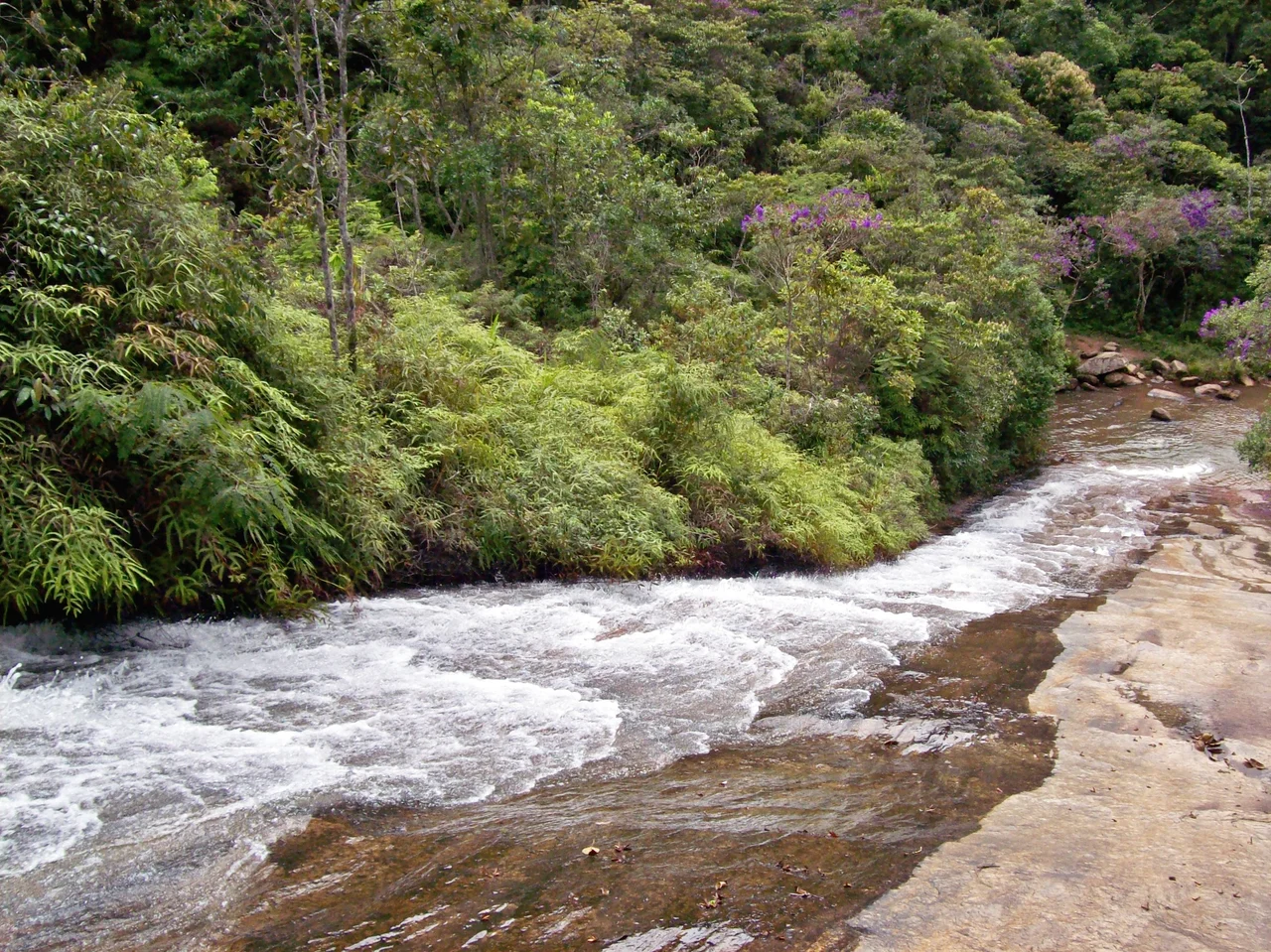
The sport tourism has multiplied. Mountain bikers, climbers, backpackers, rappellers, and off-roaders have all found reasons to come here. The Jipe Clube Vale do Aço, the local off-road club, runs organized tours and competitions on the trails. Climbers work the Pedra dos Cem Homens, the Rock of the Hundred Men, a vertical face that takes its name from how many climbers could theoretically belay off its upper ledges. The Pedra Dois Irmãos, the Two Brothers Rock, requires a steep wooded trail to reach but offers panoramic views across the entire Steel Valley. Near the Caladão neighborhood, the Pedra do Caladão provides another overlook. The Escorregador Waterfall takes its name - the slide - from the smooth rock shelves that form a natural toboggan run. The Cachoeirão Waterfall drops about 120 meters through remaining Atlantic Forest, a popular backpacking destination. The Biquinha de Santa Vitória is a smaller natural spring of drinkable water near the namesake village. Each of these places existed before anyone came to photograph them. They will exist after.
From the Air
Serra dos Cocais is centered at 19.46 degrees south, 42.68 degrees west, in the interior of Minas Gerais about 20 km from Coronel Fabriciano in the Steel Valley region. The range reaches 1,200 m at its highest point, rising from surrounding terrain at 500-800 m elevation. Recommended viewing altitude 5,000-7,000 ft AGL for terrain clearance. The range appears as a ridge line of forested slopes with patches of eucalyptus plantation at lower elevations. Nearest airport is Usiminas Airport (SBIP) at Ipatinga, about 25 km east; Belo Horizonte Confins (SBCF) is about 200 km southwest. The Doce River valley runs just south of the range. Weather patterns typical of inland Minas - afternoon thunderstorms in wet season, morning valley fog common.
Nearby Stories
- Santo Antônio do Rio Abaixo 22 km away
- Santa Bárbara, Minas Gerais 35 km away
- Vila Império 38 km away
- Feliciano Miguel Abdala Private Natural Heritage Reserve 39 km away
- Governador Valadares, Minas Gerais 69 km away
- Pico do Itambé State Park 85 km away
- Robert Quayle (1814 ship) 92 km away
- Rio Preto State Park 128 km away