Rio Preto State Park
Somewhere in the park's uplands, on a wall of weathered stone, prehistoric hands left paintings that nobody has fully decoded. A few kilometers away, the Estrada Real - the colonial Royal Road that once carried gold and diamonds 1,400 kilometers toward the coast - still leaves faint traces in the soil. Rio Preto State Park sits in the northern Espinhaço Mountains, protecting 12,184 hectares of cerrado vegetation so harsh it bends its trees into twisted shapes, so rich it shelters species found almost nowhere else. The river that gives the park its name runs white-sanded and clear, cutting canyons, forming pools, and pushing toward the Jequitinhonha River far below.
Where the Road Still Runs
The Estrada Real was the imperial highway of colonial Brazil - a 1,400-kilometer network that moved gold from Minas Gerais to Rio de Janeiro, closed to anyone without a royal license. Tax agents watched the mule trains. Smugglers walked side trails to avoid them. A piece of one of those trails runs through Rio Preto State Park. Traces still remain in the stones and the lay of the land, 70 kilometers from Diamantina, the diamond-mining town whose wealth once flowed this way. Walk these hills and you walk where prospectors walked, where enslaved people walked under guard, where a whole colonial economy of extraction left its footprint in the brown earth.
Trees That Twist
Cerrado is one of Brazil's great biomes, and it writes on its trees. The plants here lean and distort, with irregular, gnarled branches that look wind-carved even in calm air. Above 900 meters elevation, everything grows closer to the ground. In the stream valleys, semi-deciduous trees find more water and stand taller. The eastern edge of the park brushes against Atlantic Forest, creating a botanical borderland where species from both biomes meet. Flora include monjolo, pau pereira, candeia, sucupira, pau d'óleo, peroba, ipê, araticum, and carvalho - a glossary of Minas Gerais in Portuguese and Indigenous roots. At the highest reaches, alpine tundra takes over, where nothing grows but the toughest grasses and lichens holding fast to quartz.
Birds Found Only Here
The hyacinth visorbearer - a hummingbird with an iridescent blue crest - lives almost nowhere outside this stretch of the Espinhaço. So does the Cipo canastero, a small brown songbird of the rocky grasslands, and the serra finch, whose range barely extends beyond the mountain chain. Endemism is the park's signature. The birds here evolved in isolation among the quartz cliffs and cerrado scrub, and they cannot easily survive elsewhere. The mammals include the maned wolf - a long-legged, russet-furred canid that hunts alone through the high grass at dusk - along with the giant anteater, giant armadillo, ocelot, and cougar. Every creature on the list requires space the cerrado is losing faster than any other Brazilian biome.
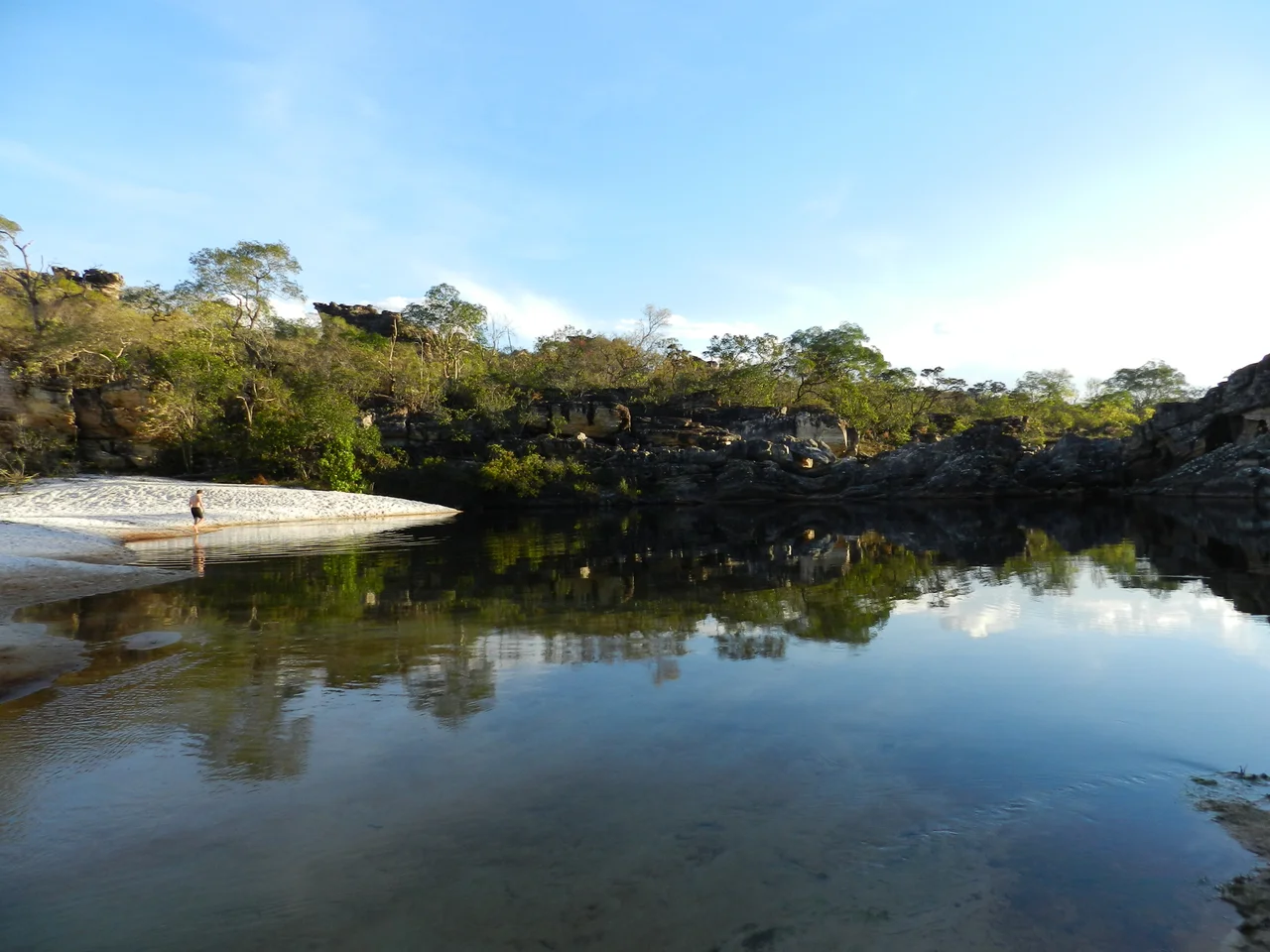
Water Through Quartz
The Rio Preto rises in these hills - a main tributary of the Araçuaí River, which feeds the Jequitinhonha, which finally meets the Atlantic hundreds of kilometers east. But the water before it becomes a river is what visitors come to see. Waterfalls spill over quartz shelves into natural pools. Rapids rush through narrow canyons. In quieter reaches, the river slows and spreads into fluvial beaches with sand so pale it looks bleached. The Crioulo and Sempre Viva waterfalls are the marquee attractions, but the whole river network rewards walkers who follow the trails to unlabeled pools. The dry season runs from April to October, and this is when the skies clear and the light sharpens against the cliffs.
A Park Fought For
The Rio Preto was declared a permanently protected river in 1991, after local communities demanded it. Three years later, on 1 June 1994, Decree 35,611 created the state park around 10,755 hectares. It opened to visitors in 2002, and later decrees enlarged its boundaries. In 2010, it joined the Espinhaço Mosaic - a constellation of conservation units spread along the mountain chain. But in 2013 the Public Ministry of Minas Gerais charged that the State Forestry Institute was failing the park and several others: lacking management plans, lacking personnel, lacking resolved land titles. Protection on paper does not automatically become protection on the ground. Still, the park persists, twelve lodges sleeping 52 people, a camping area for 25 tents, and 46 kilometers of cerrado trail waiting for the next walker with water and good boots.
From the Air
Coordinates 18.17°S, 43.34°W, in the northern Espinhaço Mountains, 355 km north of Belo Horizonte and 70 km from Diamantina. Recommended viewing altitude 7,000-10,000 feet AGL to appreciate the rugged quartz cliffs and the pale thread of the Rio Preto winding through cerrado uplands. Nearest airport is Diamantina/Almenara Airport (SNDT). Tancredo Neves International (SBCF) at Belo Horizonte lies 355 km south. Clear dry-season skies (April to October) offer the best views.
Nearby Stories
- Minas Novas 85 km away
- Minas Gerais 85 km away
- Santo Antônio do Rio Abaixo 87 km away
- Malacacheta 95 km away
- Vila Império 108 km away
- Das Velhas River 123 km away
- Grão Mogol 162 km away