
Pleistos
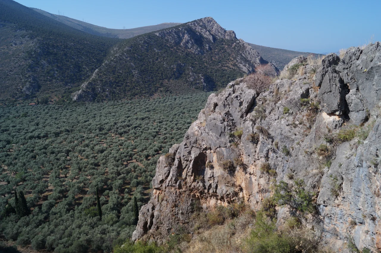
If Pleistos means "full," as some ancient scholars believe, the name is an irony. Stand on the road above Delphi in summer and look down: the riverbed is bare limestone, pale and dry, catching the light so cunningly that it mimics the glint of flowing water. The Pleistos is a river that hides. It runs mostly underground through the karst rock, surfacing only in winter, trickling through channels that farmers long ago redirected to feed their olive trees. The valley it carved — a young rift opened just one million years ago by the same tectonic restlessness that made the Gulf of Corinth — is not what you expect. It is not a broad, gentle floodplain. It is a world of precipitous scarps, rockfall netting, landslide debris, and below all that geology: an ocean of olives stretching from the flanks of Parnassus to the salt water at Itea.
A River That Flows Underground
The Pleistos begins on the slopes of Mount Parnassus, near the mountain town of Arachova, at roughly 700 metres elevation. From there it flows west between Parnassus and Mount Cirphis, passing south of Delphi, through the Krisaean plain, and finally reaching the Gulf of Itea — a bay of the Corinthian Gulf — near the small harbour of Kirra. The Castalian Spring, that sacred source above the sanctuary of Apollo, feeds into it. So do the numerous springs that seep from the base of the great north scarp, the flank of Parnassus itself acting as a slow-draining sieve.
But most of the journey is hidden. The limestone terrain is karst — riddled with cracks and cavities — and much of the water routes itself through underground channels. In summer the visible bed is empty, a pale track of bare stone. Farmers have reinforced this invisibility over the centuries, diverting what surface water exists into controlled irrigation channels that thread the olive groves. The original course has been so thoroughly managed that a second river, the Skitsa, which drains the Amfissa valley to the west, was once also called the Plistos — suggesting the same river once drained both valleys before the hydrology was rerouted.
The Sea of Olives
Look down from the road at Delphi and the valley floor seems to move. On a windy day the millions of olive leaves turn silver and back to green in waves, exactly like the sea the locals named it after. The "sea of olives" is not a poetic exaggeration — it covers the entire non-urban floor of the valley system, reaching from Delphi down to the coast. These groves have been in place since prehistoric times. The semi-arid valley floor, too broken and steep for cities, is perfectly suited to olive cultivation: the scree slopes drain well, the limestone soil is thin but workable, and the Mediterranean climate supplies enough rain in winter to sustain the trees without irrigation through the dry summer.
The protected view from the sanctuary of Delphi reinforces this timelessness. High-voltage power lines are routed out of sight. Industrial structures do not intrude. Standing at the ancient terraces and looking south, a visitor in 2026 sees roughly what a 5th-century BC Greek pilgrim saw: the valley floor silvered with olives, the ravine of the Pleistos cutting through the scree below, and beyond it, the blue of the Corinthian Gulf. Scale and serenity together.
Geology Written in the Walls
The Pleistos valley exists because two great geological forces collided and then partially rebounded. Africa's northward push against Eurasia raised the Hellenides — the mountain chains of Greece — and also triggered a back-arc extension that stretched and thinned the land behind the raised front, pulling it apart. That stretching opened the Corinth Rift, separating the mountains of Central Greece from the Peloponnese. The Pleistos valley is a younger, smaller version of the same process: a normal fault opened roughly one million years ago, and its scarp is still visible as the north wall of the valley — a cliff face of bare rock above the talus slopes.
The geometry created something accidental and extraordinary. An older reverse fault from the orogeny cuts across the normal fault of the valley, splitting the north wall into two facing peaks: the Phaedriades. Water draining through that reverse fault emerges in the valley as a system of springs. Those springs, collecting at the foot of a cleft that ancient visitors found evocative of the earth itself, became the site of the Castalian Spring. The oracle at Delphi was born, at least in part, from hydrology — from the particular way two fault systems happened to intersect in this valley.
History Poisoned and Remembered
The Pleistos appears in ancient accounts not just as a landmark but as a weapon. Around 590 BC, during the siege of Kirrha — the port town at the valley's mouth — the Athenian statesman Solon is said to have ordered hellebore roots cast into an aqueduct fed by the river, poisoning the water supply of the besieged city. The stratagem worked. Kirrha fell. The story, whether strictly true or not, captures the valley's strategic importance: whoever controlled access to the Pleistos controlled movement through this part of central Greece.
Both Strabo and Pausanias mention the river in their geographies, noting its course and the olive wealth of its valley. Solon's poisoning aside, the river's peacetime role was prosaic: it watered trees, it carved the ravine below Delphi, it vanished into the limestone in summer and returned with winter rains. A hiking trail today follows the old access road from the docks at Kirra up through the olive groves to the Castalian Spring — a 3 to 4 hour walk that traces the same path ancient pilgrims used before the road was cut. The springs at the top still flow. The olives are still there. The river still hides.
From the Air
The Pleistos valley lies at approximately 38.43°N, 22.45°E, running west from Arachova (near 38.48°N, 22.58°E) to the Gulf of Itea at Kirra (38.37°N, 22.40°E). From altitude, the valley is unmistakable: a narrow, dark-green corridor of olive groves cutting between pale limestone ridges, with the broader blue-grey expanse of the Corinthian Gulf to the south. The sanctuary of Delphi is visible as a series of terraces on the north slope, roughly midway along the valley. Recommended viewing altitude 3,000–5,000 ft to take in the full extent of the olive sea. Nearest major airports: LGRX (Araxos, across the Gulf of Corinth, ~80 km south by air) and LGAV (Athens Eleftherios Venizelos, ~150 km east, the usual visitor gateway). Visibility is typically excellent in summer; morning haze can soften the valley in early hours.
Nearby Stories
- Battle of Leontion 2.8 km away
- Siege of Livadeia 3.1 km away
- Pyre of Heracles 8.2 km away
- Corinth Rail Disaster 8.8 km away
- Rio–Antirrio Bridge 9.9 km away
- Heraion of Perachora 13 km away
- Prousou Monastery 15 km away
- Free and Real 30 km away