Pomponio State Beach
The name on the highway sign sounds like a saint, but Pomponio was no saint. He was a rebel. Born into the Coast Miwok people whose ancestors had lived along this coast for thousands of years, the man known as Pomponio refused the mission system that had swallowed so many of his kin. He formed a band called Los Insurgentes, raided ranches and missions along the central California coast, and eluded Spanish soldiers for years before his capture and execution in 1824. Two centuries later, a quiet state beach twelve miles south of Half Moon Bay carries his name, though most visitors who spread their blankets on its sand have no idea whose memory they are keeping.
The Rebel's Shore
Pomponio State Beach sits where Pomponio Creek meets the Pacific, a modest stretch of coastline along Highway 1 that lacks the dramatic cliffs of its neighbors to the north and the wide expanses of beaches farther south. What it offers instead is solitude. The beach draws fewer visitors than nearby Half Moon Bay State Beach or San Gregorio, making it one of the quieter stops on the San Mateo County coast. A small parking lot and a picnic area serve daytime visitors. There are hiking trails that wind through the coastal scrub above the beach, and a path down to the sand where the creek's freshwater meets salt. No camping is permitted, and dogs and campfires are prohibited, leaving the beach to the sound of waves and the cries of shorebirds.
An Ohlone Legacy
The Ohlone people lived along this stretch of coast for millennia before Spanish colonizers arrived in the late eighteenth century. The mission system that followed devastated their communities, concentrating indigenous people at missions where disease, forced labor, and cultural suppression took a catastrophic toll. Pomponio's rebellion was one of many acts of resistance, but his was among the most sustained. He operated across a wide territory, and the Spanish authorities considered him dangerous enough to mount repeated expeditions to capture him. His story is part of a broader history of indigenous resistance that is only now receiving the attention it deserves. The beach bearing his name sits on land that was once Ohlone territory, a fact that the rolling grasslands and creek-cut ravines do nothing to advertise.
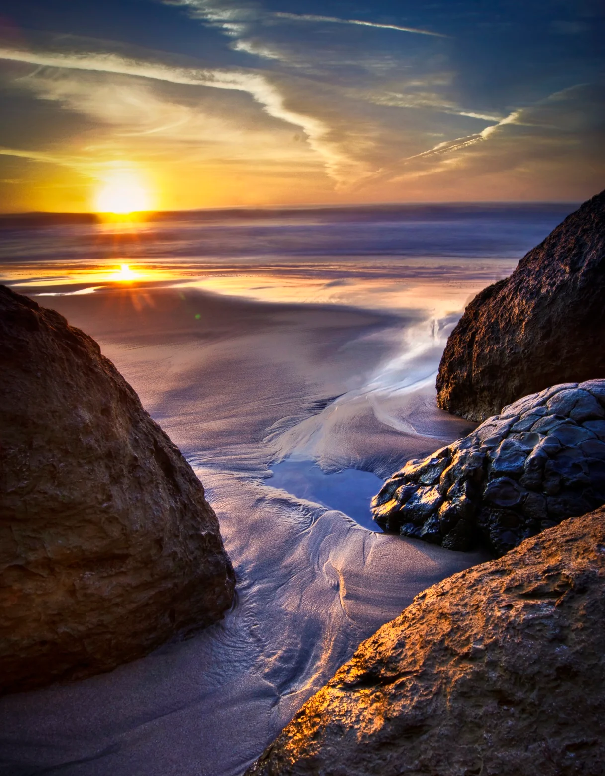
Where Creek Meets Ocean
Pomponio Creek flows through a narrow canyon before opening onto the beach, creating a small lagoon that shifts with the seasons. In winter rains, the creek cuts directly through the sand berm to the ocean. In dry months, the water seeps beneath the sand, filtering invisibly to the sea. This cycle shapes the beach itself, building and eroding the shoreline in patterns that change year to year. The surrounding coastal bluffs are low and rounded here, covered in coyote brush and wild grasses that turn gold by late summer. From the water's edge, looking south, the coastline curves gently toward Pescadero and the wilder beaches beyond. Looking north, the bluffs rise toward the more developed stretches near Half Moon Bay. Pomponio sits at the transition between the two, a quiet margin between the accessible and the remote.
From the Air
Located at 37.292°N, 122.408°W on the San Mateo County coast, 12 miles south of Half Moon Bay. Visible as a small beach at the mouth of Pomponio Creek along Highway 1. Nearest airport: Half Moon Bay Airport (KHAF), approximately 8 nm north. KSFO is 22 nm northeast. Best viewed below 2,500 ft AGL following the coastline.
Nearby Stories
- Mori Point 1.9 km away
- Solar System Exploration Research Virtual Institute 2.3 km away
- Black Diamond Mines Regional Preserve 39 km away
- Mystery Spot 47 km away
- Monterey Bay Aquarium: The Cannery That Became an Ocean 53 km away
- Cordell Bank: The Invisible Island 57 km away
- The Hole in the Head 106 km away
- ʻAkaka Falls State Park 3650 km away