Mori Point
In the climactic scene of the 1971 film Harold and Maude, a customized Jaguar E-Type modified to look like a hearse is driven off a bluff and crashes onto the beach below. That bluff is Mori Point, a 110-acre park in Pacifica that is now part of the Golden Gate National Recreation Area. The car scene is fictional. The speakeasy that once operated here was not. Neither are the endangered frogs that now live in the ponds the National Park Service dug on the hillside.
From Rancho to Speakeasy
An archaeological survey in 1969 revealed shell middens at Mori Point, evidence of pre-Columbian Native American habitation. Francisco Sanchez received Rancho San Pedro in 1839, encompassing much of present-day Pacifica. The kitchen built to feed ranch workers eventually became the Mori Point Inn, managed by Steve Mori as early as 1910. During Prohibition, the Inn operated as a well-known speakeasy. A nearby establishment at the Francisco Sanchez Adobe reportedly functioned as a restaurant on the surface and a speakeasy and bordello clandestinely. The Inn remained in operation until 1965, after which the hillsides were used for motorcycle racing.
Frogs, Snakes, and Quarry Stone
Limestone from the adjacent Rockaway Quarry was used as track ballast for the Ocean Shore Railroad and to rebuild San Francisco after the 1906 earthquake. A 1938 Dorothea Lange photograph shows a fishing village at the base of the point with the quarry visible in the background. In 2002, the property was purchased at auction and donated to the federal government, joining the GGNRA. By 2005, two ponds had been dug to restore habitat for the California red-legged frog, hoping to establish breeding colonies and attract the endangered San Francisco garter snake. In spring, the ridge explodes with wildflower displays that draw hikers from across the Bay Area.
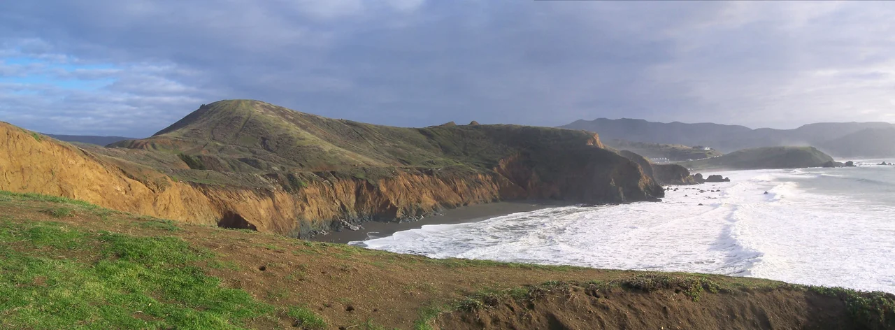
Whales and the View from the Bluff
In April 2015, a 48-foot sperm whale washed up on the beach below Mori Point. A necropsy ruled out common causes of death. Three weeks later, a 32-foot female humpback whale beached just a quarter mile north on Sharp Park Beach, bearing injuries consistent with a ship strike. Both whales were buried on the beach. The bluff itself offers panoramic views of the peninsula coastline, from the Pacifica Pier to the north to the headlands stretching south. Trails connect the ridgeline to Sharp Park Beach and to the California Coastal Trail. The point feels remote despite being minutes from suburban Pacifica, a scrap of wild coast where the twentieth century's speakeasies, film stunts, and motorcycle races have given way to something quieter and more fragile.
From the Air
Located at 37.62°N, 122.50°W on the Pacific coast in Pacifica. The bluff and ridge are visible as undeveloped coastal headland south of Sharp Park Beach. Nearest airports: SFO (KSFO, 7 nm southeast), Half Moon Bay (KHAF, 8 nm south).
Nearby Stories
- The Nonprofit That Saved Marin's Movie Palaces 0.8 km away
- Alviso, San Jose 2.2 km away
- From Ammunition Bunkers to Cattle Country 2.9 km away
- Purisima Creek 9.2 km away
- Niles Canyon Railway 15 km away
- Cordell Bank: The Invisible Island 30 km away
- The Hole in the Head 67 km away
- ʻAkaka Falls State Park 3665 km away