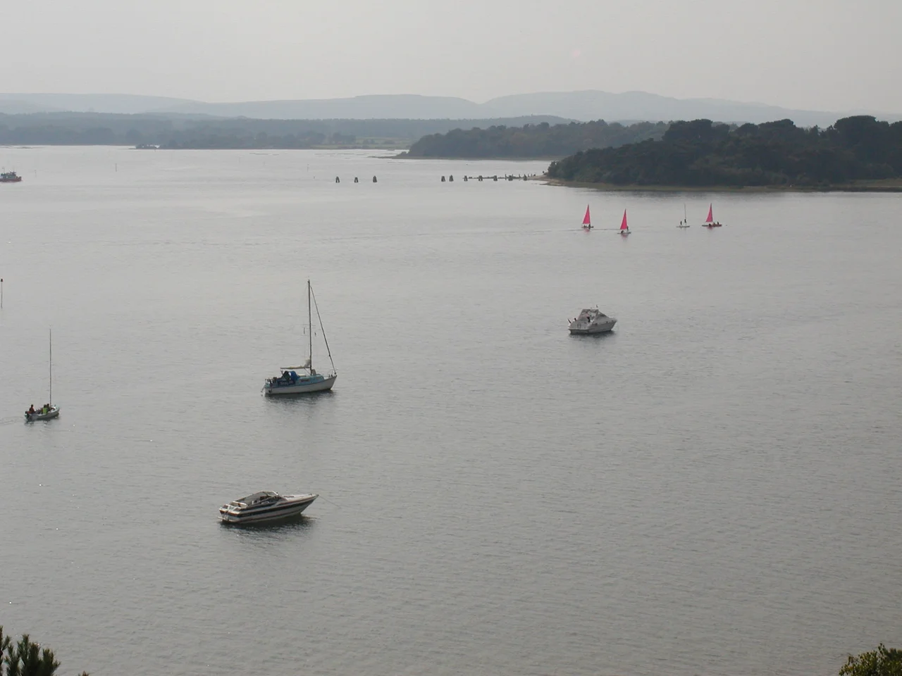

Poole Harbour
Seven thousand years ago, the rivers won. Until then, the River Frome had run east through what is now the Solent, joining the Stour, the Test, the Itchen and the Hamble before reaching the sea east of where the Isle of Wight now sits. A chalk ridge held the line. Then the climate changed, sea levels rose, the south of England sank slightly into the Channel, and the chalk gave way. The Isle of Wight was cut off from the Isle of Purbeck. The Solent flooded. And the Frome, robbed of its eastern course, settled instead into a shallow basin behind the new coast, drowning the valley to make what is now Poole Harbour, a ria of about 36 square kilometres that some still call the second largest natural harbour in the world.
The Logboat in the Mud
In 1964, dredgers working in the harbour pulled up a vessel that had been resting in the silt since around 295 BC. The Poole Logboat is ten metres of hollowed oak, one of the largest Iron Age vessels of its kind ever found in British waters. Its low freeboard, the small distance between waterline and gunwale, means it was never designed to leave the harbour for the open Channel. This was a vessel for these waters: shallow, sheltered, hemmed in by reedbeds and salt marshes, the kind of place where you could fish and trade and move goods between islands without ever needing to face the sea. The boat now sits in Poole Museum, more than two millennia after someone last poled it across these waters.
Roman Port, Medieval Wool, American Cod
The Romans landed at Hamworthy, the western half of modern Poole, and ran a road north through a fort at Lake Farm to the great Iron Age hillfort of Badbury Rings. By the Norman Conquest, the place was a small fishing village. In 1433 Poole was made Dorset's Port of the Staple for the export of wool, and the medieval town's trading links stretched from the Baltic to Italy. The real wealth came later. In the 17th century Poole began trading with Newfoundland, sending ships to fish the cod banks and bring back salt-cured fish to feed Catholic Europe. By the 18th century, Poole was the principal British port trading with North America, its merchants among the wealthiest in southern England. The big houses of Poole Old Town still carry the names of the families that built fortunes on cod and timber.
Brownsea, Furzey, Green, Round
Eight islands sit inside the harbour, the largest of which is Brownsea, a wooded mile of land off the Sandbanks peninsula that is famous for its surviving population of red squirrels and for hosting the first Scout camp in 1907. Furzey Island is the source of oil; the wells of Wytch Farm reach out under the harbour from rigs hidden in the trees. Green Island, smaller and quieter, sits directly south of Furzey. Long Island, Round Island, Pergins Island, Gigger's Island, Drove Island: each has its own character, its own creek, its own salt-marsh fringe. Stone Island, between Brownsea and Studland, is barely visible at all, a ridge of gravel and sand that appears only between high tides and is slowly being lost to rising sea levels. It is a danger to sailors who do not know the harbour, and a reminder that this whole basin is, geologically speaking, very young.
Avocets, Spoonbills, and Ospreys Again
The harbour holds three bird species in internationally important numbers: common shelduck, pied avocet and black-tailed godwit. The mudflats and salt marshes feed waders that nothing in southern England can match for diversity. Little egrets, once a rarity, now stalk the shallows in steady numbers. Spoonbills, Sandwich terns and Eurasian whimbrels are regular visitors. The harbour is on the Ramsar list of internationally important wetlands; it borders three national nature reserves including Studland and Godlingston Heath. On 23 April 2022, ospreys nesting on the harbour produced an egg, the first in southern England in modern times. The chicks that hatched were the first successful osprey brood in the region in 200 years. One of the chicks was killed by a hawk in August 2022. The pair returned the following year and hatched two more.
A Working Harbour Still
Brittany Ferries run from Poole to Cherbourg. Condor Ferries serve the Channel Islands and St Malo. Coastal traders unload at Hamworthy. A fleet of small fishing boats works out of Poole Quay. Yachts and motor cruisers fill the marinas at Cobbs Quay, Salterns, Parkstone Bay and the Port of Poole. The dredged channels that thread through the shallow water, the Swash, the Haven, the Middle Ship, and the Little Channel, are kept open by the Poole Harbour Commissioners for ships up to the 186.5-metre Norman Voyager, the longest vessel ever to enter. On 26 March 2023, about 200 barrels of reservoir fluid leaked into the harbour from a Perenco pipeline at Wytch Farm. The Environment Agency called it a major incident. The harbour is ancient, the wildlife rare, and the industry still very present. All of it shares the same shallow water.
From the Air
Centered on 50.70 degrees North, 1.99 degrees West, Poole Harbour is unmistakable from cruising altitude: a great irregular bowl of water roughly 6 nautical miles east-west by 3 nm north-south, fringed by the Sandbanks peninsula and the white chalk of Old Harry Rocks. Bournemouth Airport (EGHH) is 5 nm northeast. Southampton (EGHI) lies 20 nm east. From 5,000 feet on a clear day, the islands, channels and offshore Wytch Farm oil pads stand out against the heath of Purbeck to the south.
Nearby Stories
- Maiden Castle, Dorset 2.1 km away
- Battle of Portland 6.1 km away
- Carisbrooke Castle 7.1 km away
- Winchester Castle 11 km away
- Wardour Castle 13 km away
- Fleet Air Arm Museum 14 km away
- HMS Warrior (1917) 22 km away
- D-Day: The Longest Day 157 km away