
Port Erin
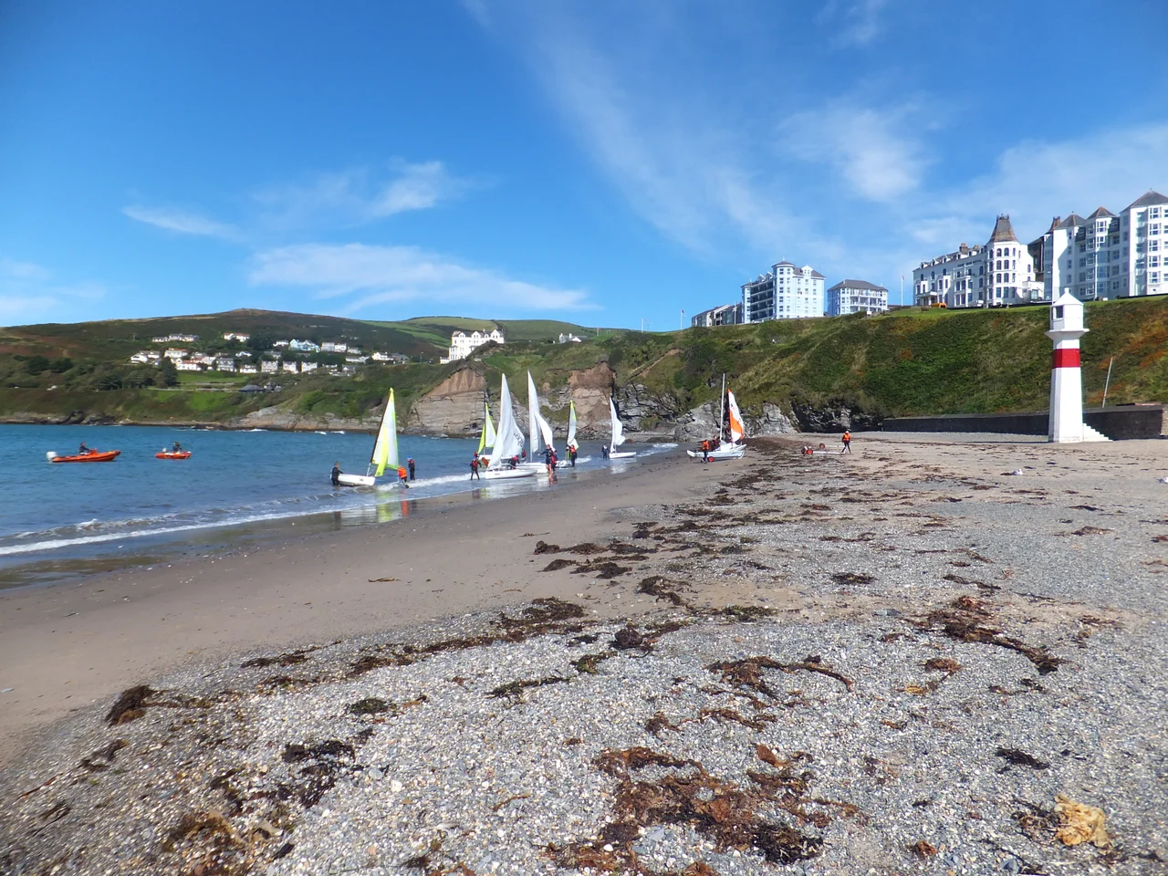
There is a hut on Port Erin beach that is shaped like an oversize wooden cigar standing on end. It is called Kishtey Çheh, which is Manx for Hot Box, and the deal is this: you go inside, you sit in a sauna for thirty to sixty minutes, and then you walk into the Irish Sea. People emerge from it pink. Some keep talking. Some don't. The bay they walk into is white-sand, bounded by two headlands, and on a sunny day it acts as a suntrap that fairly invites the cold-water plunge. Port Erin is a small village in the south-west of the Isle of Man, mostly a day-trip from Douglas, very quiet after dinner, and on the right kind of day completely lovely.
Getting Here
The most pleasing way to arrive is on the steam train. Port Erin is the western terminus of the Isle of Man Steam Railway, which runs mid-March through end of October, four trains a day, seventy minutes from Douglas via Castletown and Port St Mary. The locomotives are Victorian. The carriages are wooden. The whistle is genuine. If you would rather have a bus, route numbers 1, 2 and 11 run hourly from Douglas via Ronaldsway Airport and Castletown, combined every twenty minutes; the last bus is around 9pm, with a night bus N1 after Friday midnight. The bus terminus in the village is right at the railway station. From Ronaldsway Airport (ICAO: EGNS) it is six miles west by road. Ferries dock in Douglas, fifteen miles north-east.
The Bay and What to Do in It
Port Erin Beach is the place. Angling from the shore is permitted. Port Erin Paddleboards rent SUPs by the hour. Aquabikes (a sort of pedalo crossed with an outrigger canoe) chunter round the bay in season. Boat trips on the Shona explore the coast, with landings on the Calf of Man, the uninhabited island just off the south-west tip. Walk north from the promenade and you pick up Raad ny Foillan, the Way of the Gull, a 102-mile footpath that circles the whole Manx coast; the two-mile stretch from Bradda Head north to Fleshwick Bay is widely held to be its finest section. Bradda Head rises 382 feet above the bay and was mined for copper from the Bronze Age until 1874. The white tower on top is Milner's Tower, built in the shape of a lock and key for the Victorian safe-maker William Milner, who was something of a saint to the local fishermen. Rowany Golf Club, at the northern edge of the village, plays 5,722 yards off the whites, par 70.
Eat, Drink, Stay
The Bay Hotel on Shore Road near the harbour is the obvious old-school pub stop, doing meals, open Sunday to Thursday noon to 11pm and Friday and Saturday until midnight; no rooms. Foraging Vintners on the same stretch is a working winery and bar with cider too, Wednesday through Sunday from noon. Port Erin Chippy and Diner is by the railway station and reliably busy. La Gusto does pizza takeaway on Shore Road. For groceries, the Shoprite on Bridson Road is the town supermarket (Monday to Saturday 8am-9pm), with Robinson's next door and a Co-op Food by the station. Erin Arts Centre on Kerrin Victoria puts on competitions, concerts and the occasional film; if you have an evening, check the listings. St Catherine's Church at the corner of Promenade and Church Road, built in 1860, often holds summer concert series on Wednesday evenings. There is no campsite in Port Erin itself; the nearest is Glendown over in Port St Mary.
Going Beyond
Port St Mary, the sister village, is two miles south-east along the coast and has its own harbour, its own beach, and an excellent fish restaurant or two. The Calf of Man, the uninhabited island off the south-west tip, is a National Trust nature reserve; boat trips run from Port Erin and Port St Mary in season. Cregneash, an open-air folk museum south of Port Erin on the way to the Sound, preserves a working Manx crofting village with thatched cottages, Loaghtan sheep with their improbable curving horns, and demonstrations of weaving and traditional Manx farming. The Sound itself, the southern tip of the Isle of Man, has a visitor centre with floor-to-ceiling windows looking out at the Calf and the tidal race. Castletown, the former capital, is 7 km east and has a well-preserved medieval castle. None of this is far, and all of it is easier on foot or by the steam train than you might expect.
From the Air
Port Erin sits at 54.086 degrees north, 4.756 degrees west, on the south-west coast of the Isle of Man, 15 miles south-west of Douglas and 6 miles west of Ronaldsway Airport (ICAO: EGNS). Best viewed at 1,500 to 2,500 feet on a coastal pass, with the white sand of Port Erin Bay between Bradda Head (with Milner's Tower at 382 feet on the northern headland) and the Mull Hill ridge to the south. The Calf of Man is the larger island visible to the south-west. Strong south-westerly winds funnel into the bay.
Nearby Stories
- RAF Jurby Head 14 km away
- German submarine U-246 16 km away
- German submarine U-1051 17 km away
- Kilclief Castle 18 km away
- Ardglass 31 km away
- St Bees Lighthouse 44 km away
- Trwyn Du Lighthouse 54 km away
- Seascale Lifeboat Station 61 km away