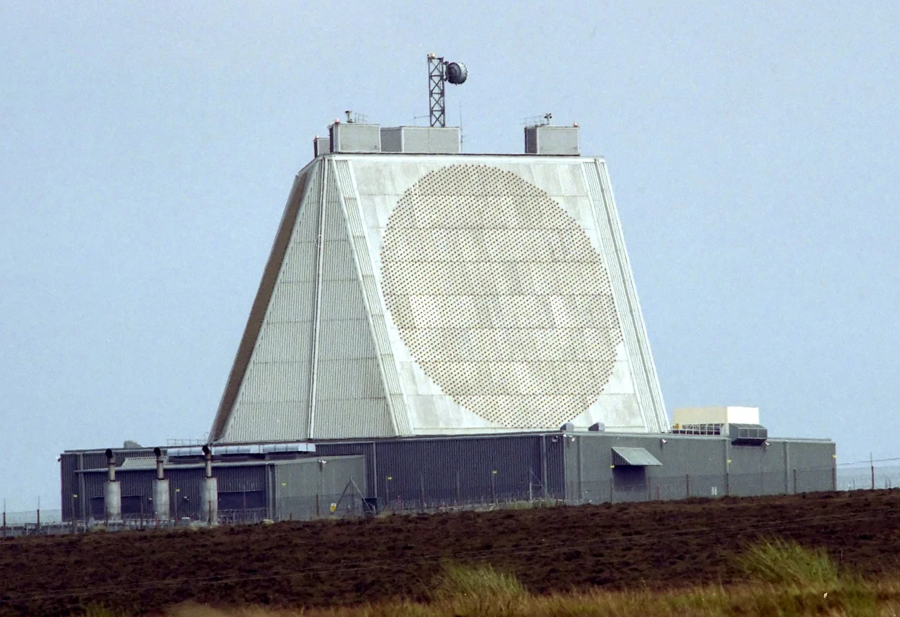

RAF Fylingdales
Vigilamus, the motto reads: We are watching. It is a strangely intimate word for what RAF Fylingdales actually does. The truncated tetrahedron rising from Snod Hill, on a windswept stretch of the North York Moors, exists to give the British and American governments warning of incoming nuclear missiles. During the Cold War the warning would have been about four minutes. The radars now scan for ballistic missiles, orbiting satellites, foreign spy platforms passing overhead, and the slow accumulating debris of humanity's reach into space. The heather and the gorse grow around it. The sheep ignore it. The pyramid keeps watching.
The Three Golfballs
Before the pyramid there were the golfballs. When RAF Fylingdales went operational on 17 September 1963, the radars sat inside three forty-metre geodesic domes, white and faceted, looking exactly like enormous golf balls dropped onto the moor. The Radio Corporation of America built the site as part of the Ballistic Missile Early Warning System, the BMEWS network that strung from Alaska through Greenland to North Yorkshire. The domes hid mechanically steered radars that swept the eastern horizon for the curving arc of a Soviet ICBM. They became, almost immediately, a local tourist attraction - the strangest thing in the strangest county. The site stood on a former wartime mortar range that the RAF had to clear of unexploded shells before the bulldozers could move in.
The Pyramid
The golfballs came down in the early 1990s. In their place rose the structure that defines Fylingdales today: a four-sided truncated pyramid, with phased array radars mounted on three of its faces, each scanning 120 degrees of sky. There are no moving parts. The beams are steered electronically, the radars looking everywhere at once. The 2007 upgrade by Boeing and Raytheon, costing £449 million, brought the site into the era of the AN/FPS-132 Upgraded Early Warning Radar, capable of tracking objects across vast distances of space. Today the data feeds directly to the North American Aerospace Defense Command at Peterson Space Force Base in Colorado, where a US officer can see what the British radar sees in something close to real time.
Watching the Watchers
Fylingdales has a third, quieter job: the Satellite Warning Service. It keeps track of foreign spy satellites passing over the UK so that secret activities on the ground - tests, exercises, the movement of sensitive equipment - can happen between the orbits, while no hostile camera is overhead. The armed services use this service, as do defence manufacturers and university researchers. The same radars also contribute to Space Situational Awareness, the slow and patient cataloguing of every piece of orbital junk above ten centimetres across, of which there are now hundreds of thousands. The Campaign for Nuclear Disarmament has protested at the gates for decades, arguing that Fylingdales makes Britain a front line in any nuclear exchange. Successive governments have agreed to keep it open anyway.
Pop Culture in a Hard Hat
The site has accumulated cultural cameos in proportion to its strangeness. The 1983 American TV film The Day After, about a nuclear strike on the United States, identifies the radar facility that detects the launch only as 'some place in England' - that place was Fylingdales. The 1960s-set ITV drama Heartbeat, filmed in the nearby village of Goathland, occasionally allowed the radar domes to appear in the background of its bucolic period scenes - a glaringly anachronistic giveaway. Newcastle University has been running a project called Turning Fylingdales Inside Out to make the site's history visible to the public for the first time. The outer perimeter is an 8,000-volt electrified fence. Beyond it, fewer than five US military personnel and ten US contractors share the site with their British counterparts. The watching continues.
From the Air
Coordinates 54.3616°N, 0.6697°W. RAF Fylingdales sits on Snod Hill in the high North York Moors, about 8 nm south of Whitby, just east of the A169 between Pickering and Whitby. The truncated pyramid - sometimes still called 'the SSPARS' - is unmistakable from the air: a four-sided concrete structure on otherwise empty moorland. The Hole of Horcum is about 4 nm to the west-southwest. This is restricted airspace; check NOTAMs and observe the Fylingdales Danger Area. Best viewed (from outside the danger area) at 3,000-5,000 ft in clear conditions. Nearest airports: Durham Tees Valley (EGNV) about 35 nm northwest, Humberside (EGNJ) about 45 nm south, Newcastle (EGNT) about 55 nm north-northwest.
Nearby Stories
- Sledmere House 8.6 km away
- Hartlepool 10 km away
- RAF Linton-on-Ouse 17 km away
- Middlesbrough Cathedral 17 km away
- SM UC-75 23 km away
- Arctic Viking (H452) 26 km away
- Breagh Gas Field 28 km away
- German submarine U-2367 50 km away