
RAF Llandwrog
In 1942, a young RAF medical officer at Llandwrog watched crews crash into the mountains of Snowdonia and decided someone should go find them. Flight Lieutenant George Desmond Graham organised a small team of station personnel - climbers, walkers, anyone who knew rope work - to scramble out on bicycle and on foot whenever the operations room reported an overdue aircraft. The Royal Air Force Mountain Rescue Service grew from that improvised effort. Graham would be awarded the MBE in 1943 for the work, then sent to Burma where he picked up a DSO for a rescue behind Japanese lines. The mountains he was reading - Snowdon, the Glyderau, the Carneddau - rise just inland from where his airfield was laid out at sea level, exactly.
Built at Sea Level
RAF Llandwrog opened in July 1941 on a low peninsula between Caernarfon Bay and Foryd Bay, the estuary of the Afon Carrog and the Afon Gwyrfai. The site was almost flat to start with; the engineers levelled it out at sea level - quite literally - and laid three runways, each fifty yards wide, in the classic wartime triangle. Two T1 hangars, a single Bellman, and six blister hangars lined the northern perimeter. The technical and administrative buildings, and a hospital, sat to the south of the field. The original plan had been a fighter station - perfect for intercepting attacks on the industrial northwest of England, or any Irish-launched invasion that nobody actually expected but planners had to consider - but in practice Llandwrog became a Flying Training Command base, turning out air gunners, radio operators and navigators.
The Mountain Rescue Idea
Training operations are dangerous in their own right. Inexperienced crews, poor weather, the looming mass of Snowdonia just to the east - the combination meant aircraft went down with depressing regularity, and crews who survived the crash often died of exposure before anyone reached them. Graham's medical office had to deal with this aftermath, and he resolved to shorten the gap. The Llandwrog team and a parallel effort at RAF Llanbedr were officially recognised at the end of 1943; by January 1944 the RAF Mountain Rescue Service was formally promulgated. The service still exists today, with teams at Leuchars, Lossiemouth, Valley, and St Athan. Its origin remains a Welsh hillside in 1942 and one doctor who refused to write the casualties off.
Strange Postwar Cargoes
Flying training ended in June 1945, but the airfield's military life was not quite over. Between 1946 and 1956 Llandwrog hosted No. 277 Maintenance Unit and was the staging point for two operations with grim names. Operation Dismal handled the disposal of captured German chemical weapons - mustard gas and tabun shells - that the British took possession of after the war. Operation Sandcastle, which ran into the mid-1950s, involved scuttling the bulk of those munitions in deep water off the Hebrides. Trains and trucks carrying the shells passed through Llandwrog on their way to Cairnryan and the deep-water dump sites. It is a strange final chapter for a training field: the place where wartime gunners learned to shoot becoming the place where wartime poison gas was sent to the bottom of the sea.
Caernarfon Airport Today
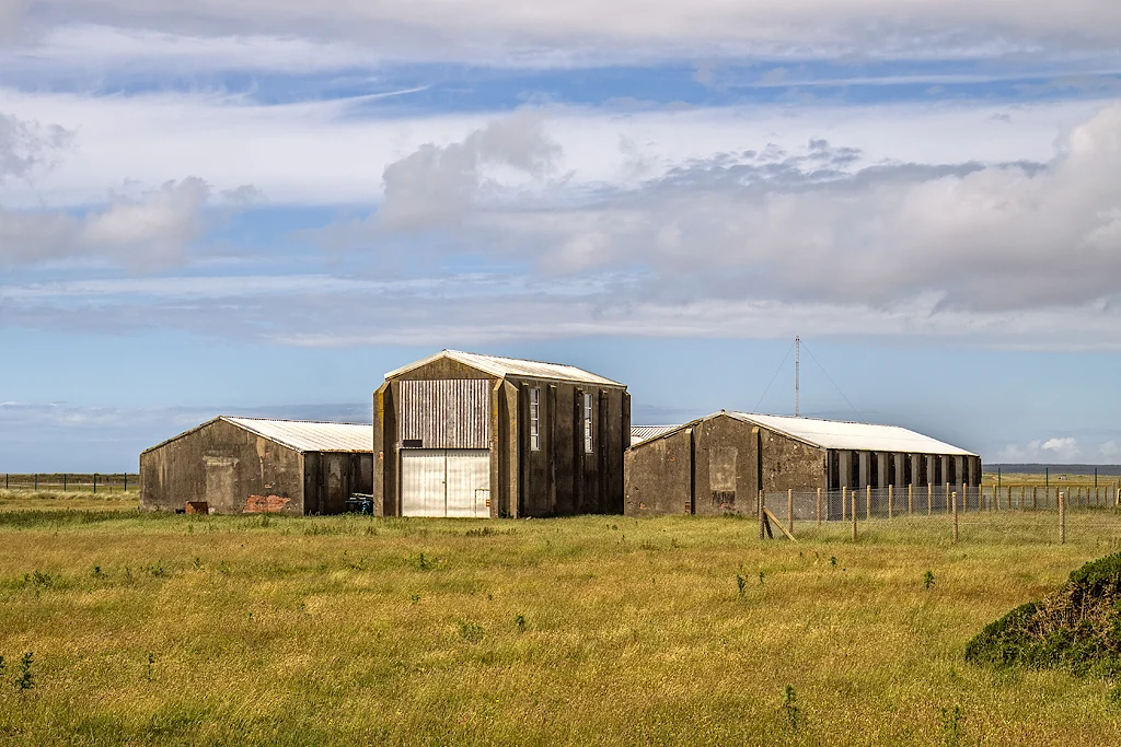
The airfield reopened in 1969 as Caernarfon Airport (ICAO: EGCK), and it has been quietly busy ever since with general aviation, sightseeing flights over Snowdonia, parachuting, and pilot training. Since 2015, when the RAF's search and rescue role was contracted out, Bristow Helicopters has operated one of its SAR helicopters from Caernarfon on behalf of HM Coastguard - the modern descendant, in a roundabout way, of George Graham's mountain rescue team. The wartime layout is still visible everywhere. Many of the original buildings stand largely untouched - station chapel, main stores, defended air raid shelter, the triple-turret gunnery trainer - reused as workshops and small businesses or simply preserved. Walk the perimeter track and you can still see where 1941 ended and 1969 began.
From the Air
Caernarfon Airport (EGCK), on the site of RAF Llandwrog, lies at 53.104N, 4.340W on the coast 3.5 nm southwest of Caernarfon town. The triangular wartime runway pattern remains clearly visible from the air; the active runway is 08/26. The Snowdonia massif rises immediately east - Yr Wyddfa (Snowdon) is 12 nm at 080. RAF Valley (EGOV) is 14 nm to the northwest across Caernarfon Bay. Watch for parachute operations and SAR helicopter movements. Coastal approach from the southwest is straightforward over the dunes of Dinas Dinlle.
Nearby Stories
- Wakestock 1.7 km away
- Trefriw 3.8 km away
- Irish Sea 8.7 km away
- Irish Sea Bridge 20 km away
- East–West Interconnector 30 km away
- Machynlleth 36 km away
- HMS Tyler 41 km away
- New Brighton Lifeboat Station 54 km away