.jpg)
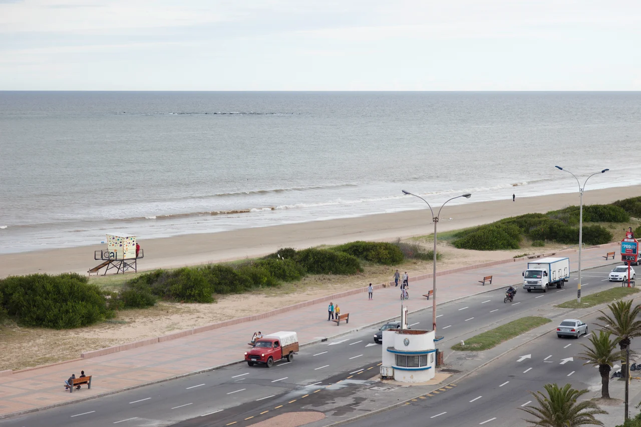
Rambla of Montevideo
Hand someone a mate gourd, point them toward the water, and you have explained Montevideo. The Rambla runs for more than 22 uninterrupted kilometers along the Río de la Plata, one of the longest continuous waterfront walks on Earth, and on any given evening it fills with the entire city: joggers, anglers, kite-flyers, lovers, and thousands of people simply sitting on the seawall, sipping mate, watching the sun sink into an estuary so wide the far bank disappears. It is not a tourist attraction bolted onto the city. It is the city's living room.
A Coastline Made Public
The Rambla was an act of deliberate generosity. Built largely between 1923 and 1935, during an era when Uruguay was reinventing itself as one of South America's most progressive societies, it was conceived to give every resident access to the shore. The beach is state-owned, and building anything across the Rambla remains tightly regulated - the waterfront belongs to the public, not to private developers. The Rambla Sur, carved along the city's southern edge, transformed the old outskirts so dramatically that an entire former red-light district was reshaped into a grand civic avenue. The result was a democratic coastline, available to all, by design.
One Road, Many Names
Walk the full length and you walk through the whole of Montevideo, because the Rambla changes its name as it passes from one neighborhood to the next. It begins at the breakwaters of the old port in Ciudad Vieja, swings past the remnants of colonial fortifications, and curls south around the headland of Punta Carretas, where it carries the names of Presidente Wilson and Mahatma Gandhi. It runs the crescent beach of Pocitos, rounds the yacht harbor at Buceo, and continues east through Malvín, Punta Gorda, and Carrasco. Each segment honors a nation, a president, or a hero - República de Argentina, Charles de Gaulle, O'Higgins, República de México - a geography lesson written in street signs.
The Rhythm of Mate
To understand the Rambla, you have to understand mate, the bitter herbal infusion Uruguayans carry everywhere in a gourd, thermos tucked under one arm. On the seawall, mate is the quiet engine of social life - shared in slow circles, passed from hand to hand, an excuse to sit still and talk while the river goes copper in the evening light. Around the ritual swirls everything else: skateboarders in their designated zones, anglers casting into the brown water, children chasing kites in the steady estuary wind. In summer a dedicated Tourism Police unit keeps watch, but mostly the Rambla polices itself, held together by habit and shared affection.
The River That Looks Like a Sea
Part of the Rambla's spell is the water it faces. The Río de la Plata is technically a river - the vast funnel-shaped estuary where the Uruguay and Paraná rivers empty toward the Atlantic - but it is so enormous that from the Montevideo shore the far bank simply vanishes over the horizon. The result is a coastline that feels oceanic, its silty water shifting from brown to copper to slate depending on the light and the wind. Storms roll in off the open estuary and crash against the seawall, sending spray over the promenade; calm summer evenings turn the whole surface to molten gold. The neighborhoods strung along the route each meet this water differently - the rocky headland of Punta Carretas, the wide swimming beach of Pocitos, the yacht-dotted harbor of Buceo - but all of them turn to face it.
A Monument in Motion
Most landmarks are a single building you photograph and leave. The Rambla is a landmark you inhabit, kilometer after kilometer, and Montevideans treat it accordingly - as inseparable from their identity as their flag or their football. Uruguay has placed it on its tentative list of UNESCO World Heritage Sites, an unusual nomination for what is, technically, a sidewalk and a road. But it is the right instinct. The Rambla is where a famously understated nation comes to be together in the open air, generation after generation, gourd in hand, facing the water that made the city and never turning away.
From the Air
The Rambla traces the entire southern coastline of Montevideo, centered near 34.90°S, 56.20°W. From the air it reads as an unbroken ribbon of road hugging the shore for over 22 km, from the Port of Montevideo and Ciudad Vieja in the west, around the Punta Carretas headland, past the curved beaches of Pocitos and Carrasco, to the Arroyo Carrasco stream at the city's eastern edge. The dense apartment towers of Pocitos and Punta Carretas, the yacht harbor at Buceo, and the wide tan beaches make excellent reference points. Carrasco International Airport (ICAO: SUMU) lies just beyond the eastern terminus; Ángel Adami Airport (SUAA) is inland to the northwest. Best appreciated at low to medium altitude in clear conditions, following the coast eastward.
Nearby Stories
- Piriápolis 24 km away
- Minas 40 km away
- Tronador (rocket) 67 km away
- Nueva Helvecia 69 km away
- La Plata Museum 122 km away
- Battle of Sarandí 126 km away
- Mundo Marino 145 km away
- South Georgia Island 2584 km away