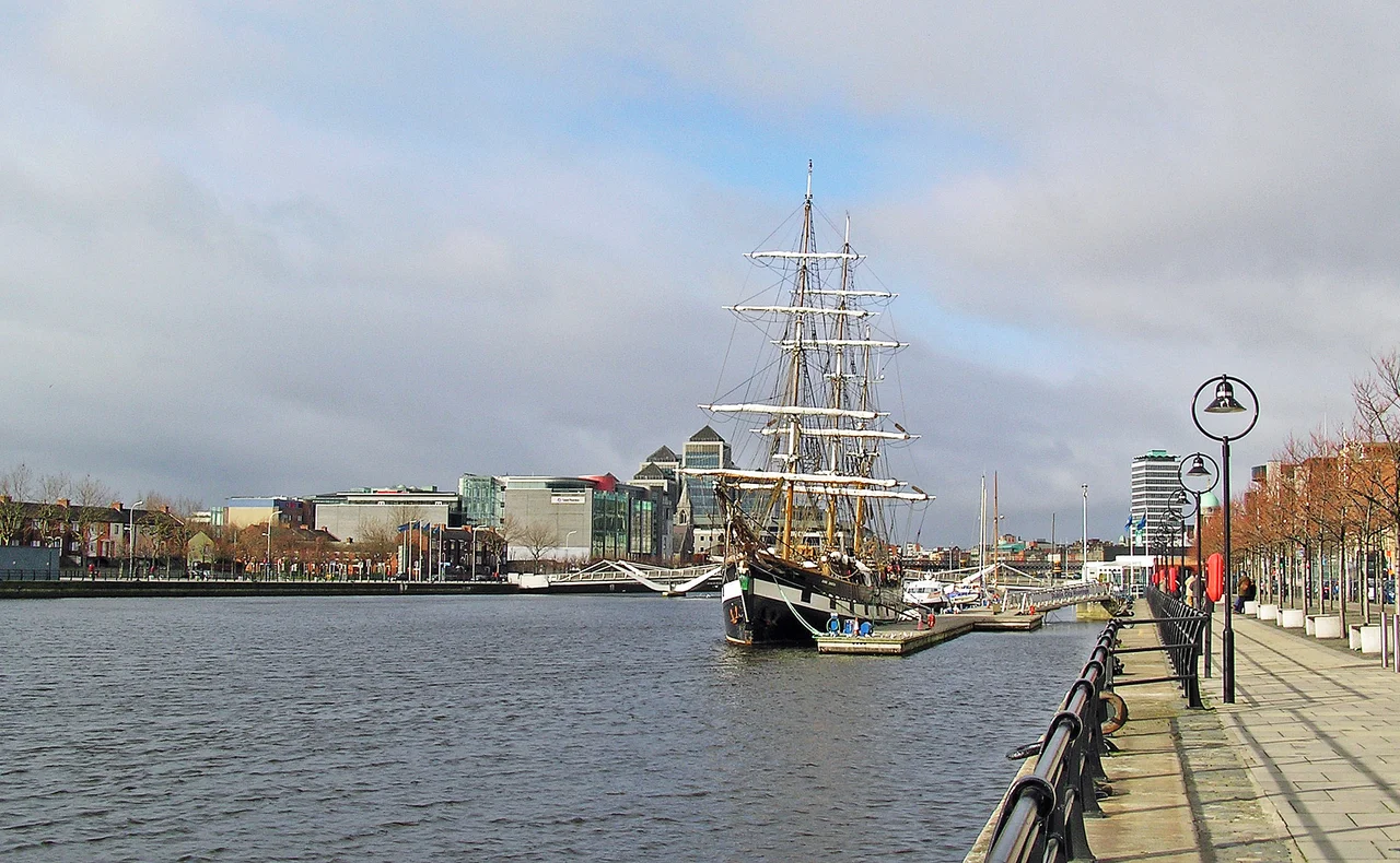

River Liffey
Before it acquired a Latin name, before Vikings or Normans or English landlords, the river was An Ruirthech - the strong runner. It begins as scattered streamlets in the peat bogs between Kippure and Tonduff, two Wicklow mountains that hold their weather close. From that high boggy ground the Liffey takes 132 kilometres to reach Dublin Bay, looping west into Kildare before swinging back east through the capital, draining a catchment of 1,256 square kilometres and discharging roughly eighteen cubic metres of brown peaty water every second. James Joyce gave the river a woman's name and called her Anna Livia Plurabelle, the wandering heroine of Finnegans Wake who is both river and woman, both the city's mother and its mirror. Dubliners just call her the Liffey, and they have been arguing about her bridges since the Dominicans built the first stone one in 1428.
The Dark Pool
The Liffey gave Dublin its name twice over. The English version comes from Dubh Linn - dark pool - the tidal basin where the small River Poddle once spilled into the Liffey near the present site of Dublin Castle. The Irish name, Baile Átha Cliath, refers to the ford of hurdle reeds the Liffey could be crossed at when it was shallow enough. Two names for two facts of the same river: the deep place where Viking longships could anchor, and the shallow place where everyone else could wade across. Both points sit within a few hundred metres of one another, both shaped Dublin's earliest streets, and both have since been built over. The Poddle now runs in a culvert beneath the city, surfacing only to discharge into the Liffey through a stone arch you can see at low tide near the Civic Offices.
Bridges by Century
Read the bridges from west to east and you read four centuries of Dublin politics. Mellows Bridge, built in 1764 on the wreckage of an older bridge swept away by floods, is the oldest still standing. The Ha'penny Bridge, a delicate cast-iron arch from 1816, charged a halfpenny toll until 1919 and gave the city its most photographed crossing. O'Connell Bridge is famously almost as wide as it is long. Then the twenty-first century brought the architects in: the James Joyce Bridge in 2003 and the harp-shaped Samuel Beckett Bridge in 2009, both designed by Santiago Calatrava, both controversial, both now beloved. The Rosie Hackett Bridge, named for the trade unionist and 1916 veteran, opened in 2014 and was the first Liffey bridge named for a woman since Sarah Bridge in 1792. Each addition shifted the city's centre of gravity a little further east, towards the old docklands now reborn as the Silicon Docks.
What the River Does
About sixty percent of the Liffey's flow is pulled out before it reaches the sea, abstracted at Poulaphouca and Leixlip to supply drinking water and industry, then returned through wastewater plants further downstream. Three ESB hydroelectric stations sit on the river - at Poulaphouca, Golden Falls, and Leixlip - holding back reservoirs that drowned what were once dramatic waterfalls. The Guinness brewery, despite the persistent myth, does not brew with Liffey water; St James's Gate draws from a pipeline that runs down from the Wicklow Mountains. Above Dublin, rowing clubs share the Chapelizod stretch with the Garda. The Liffey Descent canoe race has run every September since 1960, twenty-seven kilometres from Straffan to Islandbridge. And every late August the Liffey Swim sends competitors from Watling Bridge down to the Custom House, hundreds of swimmers in dark green water turning the quays into bleachers.
The Quays
Walk east along the north quays from Heuston Station and the names change every hundred metres: Wolfe Tone, Sarsfield, Ellis, Arran, Inns, Ormond Upper, Ormond Lower, Bachelors Walk, Eden, Custom House, North Wall. The south side answers with Victoria, Usher's Island, Merchants, Wood, Essex, Wellington, Crampton, Aston, Burgh, George's, City, Sir John Rogerson's. Each quay was once a working dock; each marks a phase of mercantile Dublin. Usher's Island, on the south bank, is where Joyce set 'The Dead,' the closing story of Dubliners, in a house his great-aunts actually lived in. Wood Quay is where Wood Quay was - until Dublin City Council built its offices on top of the largest Viking-Age excavation in Europe, despite a march of twenty thousand people in 1978 begging them not to. The river remembers; the city occasionally does.
Anna Livia
In Finnegans Wake, the river is a woman who is also Ireland who is also the protagonist's wife who is also history itself. Joyce wrote her in seventeen years of voluntary exile, working in Paris and Trieste while remembering the exact curve of the Liffey at every bridge. The 'Anna Livia Plurabelle' chapter - washerwomen on opposite banks gossiping as the river broadens towards night - is the most musical thing in the book and the most beloved. A 1988 statue of Anna Livia, a reclining bronze woman pouring water from her hands, was installed in O'Connell Street and promptly nicknamed 'the floozie in the jacuzzi.' She was moved in 2001 to make way for the Spire. She now reclines in the Croppies Acre Memorial Park near Heuston, less famous than her river but still there, still pouring.
From the Air
The Liffey rises in the Wicklow Mountains at the Liffey Head Bog (approximately 53.13 degrees N, 6.36 degrees W) and flows east-northeast for 132 km to Dublin Bay. From altitude the river traces an unmistakable curve through the centre of Dublin (city centre at roughly 53.346 degrees N, 6.27 degrees W), splitting the capital into the historically Catholic Northside and the historically Protestant Southside. Dublin Airport (EIDW/DUB) lies 10 km north of the river mouth; approach traffic from the south often overflies the lower Liffey and the dramatic Calatrava-designed Samuel Beckett Bridge. Weston Airport (EIWT) sits 14 km west of the city centre and is the closest field to the river's central stretch. Visible from cruising altitude: the chain of ESB reservoirs at Poulaphouca, Golden Falls, and Leixlip; Phoenix Park's green block on the north bank; and the silver curve of Dublin Bay opening east into the Irish Sea. Best viewing altitude 3,000-6,000 ft for the full course of the river through the city. Maritime climate; expect low cloud and showers year-round.
Nearby Stories
- Malahide Castle 1.2 km away
- Castlemartin House and Estate 6.4 km away
- Avoca, County Wicklow 8 km away
- Trim, County Meath 15 km away
- German submarine U-1051 29 km away
- County Carlow 29 km away
- HMS Tyler 32 km away
- Irish Sea Bridge 46 km away