Rukwa Region
Two lakes bookend Rukwa. Lake Tanganyika to the west is the deeper, 773 meters above sea level at its shore and another 1,470 meters down to its bed. Lake Rukwa to the south is the shallower and stranger - an alkaline shallow sheet of water that grows and shrinks by tens of kilometers depending on the season. Between them rises the Ufipa Plateau, reaching 2,461 meters at Malonje, a landscape of miombo woodlands, grasslands, and scattered farms tended by people whose ancestors have shaped this country for centuries. The Fipa, the Mambwe, the Lungu, the Nyiha, the Lyangalile. In 2022, Tanzania's national census counted 1,540,519 people living across 27,765 square kilometers - a territory, as the Tanzanian government likes to note, comparable in size to the country of Haiti.
A Region Created, Recreated
Rukwa Region took its current name from Lake Rukwa when President Julius Nyerere created it in 1975, carving Mpanda District from Tabora Region and the older Sumbawanga District from Mbeya. Nkasi District was added in 1984. In 2012, Mpanda was peeled away again to form the new Katavi Region, leaving Rukwa with Sumbawanga, Nkasi, and Kalambo districts. These are not merely bureaucratic reshufflings. Each boundary change follows the logic of how people actually live - which markets serve which villages, where the schools and clinics ought to be, how far a farmer needs to travel to sell a crop. The capital is Sumbawanga, a highland city set well above 1,700 meters, cool by East African standards, with wide streets and the brick-and-tin architecture of a planned colonial town.
The Fipa and the Plateau
The Fipa are the region's founding people. Their home is the Ufipa Plateau, a broad tableland between the two lakes where cooler air and reliable rain have supported dense populations for at least a thousand years. Archaeological evidence of iron smelting in Ufipa dates back to the first millennium, and Fipa blacksmiths built a reputation across the region for the quality of their hoes. Today about 25 percent of Rukwa's population are recent migrants - Sukuma and Nyamwezi cattle-herders driven south from Tabora and Shinyanga in search of pasture, each herd-owner bringing 100 to 300 cattle with him. That scale of migration has reshaped the plateau. The Fipa still farm maize, paddy rice, beans, and cassava on smallholdings of a hectare or two. The newcomers graze cattle across land that was once closed miombo. Neither group has quite finished deciding how to share it.
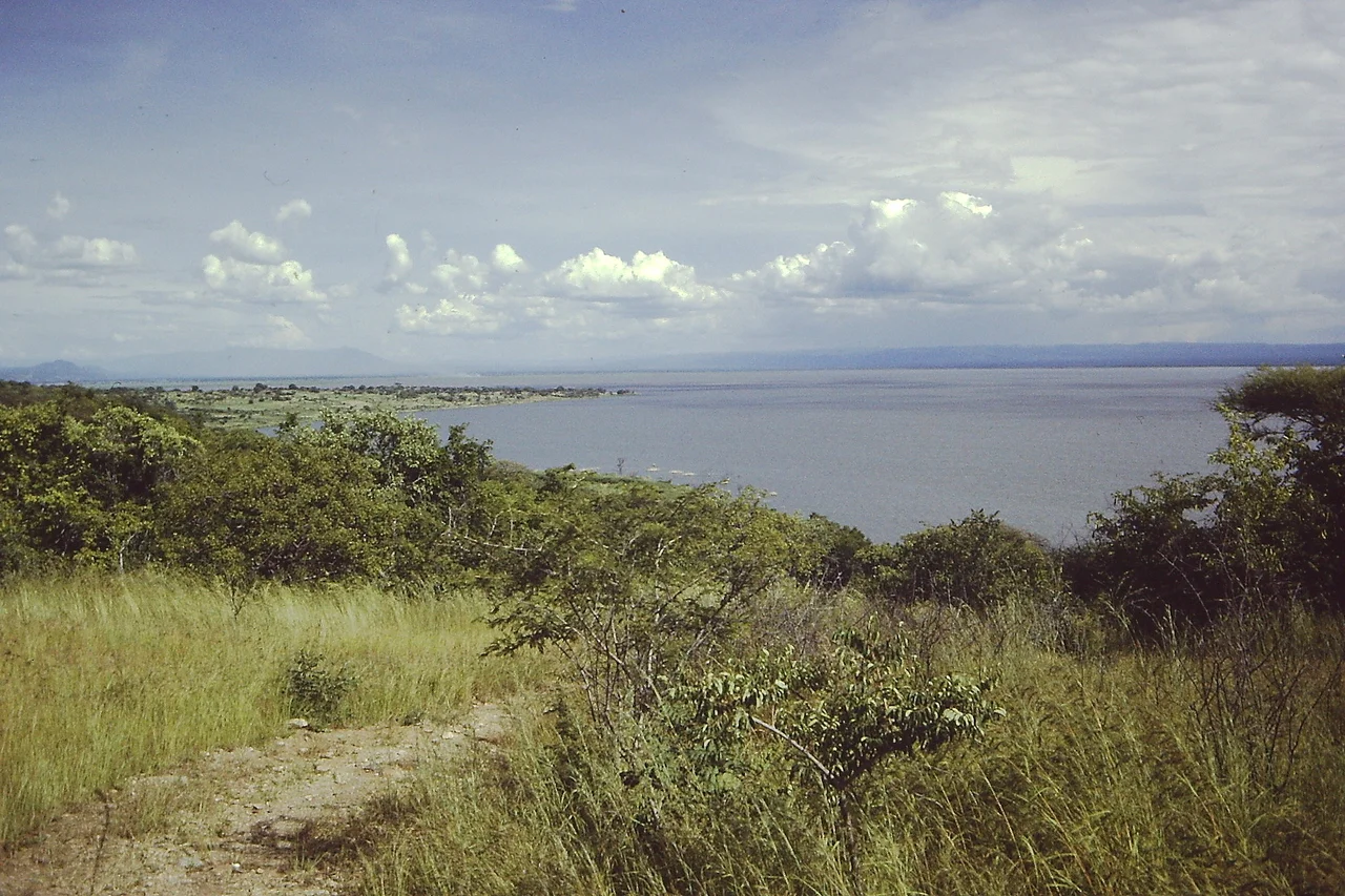
Two Lakes, Many Fish
On Lake Tanganyika, two aging commercial vessels - the MV Mwongozo and the MV Liemba - still connect the lakeshore communities of Kabwe, Korongwe, Ninde, Wampembe, Kala, Kirando, Kipili, and Kasanga. The MV Liemba in particular has a history worth knowing: it was built in Germany before World War I, shipped in pieces to Lake Tanganyika, and launched as the Graf von Gotzen. The Germans scuttled it in 1916 to keep it from Allied hands, the British raised it in 1924, and it has been running Tanganyika's coast ever since. Kasanga is the only port with a proper landing platform. Everywhere else, ships anchor a kilometer or more offshore and small boats ferry passengers and cargo. On Lake Rukwa, only small boats work the water - the lake is too shallow and too alkaline for commercial vessels. Between 1997 and 2002, the region produced 102,260 tons of fish, worth 3.45 billion Tanzanian shillings. Sardines, tilapia, Nile perch, mud fish, Migebuka. The crocodile farm at Muze adds a small and specialized business of its own.
Gems Without Mines
Rukwa's rocks hold emeralds, aquamarine, amethyst, ruby, topaz, moonstone - along with kaolin, quartz, graphite, tin, limonite, copper, and cobalt. What it does not hold is a single large commercial mine. The gemstones that emerge come out through small-scale artisan workings, a miner and a sieve at a time, and the minerals move through trade networks that mostly bypass the formal economy. Eighty percent of the region's people still earn their livelihood from agriculture. Electricity reaches only seven percent of households, supplied partly by hydropower from Zambia across the southern border. The one public airport sits in Sumbawanga, with two commercial flights served by the Tanzania Airports Authority. Rukwa is not an isolated place - the TAZARA Railway passes to the east, the ferry routes link it to Zambia and the DRC - but it is a place where the pace of things is set by small farms and small boats, by the slow filling and draining of Lake Rukwa with the seasons, by the Fipa plateau that has outlasted every government that has tried to administer it.
From the Air
Located at 8.00 degrees south, 31.33 degrees east in western Tanzania, bordering Lake Tanganyika to the west and the country of Zambia to the south. The regional capital Sumbawanga is at 1,780 meters elevation with an airstrip. From altitude, the distinctive landmarks are Lake Tanganyika's deep trough on the western edge, Lake Rukwa's shallow alkaline flats to the south, and the Ufipa Plateau rising 1,700 meters between them.
Nearby Stories
- Kasanga 42 km away
- Mpimbwe District 72 km away
- Nsumbu National Park 81 km away
- Ngualla 93 km away
- Mbeya Region 114 km away
- Karema, Tanzania 116 km away
- Lake Mweru Wantipa 151 km away
- Songwe Region 158 km away