Mpimbwe District
The statistic arrives without fanfare in the district's self-description: maternal mortality in Mpimbwe stands at 58 deaths per 100,000 mothers, compared to a Tanzanian national figure of 3 per 100,000. That ratio is staggering, almost twenty times the national average, and it tells you much of what you need to know about how remote this corner of the Katavi Region really is. In 2016, only 42 percent of the rural population had safe and reliable access to clean water. There are no paved roads. There are two health centers and ten clinics, scattered across 7,704 square kilometers of bushland, savanna, and lake shore.
A District Carved From a District
Mpimbwe District did not exist ten years ago. In 2016 Tanzania split it off from the Mlele District, which had itself been carved out of Mpanda District only four years earlier. That in turn was part of the 2012 creation of the Katavi Region from the older Rukwa Region, which had been separated from Tabora Region in 1974. Reading the administrative lineage backward reveals a country that keeps redrawing its internal borders to push governance a little closer to the villages. Mpimbwe now has its own council, its own 9 wards, 31 villages, and 168 hamlets. The largest ward, Mamba, holds 24,520 people. The smallest, Chamalendi, just 8,747. The district's total population doubled between 2012 and 2022, climbing from 103,165 to 215,438.
The Wapimbwe and the Wasukuma
Two peoples dominate the district. The Wapimbwe are native to the area and give the district its name, about 20 percent of the population. The Wasukuma, the largest Tanzanian ethnic group by national count, began arriving here in the 1970s and now make up about 60 percent. Smaller communities of Wafipa, Wabende, Wangoni, and Wachagga round out the mosaic. Migration reshaped Mpimbwe within living memory. The elders who welcomed Wasukuma cattle herders into these lowlands are not yet gone. The households today are mostly farming households: cassava, paddy rice, and maize for the table, groundnuts and more maize for the cash market. The 2016 livestock census counted 39,883 cattle, 30,235 goats, and over 300,000 chickens.
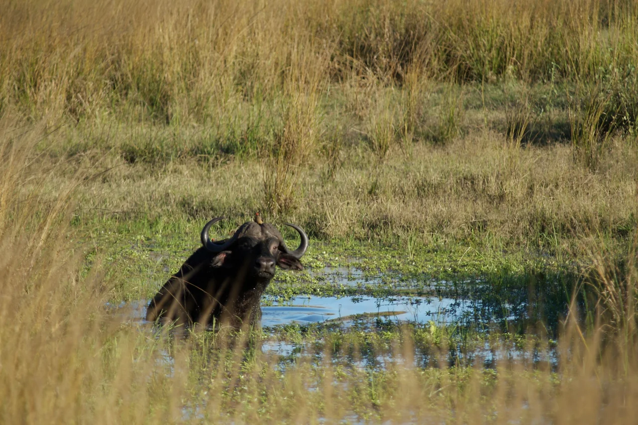
Lions at the Edge of the Farm
Katavi National Park lies inside the district. So does the Rukwa Game Reserve. Elephants, lions, hippopotamus, hyenas, buffalo, giraffes, and bushpigs all live within sight of Mpimbwe's villages. For generations this meant livestock losses and sometimes worse, the kind of conflict that ends with a speared lion or a trampled maize field. Wildlife researchers who have worked in this district for years, the same researchers who produced the papers behind phrases like 'from avengers to hunters,' have documented how local conservation bylaws changed the calculus. Livestock losses to lions and hyenas are now minimal. Coexistence is not peace, exactly, but it is something workable. The Wapimbwe and Wasukuma communities have learned routines that the big predators respect, and the predators have learned which herds to leave alone.
Bee Resources and Bachelor's Degrees
Education here works against long odds. The district's 29 primary schools enroll 20,308 students, split almost evenly between 10,049 girls and 10,259 boys, which is a quiet kind of triumph in rural East Africa. Four secondary schools serve a much smaller cohort of 1,612. And at the top of the pyramid sits one institution with a name that captures the district's particular position in the world: the Mizengo Pinda Campus College, an extension of Sokoine University of Agriculture. It offers a Bachelor's degree in Bee Resources Management, a Diploma in Crop Production, and a Certificate in Tourism and Hunting. Three hundred students can enroll. For a district where 95 percent of people farm and wildlife is both livelihood and threat, those three programs are not arbitrary. They are the skills this place needs.
Climate and Calendar
Mpimbwe has a tropical savanna climate, Aw on the Koppen-Geiger chart, with an average temperature of 23.2 degrees Celsius and 828 millimeters of rain a year. The rain comes mostly in one season. The rest of the year, dust rises off the dirt roads and the Katuma River ponds shrink to hippo-packed puddles. Of the 708 kilometers of road in the district, 54.6 kilometers are gravel, the rest dirt, and only 205 kilometers remain usable year-round. In the wet months, Mpimbwe folds in on itself, and the villages get very local very fast.
From the Air
Mpimbwe District centers around 7.17°S, 31.79°E in Tanzania's Katavi Region. Terrain is flat to rolling miombo woodland at 900-1,200 meters elevation, with Lake Rukwa visible along the southern boundary. Recommended viewing altitude 6,000-8,000 feet MSL. Katavi National Park and Rukwa Game Reserve lie within/adjacent to the district - the Katuma River floodplain and Chada Plain are visual highlights, especially the end-of-dry-season hippo pools. Nearest airports: Mpanda (HTMP) to the north, Sumbawanga (HTSU) to the south. No airstrips in the district itself. Weather note: single wet season (November-April); visibility best June-October. No paved roads on any route in or out.
Nearby Stories
- Nsimbo District 55 km away
- Ngualla 66 km away
- Katavi Region 74 km away
- Rukwa Region 87 km away
- Mpanda 90 km away
- Kasanga 121 km away
- Mbeya Region 170 km away
- Battle of Tabora 211 km away