Nsimbo District
Roughly two-thirds of Nsimbo District is forest the government has agreed not to cut. That single fact tells you most of what you need to know about this place - 14,623 square kilometers of Tanzania's Southern Highlands, of which 8,920 are protected reserve. In the remaining third, the Wabende, Wakonongo, Wafipa, Wapimbwe, Bahutu, Wachanga, and Basukuma peoples grow cassava and tobacco across 59 villages and 272 hamlets, working the edge of one of the most biodiverse corners of East Africa. The district only exists on paper since 2012, when Katavi Region was carved out of Rukwa. On the ground, of course, it has existed for far longer.
A District Without an Old Name
Nsimbo is one of the youngest administrative units in Tanzania. Before 2012, this land was part of the Mpanda District of Rukwa Region, and before 1973 it belonged to either Tabora or Mbeya. Governments draw lines and then redraw them - in 2015 Mpanda Town became a municipal council, in 2016 Mpimbwe District split away to the south. The village of Sitalike sat in the same fields through each renaming. Litapunga is now the district's largest ward, home to 35,444 people as of the 2016 census, though no political cartographer would have picked it out for special attention a generation ago. The people counted in those tallies belong to seven named ethnic groups, and their languages, crops, and family ties cross the new borders as if the borders were not there - which, in the ways that matter, they often are not.
Where the Forest Still Wins
The elevation ranges from 1,000 to 2,500 meters, and the Koppen classification is Aw - tropical savanna, with 1,093 millimeters of rain in a good year and an average temperature near 23 degrees Celsius. What grows in that climate, when humans leave it alone, is miombo woodland: broad-leaved trees that flush red before they flush green, understory grasses tall enough to hide a lion. Much of Katavi National Park falls inside Nsimbo, and so does the Ugalla River Forest Reserve, which spills north into Tabora. Elephants here still follow ancient routes to water. The reason is not sentiment but arithmetic: when 61 percent of your land is off-limits to axes, wildlife has room to be wild.
Small Mines, Small Harvests
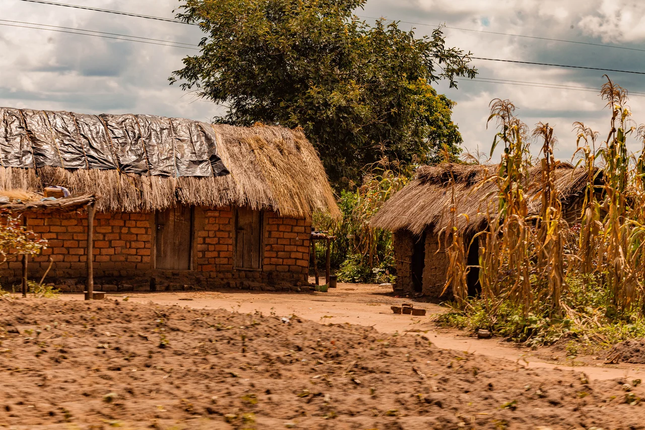
The economy is agriculture almost all the way down. Families grow cassava, maize, rice, sweet potatoes, yams, and bananas to eat; they grow tobacco, peanuts, sunflowers, sesame, and sugarcane to sell. There are no large industries. But beneath the red soil, there are small deposits of gold, copper, silver, lead, tungsten, rose quartz, and nitre, and local people work those seams at a scale that would be invisible to a mining conglomerate - a pit, a hammer, a sieve, a family. The 2022 census counted 201,102 people across the district, up from 144,245 a decade earlier. That is the arithmetic of a place where most couples have more than two children and the climate still allows a harvest most years.
Getting By, Going On
Three health centers and 18 clinics serve those 201,102 people. Forty-seven primary schools and eight secondary schools teach their children. The numbers are lean by any measure, but they are growing - each new school is a building someone in Kapalala or Machimboni fought to put up. The district headquarters in Nsimbo town counts 8,085 residents, far fewer than Katumba's 27,239 or Litapunga's 35,444. That inversion tells you something about how governance works here. The administrative seat is not the largest settlement; it is simply the place where the paperwork lives. The real center of Nsimbo is wherever the next cassava field meets the next patch of miombo.
From the Air
Located at 6.37 degrees south, 31.18 degrees east in western Tanzania's Southern Highlands. Elevation ranges from 1,000 to 2,500 meters. The nearest significant airfield is Mpanda Airport (HTMP) about 50 km west. From cruising altitude, look for the dark patches of Katavi National Park miombo woodland contrasting with the lighter agricultural mosaic near Sitalike and Katumba.
Nearby Stories
- Karema, Tanzania 23 km away
- Katavi National Park 36 km away
- Mpimbwe District 57 km away
- Mahale Mountains 69 km away
- Lagosa 83 km away
- Lake Tanganyika 179 km away
- Battle of Tabora 180 km away
- Ngualla 195 km away