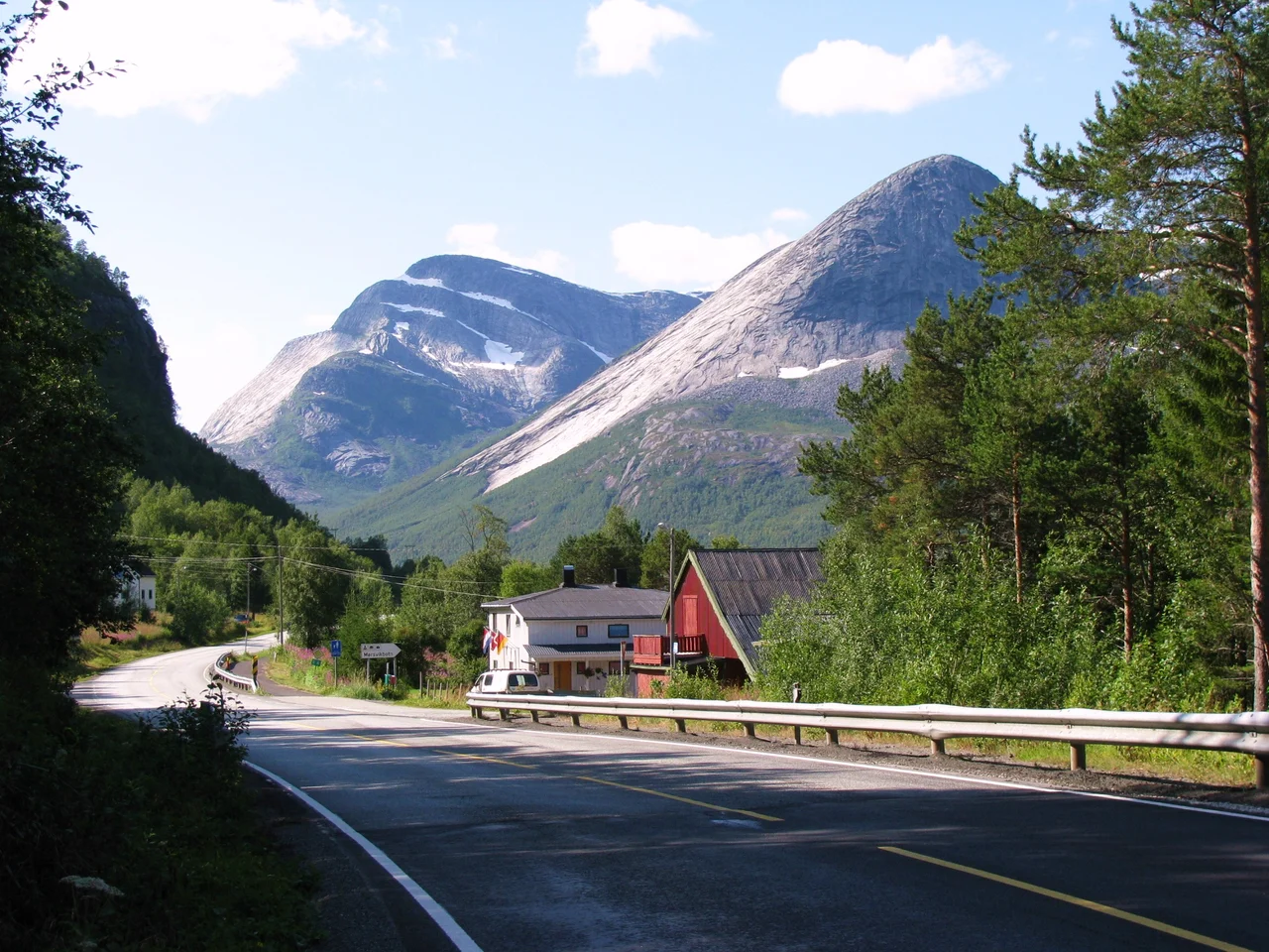

Sørfold Municipality
Sørfold covers 1,637 square kilometres and holds fewer than 1,900 people. Of that land, 141 square kilometres are permanent ice and snow, and only about 266 square kilometres — roughly one part in six — lie below the 150-metre contour. In 1987 the municipality counted just 3.2 square kilometres under active cultivation. The rest is rock, ice, fjord and forest, threaded with 249 kilometres of coastline and something close to twenty named lakes. This is a place, 120 kilometres north of the Arctic Circle, where the usable ground has to be looked for.
Two Arms of a Word Nobody Can Translate
The fjord came first, and the fjord is called Folda. Its inner reach splits into two arms — Nordfolda to the north, Sørfolda to the south — and the southern one gave the municipality its name when the old Folden Municipality was cut in half on 1 January 1887, leaving 1,946 people on the southern side and 1,347 on the northern. The prefix is easy: sør, southern. The rest of the word has resisted every scholar who has taken it on. The best anyone can offer is a guess that it once meant something like 'the broad one.' The spelling drifted from Sørfolden to Sørfold by royal resolution on 6 January 1908, and on 16 February 2024 the national government added a second official name of equal standing: Fuolldá, or Fuoldá suohkan when the full municipal form is used — Sami written back onto a map it never left.
A Turbine on a Blue Field
Most Norwegian municipalities put a ship or a saint or a stag on their arms. Sørfold, granted its coat of arms on 24 April 1987, chose a white turbine wheel on a blue ground — a design by Arvid Sveen of Vadsø, meant to stand for rivers full of rapids and waterfalls and for the money those rivers make. The same year, Statkraft finished Kobbelv power station in the north of the municipality: two Francis turbines, 300 megawatts, an average of 743 gigawatt-hours a year, all of it wrung from a 611-metre drop toward the lake Kobbvatnet, fed by seven separate reservoirs strung across the high ground. Downstream at Straumen, the administrative centre and home to about 840 people, the Elkem Salten smelter turns some of that current into ferrosilicon for the European market. It is a small economy, but it is built on exactly the thing Sørfold has too much of: water with somewhere to fall.
The Railway That Was Never Finished
About five kilometres north of the little village of Mørsvikbotn, near the lake Mørsvikvatnet, the German army ran a prisoner-of-war camp during the Second World War. The prisoners held there — mostly men taken on the Eastern Front — were put to work building the Polarbanen, a railway meant to run from Fauske to Narvik and eventually to Kirkenes. Construction began in January 1943 under Organisation Todt. Roughly 30,000 prisoners were used on the line, and an estimated one in ten of them died doing it; when Germany surrendered in May 1945 there were still some 8,300 in camps along the stretch between Fauske and Drag. The railway never got beyond Tysfjord. What is left in Sørfold is a ruin of the camp, the graded foundations of a line that carried nothing, a tunnel, some roads — and an empty cemetery for Russian soldiers, fifty metres off the left-hand side of the road just before the single concrete bridge. The men are gone from it now. The ground is still theirs.
Whatever the Ice Left
The high point of the municipality is Skagmatoppen, 1,663.6 metres, but height is not really the story here — the story is how little flat land the glaciers bothered to leave. Farms went in wherever a delta or a terrace offered a few hectares, and one of them, Kjelvik, survives as a protected cultural landscape, reachable on foot, a working answer to the question of how anyone lived on ground like this. Røsvik was a trading post. Elsewhere the settlements simply thin out. The people Sørfold has sent into the wider world tell you something about the temperament: Alfred B. Skar, born here in 1896, became a newspaper editor and trade unionist; Eivind Tverbak, born a year later, wrote novels and children's books; Oddmund Ingvald Jensen skied for Norway at the 1956 and 1960 Winter Olympics; Thor Helland ran the 5,000 metres at the 1964 Games in Tokyo. Endurance sports, in a place that requires them.
From the Air
Sørfold's centre lies near 67.22°N, 15.81°E, about 120 kilometres north of the Arctic Circle and roughly 60 kilometres northeast of Bodø. From 8,000 to 12,000 feet the shape is unmistakable: the Folda fjord system driving inland and forking into the Nordfolda and Sørfolda arms, with the E6 threading the shoreline through a long series of tunnels and across the Trengsel Bridge. Snowfields and the small icecaps of the interior stay visible into late summer, and Skagmatoppen (1,663.6 m) marks the high ground. The nearest airport by a wide margin is Bodø (ENBO); Harstad/Narvik Evenes (ENEV) lies to the north. Fjord-mouth cloud and rapid orographic build-up over the interior are the norm — expect the coast to be clearer than the mountains.
Nearby Stories
- Saltdal Municipality 6.9 km away
- Sulitjelma (mountain) 13 km away
- Saltstraumen 22 km away
- Vuoggatjålme 45 km away
- Operation Musketoon 53 km away
- Lofoten Fishery 63 km away
- Árran Lule Sámi Centre 64 km away
- 2012 Norwegian Air Force C-130 Crash 109 km away