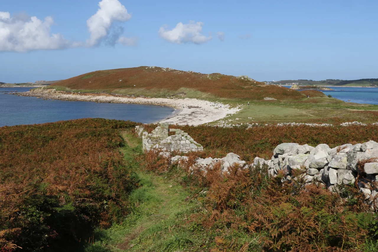

Samson, Isles of Scilly
Samson has two hills, and the people who lived there for thousands of years are all gone. The island sits between Bryher and St Mary's, 38 hectares of granite, bracken, and dune, with a single sandy isthmus tying its North Hill to its South Hill like a knot in a thrown rope. From the air the silhouette is unmistakable. From the ground it is haunted. The cottages still stand, roofless and ivy-throttled, exactly where they were left when the last families were taken off in 1855. The official reason given was poverty. The deeper reason was that an island as small and exposed as Samson cannot sustain the kind of life that thinks itself permanent.
Twin Hills, Ancient Names
The early inhabitants of the Atlantic fringe were not shy about reading the human body into the land. The twin hills of Samson sit beside the Paps of Jura in Scotland and the Paps of Anu in Ireland as breast-shaped landscape features that drew the same anthropomorphic vocabulary across the Celtic west. Whatever the islanders called them in the language now lost to us, the shape was unmistakable. Both hills also became burial grounds. Substantial prehistoric cairns crown North Hill and South Hill, the unmistakable signatures of a Bronze Age people who chose this skyline to lay their dead. The island's modern name comes from Samson of Dol, a sixth-century Welsh-born Breton saint whose missionary cult left dedications scattered across Brittany and Cornwall.
The Documented Life
The first written evidence of habitation comes from the Interregnum Survey of 1651-52, the same Parliamentary administration that had just hammered the Royalist garrison at St Mary's into surrender. Samson supported a handful of families through fishing, kelp burning, and tiny patches of cultivation in the lee of the hills. The granite walls of their cottages were built thick because the wind here is relentless: there is no shelter except what you build, and what you build leans into the gale. By the early nineteenth century perhaps thirty people lived on the island, the Webber and Woodcock families dominant among them, intermarried across generations until almost everyone on Samson was someone else's cousin.
The Eviction
Augustus Smith, the new Lord Proprietor of Scilly from 1834, was a reformer with a hard edge. He found the Samson families starving, isolated, and dependent on poor relief from the larger islands. In 1855 he removed them. The official story is that he persuaded the last residents to leave for their own good; the human story is that they had nowhere left to bargain. Smith ordered the cottages unroofed so they could not be reoccupied, then turned the entire island into a deer park, which itself failed within a few years because the deer kept swimming away to Tresco. The fields reverted to bracken. The walls remained. Today the Isles of Scilly Wildlife Trust manages Samson as a protected landscape, and the ruined cottages are catalogued, photographed, and left to the weather that finally got the better of every generation that lived here.
What Returns
Uninhabited does not mean empty. Samson is one of the most important grey seal pupping sites in the archipelago, and shelducks, oystercatchers, and ringed plovers raise their broods undisturbed along its beaches. Manx shearwaters once nested in the cairns; the island has been considered for shearwater restoration as part of the Isles of Scilly Seabird Recovery Project, which eliminated rats from the smaller islands to allow ground-nesting seabirds to return. Visitors arrive by boat in summer, walking the abandoned lanes where the field walls still mark out gardens that have not been tended for 170 years. The cairns on the hilltops are older than any of it. The Bronze Age dead chose this skyline for a reason, and the reason is still here: two hills, the sea on every side, and the long view from a place that does not pretend to be anything more than itself.
From the Air
Located at 49.93N, 6.35W between Bryher to the north and St Mary's to the east, Isles of Scilly. Best viewed at 1,000-2,000 ft AGL, the twin-hill silhouette is immediately recognisable. Nearest airport is St Mary's (EGHE) 2 nm east. Land's End (EGHC) is 28 nm east on the Cornish mainland. The roofless cottages on the eastern slope are visible from low altitude in clear conditions. No landings; the island is accessed only by tour boat in summer.
Nearby Stories
- SS Vigrid 6.2 km away
- SS Georgia (1890) 32 km away
- SS Irma (1905) 35 km away
- 1979 Fastnet Race 45 km away
- Great Wheal Charlotte 53 km away
- SM U-27 55 km away
- Wolfpack Prien 151 km away
- Tower of Hercules 715 km away