San Gregorio, California
In 1915, this tiny crossroads community one mile inland from the Pacific was home to seven cheese factories. Seven. In a village that today counts 214 residents, the idea seems almost absurd, but it speaks to a moment when San Gregorio was connected -- to San Francisco by stagecoach, to the dairy farms that quilted the surrounding hills, to a coastal economy that has since contracted to nearly nothing. Named for Pope Gregory the Great, San Gregorio sits just east of Highway 1 on Highway 84, a blink-and-miss-it collection of buildings that includes the old general store, a handful of homes, and the fading memory of a place that once boomed.
Ohlone Country
Long before Spanish missionaries or American farmers arrived, this valley belonged to the Oljon, an Ohlone people who lived along the lower drainages of San Gregorio Creek and Pescadero Creek. Their villages -- Zucigim and Pructaca appear in Mission Dolores records -- were home to an estimated 157 people led by a headman named Lachi or Lachigi. When the Portola expedition passed through in late October 1769, the Spanish found a community that was generous and welcoming. Franciscan missionary Juan Crespi recorded that the expedition camped here for three days, October 24 through 26, and described "a good-sized village of very fine, very well-behaved, fair and beaded heathens who received us with a great deal of hospitality." Crespi saw mission potential in the valley's fertile soil and flowing water, naming the site Nuestro Padre Santo Domingo. No mission was ever built here; the string of missions that followed took an inland route through San Jose instead.
Stagecoach Society
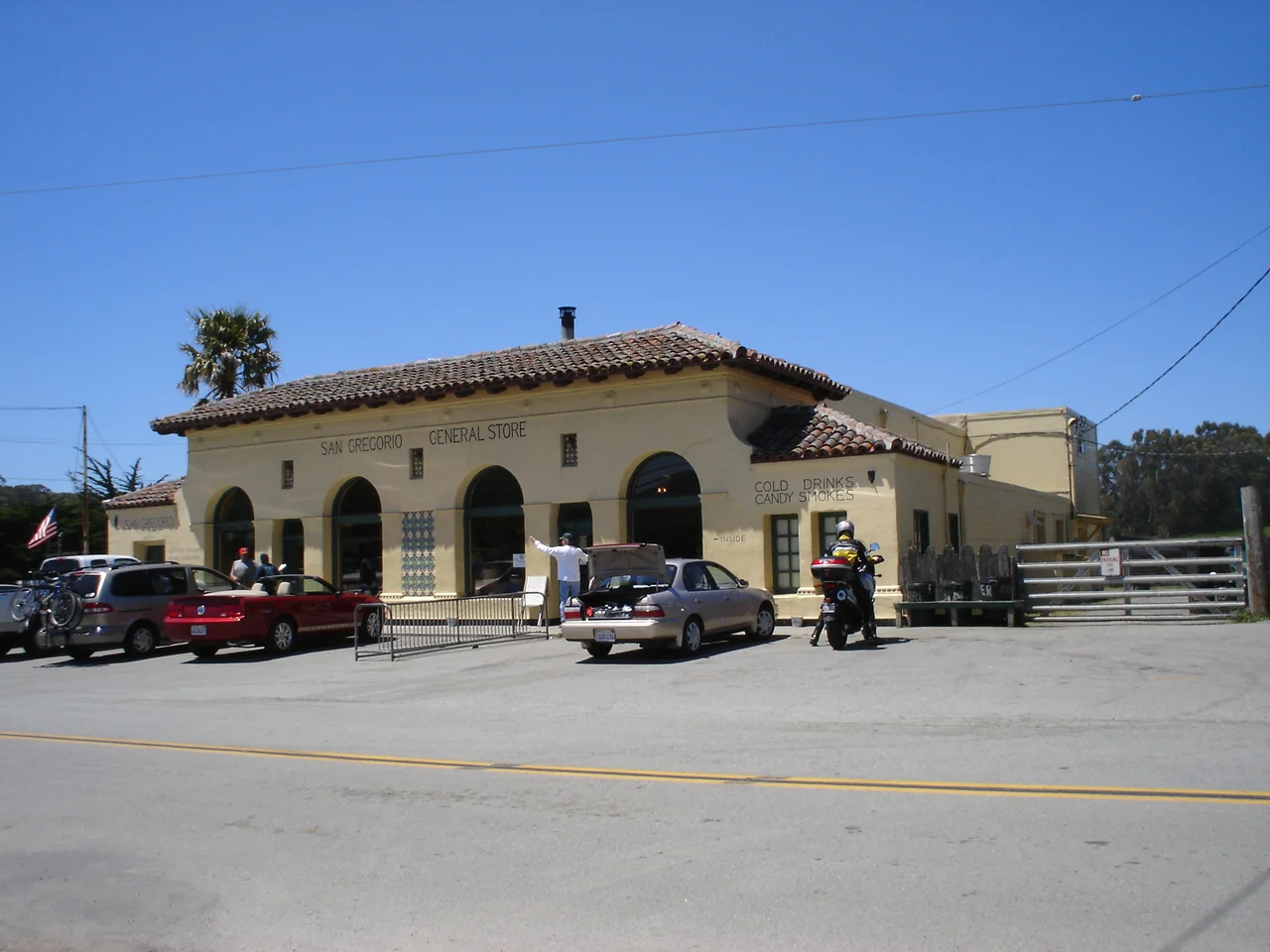
San Gregorio's boom years came in the 1850s, when wealthy San Franciscans discovered the coast. They traveled by stagecoach over the Santa Cruz Mountains to reach the San Gregorio House, a hotel that offered fishing, hunting, sea bathing, and boat races. The building still stands on Old Stage Road, listed on the National Register of Historic Places since 1977, though it has not functioned as a hotel in decades. The original stagecoach stop sits across Highway 84 from the general store, which itself has become something of a local institution, hosting weekend music sessions that draw visitors from around the Bay Area. During the Mexican era, the area was part of Rancho San Gregorio, and the transition to American settlement brought dairy farming that would define the community for generations.
Fog and Persistence
San Gregorio's climate tells you everything about why the coast developed slowly. Summer fog rolls in at night and hovers through morning, keeping temperatures cool enough that the warmest month averages just 72 degrees. Snow is rare but not unheard of: four inches fell on January 21, 1962. The wettest year on record, 1983, dumped nearly 58 inches of rain. These conditions make for excellent dairy pasture but poor real estate marketing. While Half Moon Bay and Pacifica grew with the Bay Area's postwar expansion, San Gregorio stayed small, too far from the freeway, too shrouded in fog, too content with its general store and its rolling hills. The community has served as a backdrop for several films and television episodes over the years, its photogenic isolation proving useful to productions that need a convincing nowhere. For the 214 people who live here, the nowhere is home.
From the Air
Located at 37.327°N, 122.387°W, one mile inland from the coast at the junction of Highways 1 and 84. The village is a small cluster of buildings visible along Highway 84 east of the beach. Nearest airport: Half Moon Bay Airport (KHAF), 7 nm north. San Gregorio Creek is visible flowing westward to San Gregorio State Beach. Best viewed below 2,500 ft AGL.
Nearby Stories
- Mori Point 1.9 km away
- Solar System Exploration Research Virtual Institute 2.3 km away
- Black Diamond Mines Regional Preserve 39 km away
- Mystery Spot 47 km away
- Monterey Bay Aquarium: The Cannery That Became an Ocean 53 km away
- Cordell Bank: The Invisible Island 57 km away
- The Hole in the Head 106 km away
- ʻAkaka Falls State Park 3650 km away