.jpg)
San Juan Islands National Wildlife Refuge
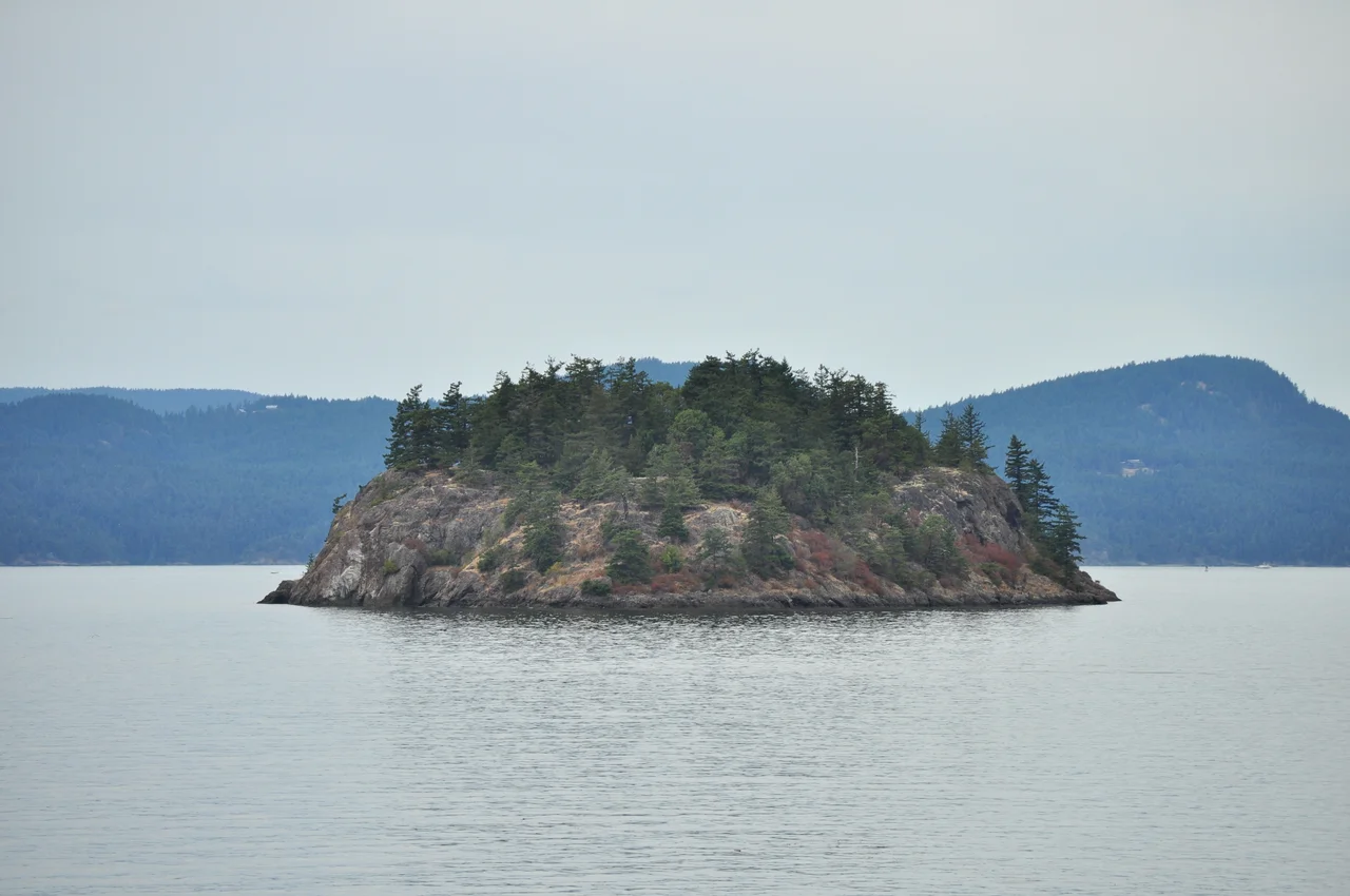
This is a national wildlife refuge you are not allowed to set foot on. Eighty-three islands make it up, scattered like spilled gravel across the San Juan archipelago in Washington's Salish Sea, and they add up to about 454 acres in total - an average of roughly five and a half acres apiece. Some are wooded knobs. Many are bare rock that barely clears the tide. Established in 1960 and consolidated with three earlier refuges in 1975, the refuge is run by the U.S. Fish and Wildlife Service, which protects its inhabitants not with fences or wardens but with distance: visitors are prohibited, and boaters are asked to stay at least two hundred yards off the shore. It is a strange kind of public land - owned by everyone, entered by almost no one.
Why Two Hundred Yards
The number sounds arbitrary until you have watched what happens when a boat comes closer. Seabirds nesting on exposed rock have no cover and no second chance; a single flush can send adults off their eggs long enough for gulls to take them, or leave chicks exposed to sun and cold. Harbour seals hauled out on a ledge will pour into the water at the first disturbance, and pups can be separated from their mothers in the rush. The buffer exists because these islands offer no room to retreat. All but three of the eighty-three are designated wilderness - the San Juan Wilderness, 353 acres, created in 1976 - which is a formal way of saying that on these rocks, human absence is the management plan.
Rocks, Grass and Cliff
For such a small total acreage, the range of habitat is wide. At one end are islets that amount to little more than a reef with a high-water mark, kelp streaming from their edges. At the other are islands big enough to carry grassland or forest. In between, and most valuable of all, are the ones with high cliffs. Vertical rock above deep water is close to ideal for nesting marine birds: inaccessible to land predators, near the food, with ledges enough for a colony. Puget Sound and the Strait of Georgia produce the feed; these scraps of stone supply the real estate. The refuge exists because the archipelago's larger, friendlier islands were long ago settled, farmed and built on, and the birds went where people would not follow.
The Tenants
About 200 species of bird pass through the islands in the course of a year. The regulars read like a catalogue of the northwest coast: gulls and cormorants, pigeon guillemots, auklets, tufted puffins, black oystercatchers working the tideline, killdeer, brant, and bald eagles watching the whole operation from the tallest available perch. Harbour seals haul out on the ledges and are common in the water around them, as are whales moving through the channels. Black brant have historically used the kelp beds here as winter feeding grounds, grazing eelgrass and algae in the shallows before continuing along the flyway. None of it is spectacle staged for anyone. It simply goes on, a few hundred yards from passing boats, unbothered as long as those boats keep their distance.
Matia, and the Other Exceptions
Three places break the rule. Five acres of Matia Island and all of Turn Island are run as state parks jointly with the Washington State Park System, and Smith Island and Minor Island are excluded from the wilderness designation. Matia is the one most people can actually reach: a cove with a dock, a five-acre campground, and a single one-mile trail that loops through the wilderness and back. It is about as modest as public access gets, and that is the point. The trail lets a handful of visitors walk through the kind of place the other eighty-two islands are, so that the refuge is not purely abstract - somewhere you have heard of and will never see. Come by boat, tie up in the cove, walk the mile, and leave the rest of it alone.
From the Air
The San Juan Islands National Wildlife Refuge is scattered across the archipelago rather than concentrated in one place; a representative point is 48.64704 N, 123.08296 W, in the northern San Juans of Washington's Salish Sea. From the air the refuge units read as the small unbuilt rocks and islets between the settled islands - no roads, no docks, no clearings, often with visible white guano staining on the nesting cliffs and kelp beds trailing downcurrent from their edges. Orient on the big islands: Orcas, San Juan, Lopez and Shaw, with Rosario Strait to the east, Haro Strait and the Canadian border to the west, and Matia and Sucia lying north of Orcas. Friday Harbor (KFHR) and Orcas Island (KORS) are the local fields, with Bellingham (KBLI) about 20 nm east and Anacortes (74S) to the southeast. Federal agencies ask pilots to remain at least 2,000 feet above wildlife refuges to avoid flushing nesting colonies and hauled-out seals, so keep any sightseeing well above that and do not circle the small islands. Marine fog is frequent in summer mornings; visibility usually improves by midday with a westerly.
Nearby Stories
- Cypress Island Atlantic Salmon Pen Break 5.1 km away
- Pacific Northwest Naval Air Museum 6.5 km away
- Koksilah Ridge 11 km away
- Montague Harbour Marine Provincial Park 14 km away
- Stz'uminus First Nation 14 km away
- Strait of Juan de Fuca 19 km away
- Race Rocks Ecological Reserve 23 km away
- Canadian Museum of Flight 26 km away