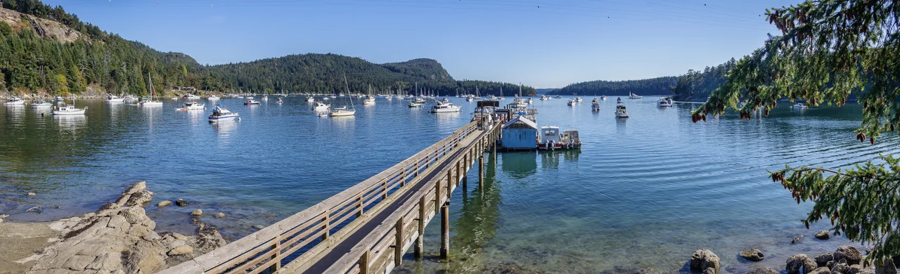

Montague Harbour Marine Provincial Park
The beach is white, and it is not sand. Walk it and you hear a faint crunch underfoot, because what you are standing on is crushed clam shell — a midden, the accumulated remains of roughly three thousand years of meals eaten within a few dozen metres of where you are standing. Montague Harbour was a large Coast Salish village for that entire span. The park that now occupies the site is best known as a summer anchorage, and on an August evening the harbour is a forest of masts, but the ground itself is an archive, and the people who built it are the reason there is anything to visit.
An Archive Made of Dinner
Shell middens are among the most informative sites archaeologists work with, because shell is alkaline and preserves bone, antler, and worked stone that would dissolve in ordinary acidic coastal soil. Seventeen archaeological sites have been identified around this harbour — extensive middens, habitation areas, and what appears to be a fish trap — including material representing the Marpole culture, and at least one midden now lying submerged below the tide line. Excavations have turned up arrowheads, spearpoints, and carved stone. Clams and other shellfish were the dependable core of the diet here, the food you could always get, and the beach is the physical record of that reliability, layer on layer on layer.
Gray Peninsula
The park wraps a low wooded peninsula reaching north into the harbour, joined to Galiano by a narrow neck with a shallow tidal lagoon on one side. In historical times the Penelakut First Nation lived on this peninsula and elsewhere on the island; Coast Salish nations were here long before Spanish ships appeared in these channels in the 1790s. Arbutus grows along the shoreline, including one specimen big enough to stop people mid-trail, its bark peeling in cinnamon sheets over smooth green wood. Sandstone shelves at the water's edge hold pools worth the time it takes to crouch and stare into them — anemones, crabs, small fish waiting out the low tide. Mount Sutil rises across the water to the south. At the lagoon, the tide does something quietly theatrical twice a day: the shallow basin drains almost entirely, exposing a floor of eelgrass and mud that herons stalk with enormous patience, then refills and turns glassy enough to mirror the trees.
Masts and Mooring Buoys
Protection is what makes an anchorage, and Montague has it: a deep, sheltered basin with good holding, easy access from both Trincomali Channel and the wider Gulf Islands cruising grounds. The park provides mooring buoys, which fill quickly in July and August. Kayakers pull out here for the night on longer island crossings. Campsites look straight out over the water, with picnic tables and pit toilets — this is not a resort, and that is the appeal. A small marina within walking distance carries basic supplies, the sort of place where you can get ice, a chart, and an opinion about the weather. A memorial in the park remembers those lost in the Cap Rouge II shipwreck - a reminder, among all the holiday masts, that this is working water and has always taken its toll.
Getting Here Is Part of It
There is no bridge to Galiano. You arrive by BC Ferries from Swartz Bay on Vancouver Island or Tsawwassen on the mainland, landing at Sturdies Bay about six kilometres from the park, or you arrive under your own power — hull, paddle, or float. The park was established in 1959, early in the province's thinking about protecting marine landscapes rather than just terrestrial ones, and the logic holds up. A marine park protects the anchorage, the shoreline, the intertidal zone, and the seabed as one system. Here it also happens to protect three thousand years of somebody's home.
From the Air
Montague Harbour sits at 48.901°N, 123.405°W on the west side of Galiano Island, in British Columbia's Gulf Islands between Vancouver Island and the mainland. Fly it at 2,000 to 4,000 feet for the best read of the geography. Galiano is the giveaway from the air: a long, narrow, ruler-straight island running northwest to southeast along Trincomali Channel, with Montague Harbour indenting its southwestern shore behind the low hook of Gray Peninsula. The white shell beach shows as a bright line against darker shoreline — genuinely visible from altitude in good light. Mount Sutil rises just south of the harbour, Sturdies Bay and the ferry terminal sit at the island's southeast end, and Active Pass — the narrow, current-swept channel carrying the Tsawwassen–Swartz Bay ferries — cuts between Galiano and Mayne Island nearby. Floatplanes serve Montague Harbour and Sturdies Bay directly from Vancouver's harbour; Victoria International (CYYJ) lies about 25 nautical miles south, Vancouver International (CYVR) about 20 nautical miles northeast across the Strait of Georgia, and Vancouver Harbour Water Aerodrome (CYHC) handles the scheduled float traffic. The Gulf Islands' rain shadow makes this one of the sunniest pockets on the coast, though fog can fill the channels on autumn mornings and strong outflow winds funnel through the passes in winter.
Nearby Stories
- Waldron Island 0.9 km away
- Lily Point Marine Reserve 2.9 km away
- Station Square collapse 3.3 km away
- Red Gap, British Columbia 6.3 km away
- Harris Creek Sitka Spruce 8.4 km away
- Kinsol Trestle 9.2 km away
- Youbou, British Columbia 12 km away
- Bowen Island 23 km away