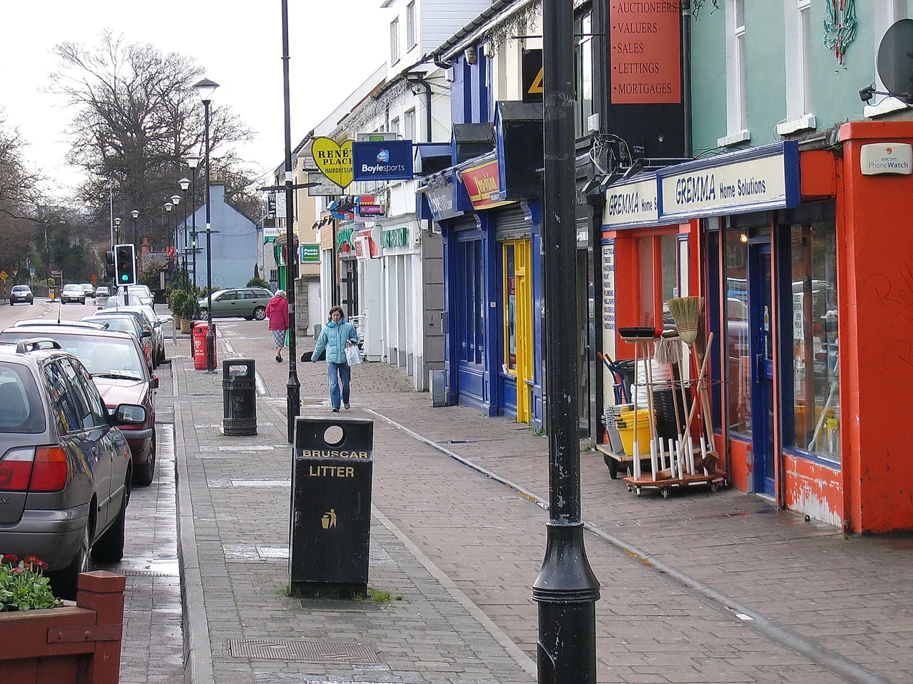

Shankill, Dublin
The name is older than anything you can see. Shankill comes from Seanchill, Irish for old church - a foundation so ancient that no one remembers exactly when it was built or who built it, only that by the thirteenth century there was already an Archbishop ordering forests cleared around it. The suburb that took the name now runs from the Irish Sea inland to the foothills of the Dublin Mountains, fourteen thousand people living in a stretch of coast where Killiney Bay ends and Bray begins. The view from Carrickgollogan Hill, the 278-metre lump to the west, takes in most of it: a Victorian landlord's ambition, an evicted village rebuilt on a neighbour's charity, and the strange ruined chimney of a lead smelter that once polluted half of south Dublin from a mile-long stone flue.
The Landlord Who Ruined Himself
Sir Charles Compton William Domvile inherited Shankill in the mid-nineteenth century with a grand vision: gentrify the coastal village into Georgian-style squares and terraces, the sort of place wealthy Dublin professionals would commute home to. He laid out new roads, ran water mains down from the Vartry Reservoir, and started building. He also evicted more than a hundred tenants during a period of brutal rural poverty, halving the population of Shankill and Rathmichael through the 1860s. Many of the evicted ended up in the Rathdown Work Union, the workhouse that is now Loughlinstown Hospital. Domvile's own debts mounted as the building projects swallowed his fortune. He went bankrupt before completing what he had imagined. The grand houses he did finish still stand; the village he destroyed had to be rebuilt by someone else.
Tillystown
That someone else was Benjamin Tilly, a landowner with holdings just across the townland boundary in Shanganagh. As Domvile threw families off his estate, Tilly offered them quarter-acre plots along what is now Shanganagh Road. By 1871 there were over sixty houses on his strip of land, and the new settlement was simply called Tillystown after the man who had made it possible. By the early twentieth century the name had drifted and Tillystown became, in common usage, Shankill proper. In 1911 another tract called New Vale was developed nearby as labourers' cottages. Modern Shankill grew out from these small acts of generosity rather than from any planned scheme. It is one of the few Dublin suburbs that can point to a specific moment of kindness as its founding story.
Puck's Castle and the Missing Girl
Puck's Castle is not really a castle. It is a fortified house, built in the late sixteenth century on a rise inland of the modern suburb, and named, depending on which story you believe, either for a ghost or for the puca - the shape-shifting trickster spirit of Irish folklore that gives Shakespeare's Puck his name. In 1690, after losing the Battle of the Boyne, James II and the remnants of his army are said to have sheltered here while fleeing south. Nearly two centuries later, in June 1867, the castle gathered a darker story. Jane Eleanor Sherrard, daughter of a local English family, walked out to pick flowers for the dinner table. The local postman last saw her gathering blooms at the foot of the castle's northern wall. She never came home. A widespread search turned up nothing. The Sherrards lost their daughter that summer, and a hundred and fifty-eight years later no one has ever explained how.
The Chimney on the Hill
The most striking thing about Shankill seen from a distance is something most visitors never associate with the suburb at all: the granite chimney standing on Carrickgollogan Hill, visible from much of southeast Dublin. It belonged to the Ballycorus Leadmines, where ore was smelted from the early nineteenth century until 1913. The smelting fumes were vented through a mile-long stone flue that snaked up the hillside to the chimney, where the lead-laden smoke was supposed to dissipate harmlessly into the wind. It did not. Cattle nearby were poisoned. Workers were poisoned. The flue itself, partly collapsed but still walkable in stretches, is one of the few intact industrial archaeology pieces of its kind in Ireland. The chimney, the flue, and the ruined ore-dressing buildings remain, slowly being absorbed into the Carrickgollogan walking trails as if industry had only been a brief, toxic dream the hill is now waking from.
Lost to the Sea
The Irish Sea has been chewing at Shankill's edge for as long as anyone has been keeping records. The medieval village of Longnon once stood about two hundred yards east of what is now Quinn's Road beach; it was obliterated entirely by coastal erosion, and no trace remains. The original Kingstown-to-Bray railway line, opened in 1854, hugged the coast so closely that in places the rails ended up barely five metres from the sea. A coastal wall was thrown up between Killiney and Bray to slow the erosion; you can still see fragments along the strand. The line itself had to be moved inland in 1915, swung onto the so-called Shanganagh Diversion that the DART now runs on. The old route is gone. So is Longnon. The sea is patient and Shankill, like most Irish coastal places, has learned not to argue with it for long.
From the Air
Shankill sits at approximately 53.226 degrees N, 6.124 degrees W on the southeast coast of County Dublin, between Killiney Bay to the north and Bray Head to the south. The area runs from sea level on the coast up into the foothills of the Dublin Mountains, with Carrickgollogan Hill (278 m) as the most prominent inland landmark - look for the ruined granite chimney of the Ballycorus Leadmines on its summit, visible from much of southeast Dublin. Dublin Airport (EIDW/DUB) lies 22 km north; approach traffic from the south frequently passes overhead. Weston Airport (EIWT), the main general-aviation field, sits 28 km northwest. The nearest field is Newcastle Aerodrome (EINC), a small grass strip 18 km west. Best viewing altitude 2,500-4,000 ft. From altitude the coastal scallop from Killiney down to Bray Head is the dominant feature; the M11 motorway runs inland of the suburb. Maritime Irish weather - low cloud, frequent showers, westerly winds.
Nearby Stories
- Malahide Castle 1.2 km away
- Castlemartin House and Estate 6.4 km away
- Avoca, County Wicklow 8 km away
- Trim, County Meath 15 km away
- German submarine U-1051 29 km away
- County Carlow 29 km away
- HMS Tyler 32 km away
- Irish Sea Bridge 46 km away