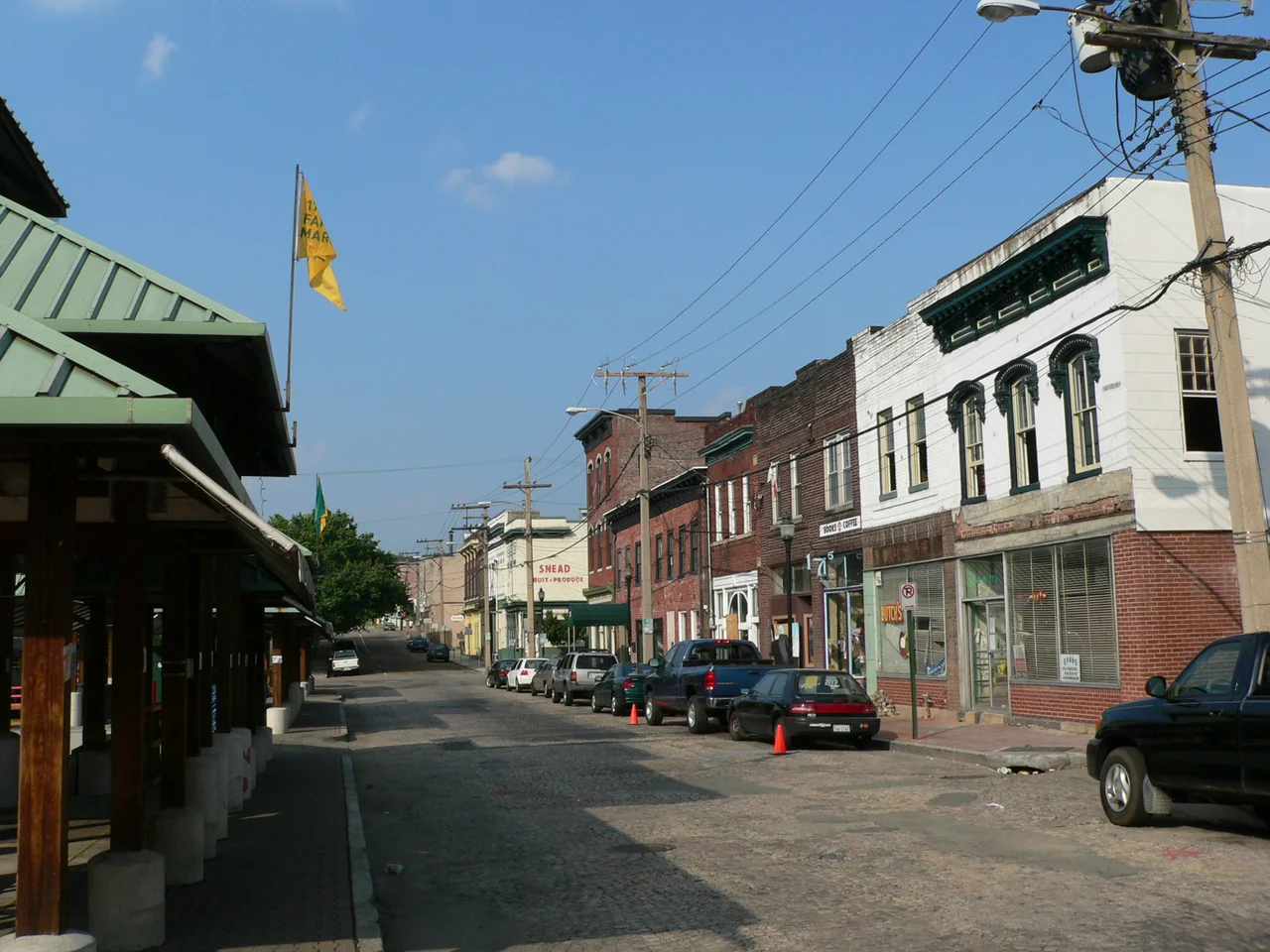

Shockoe Bottom
In the antebellum decades before the Civil War, more enslaved Africans were bought and sold here than anywhere in the United States outside New Orleans. The valley below Shockoe Hill, beside the falls of the James, was the country's second-largest domestic slave-trading center. Fifteenth Street was called Wall Street because of the money that flowed through it. Sixty-nine slave dealers and auction houses operated within a few blocks. Today the same streets hold restaurants, apartments converted from tobacco warehouses, a farmer's market, and a train station. Beneath them - and partly beneath Interstate 95 - lies the ground where Richmond buried the people the auction houses sold. This is a neighborhood whose surface and whose underneath tell very different stories about the same place.
A Bottom Between Two Hills
Shockoe Bottom, historically called Shockoe Valley, lies just east of downtown Richmond between two of the city's original hills: Shockoe Hill to the north, Church Hill to the south. Colonel William Mayo's 1737 plan of Richmond included most of this ground, making the Bottom one of the city's oldest neighborhoods. It took its name from the 1730 Tobacco Inspection Act, which sited a public warehouse here on land owned by William Byrd II. By the late eighteenth century the valley held the city's tobacco scales, the Federal Customs House, and Mayo's Bridge - completed across the James in 1788. When Virginia's capital moved to Richmond, the Bottom became the city's working waterfront, its commercial heart, and the staging ground for everything moving in or out of the upper James.
The Slave Trade That Built Richmond
By the 1830s, the domestic slave trade made Shockoe Bottom one of the largest markets for human beings in the Western Hemisphere. After the international slave trade was outlawed in 1808, slave-owning regions of the upper South - exhausted tobacco land in Virginia, Maryland, Kentucky - sold enslaved people 'down the river' to the cotton plantations of the Deep South. Richmond was the trade's eastern terminus. More than sixty-nine slave dealers and auction houses operated in the blocks around Fifteenth Street, which locals called Wall Street for the volume of capital moving through it. Robert Lumpkin's slave jail on Wall Street - known as the Devil's Half-Acre - held enslaved people awaiting auction in conditions so brutal the nickname stuck for generations. The wealth of Richmond, the fine townhouses on Church Hill, the bank buildings of Capitol Square - much of it was built on the bodies of people sold here. The trade did not end until Union troops took the city in April 1865.
The Burial Ground Beneath the Highway
The people sold from Lumpkin's Jail had to be buried somewhere. The first municipal burial ground for enslaved and free Black Richmonders - now called the Shockoe Bottom African Burial Ground - sat at Fifteenth and East Broad Street, a few yards from the jail itself. It operated from at least the 1750s until 1816, when overcrowding forced its closure and the burial ground was moved up to Shockoe Hill. For most of the twentieth century the Bottom site was a commercial parking lot, most recently leased by Virginia Commonwealth University. In 2011, after a decade of community organizing, the city reclaimed the surface as a memorial park. Part of the burial ground still lies beneath Interstate 95, which was driven straight across it in the 1950s without acknowledgment. The remains of an unknown number of Black Richmonders are still down there, under the southbound lanes.
The 1865 Fire and the Rebuilt Streets
On the night of April 2, 1865, with Union troops approaching, evacuating Confederate forces were ordered to burn the city's tobacco warehouses to keep them out of Federal hands. The fires got loose. They swept through Shockoe Slip, the commercial district immediately west of the Bottom, and through several other blocks. What survived was rebuilt quickly through the late 1860s and 1870s, producing much of the brick warehouse stock that now defines the neighborhood. The Bottom kept its working-port character through the early twentieth century, warehousing tobacco and grain. It began to decline in the 1920s as automobile traffic and downtown growth pulled commerce elsewhere. The Tobacco Exchange, which had been the heart of the district, was demolished in the 1950s.
Memory, Memorial, and Flood
Modern Shockoe Bottom is contested ground. The 1995 completion of the James River Flood Wall and Canal Walk made the Bottom developable again after centuries of periodic flooding. Old tobacco-row warehouses became apartments. Then in 2004, Hurricane Gaston flooded Shockoe Creek's basin and shut businesses down for months. In 2014 the National Trust for Historic Preservation named Shockoe Bottom one of America's 11 Most Endangered Historic Places, in response to 'Revitalize RVA' - a city plan to build a minor league baseball stadium, a slavery museum, a Hyatt hotel, and a Kroger here. The mixed-use scheme failed; the slavery museum did not. As of 2020 the city was still pursuing a Shockoe-Bottom memorial centered on the Lumpkin's Jail / Devil's Half-Acre site, with the Sacred Ground Historical Reclamation Project and other groups demanding the ground itself be honored - not redeveloped over. The work is still unfinished. The dead are still under the road.
From the Air
Shockoe Bottom sits at 37.5345 N, 77.4325 W, in the valley between Shockoe Hill and Church Hill, immediately east of downtown Richmond. From the air, look for the bend of the James River at the falls, the I-95 corridor running south-to-north through the neighborhood, and Richmond Main Street Station's clock tower at the south edge. The nearest major airport is Richmond International (KRIC), about 6 nm to the east. Recommended viewing altitude is 1,500-2,500 ft AGL to take in the river, the old warehouse blocks, and the brutal cut of I-95 across the historic burial ground.
Nearby Stories
- Kings Dominion 8.4 km away
- Battle of Hatcher's Run 9.7 km away
- Francisco's Fight 14 km away
- Piney Grove at Southall's Plantation 17 km away
- Jamestown Settlement 19 km away
- Battle of Amelia Springs 22 km away
- Menokin 29 km away
- Highland (James Monroe House) 42 km away