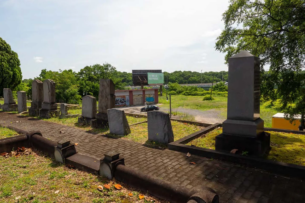

Shockoe Hill Burying Ground Historic District
When the city of Richmond bought a 28-acre parcel on its northern outskirts in 1799, the planners intended to put everything they did not want in the city center on it. Poor people who could not pay their rent. Sick people with contagious diseases. Bodies that needed burial. Gunpowder that might explode. The hanged. Over the next century the hilltop became Richmond's municipal back room - an almshouse, a hospital, a powder magazine, a gallows, and three burial grounds, segregated by race and economic class. The district was officially listed on the National Register of Historic Places on June 16, 2022. What it records is not pleasant. What it preserves is the truth.
The City's Periphery
The Shockoe Hill Burying Ground Historic District occupies land bounded by East Bates Street to the south, the Virginia Passenger Rail Authority right-of-way to the north, Second Street to the west, and the historic edge of Shockoe Creek to the east. The City of Richmond acquired most of it in 1799 to handle several functions at once, all at the edge of town. This was deliberate - the New Republic was experimenting with municipal services after the disestablishment of the Anglican Church, and Richmond, like other young American cities, was working out how to take care of (and how to discipline) the poor, the sick, the dying, and the dead. The district illustrates that experiment through the New Republic, Antebellum, Civil War, Reconstruction, and Jim Crow eras.
Six Sites on One Hill
Three properties in the district have long been recognized: The Almshouse, the Shockoe Hill Cemetery, and the Hebrew Cemetery, each individually listed on the Virginia Landmarks Register and the National Register. Three more sites were newly identified during the historic district nomination: the City Hospital and Colored Almshouse Site, the City Powder Magazine Site, and the Shockoe Hill African Burying Ground. The district was also the location of the city gallows. Every function that the antebellum and post-bellum city wanted to push to its periphery ended up here - the people who could not be supported, the people who could not be healed, the people who could not be granted a proper white cemetery, and the people whose deaths the state itself carried out.
The Largest in America
The Shockoe Hill African Burying Ground - the largest of the three burial grounds and the most painfully erased - holds the conservatively estimated remains of more than twenty-two thousand free Black Richmonders and enslaved Africans, making it likely the largest such burial ground in the United States. It opened in 1816 and closed in 1879 due to overcrowding. For most of the twentieth century the city denied it existed - the markers were removed, the land was sold off, and roads, a rail line, and Interstate 64 were driven across the graves. The burial ground was rediscovered through the descendant research of Lenora McQueen, whose work eventually pushed the entire historic district onto the National Register. It is one of 'Virginia's Most Endangered Historic Places,' threatened today by the DC2RVA high-speed rail project, the proposed east-west Commonwealth Corridor, the widening of Interstate 64, and miscellaneous infrastructure work that continues to disturb the graves.
Almshouse and Hospital
The Almshouse - Richmond's municipal poorhouse - is the most visible surviving building in the district. It was rebuilt in 1860-1861 after an earlier structure burned. Across its long life it housed indigent Richmonders, smallpox patients, Confederate wounded, and after Emancipation, Black residents of the city's Colored Almshouse, which opened in the converted City Hospital building in April 1868. The City Hospital itself, mapped in 1842, sat directly east of the walled Shockoe Hill Cemetery and tended the city's contagious-disease patients - the people no other institution could legally house. After the war the building was repurposed, and after it was demolished its grounds passed quietly into the African Burying Ground. Together the almshouse, the hospital, and the burial ground recorded Richmond's relationship to the most vulnerable people who lived and died inside its city limits.
A District That Tells the Truth
The listing in March 2022 on the Virginia Landmarks Register, followed by the National Register listing on June 16, 2022, did not change a single street, building, or fence on Shockoe Hill. What it changed was the official story. For the first time, a federal designation acknowledged that the almshouse and the cemeteries belonged together, that the Black burial ground was as central to the city's history as the marble obelisks of the white cemetery next door, and that the gallows, the powder magazine, and the smallpox hospital were not footnotes but part of the main text. The Shockoe Hill Burying Ground Historic District is not a monument. It is an acknowledgment. The dead - twenty-two thousand and counting - are still down there, still threatened by rail and highway and infrastructure plans. The district designation is a statement that they are owed better. Whether they get it is still being decided, plan by plan, hearing by hearing, on the same hill.
From the Air
The Shockoe Hill Burying Ground Historic District sits at 37.5514 N, 77.4294 W, in northern downtown Richmond. From the air, the district covers the cluster of cemetery walls and the wedge of land between Hospital Street and the CSX rail line, just east of I-95 and west of the medical college. The Hebrew Cemetery walls and the walled Shockoe Hill Cemetery are visible as discrete green rectangles; the unmarked African Burying Ground extends to the east. The nearest major airport is Richmond International (KRIC), about 6 nm to the east. Recommended viewing altitude is 1,000-2,000 ft AGL.
Nearby Stories
- Kings Dominion 8.4 km away
- Battle of Hatcher's Run 9.7 km away
- Francisco's Fight 14 km away
- Piney Grove at Southall's Plantation 17 km away
- Jamestown Settlement 19 km away
- Battle of Amelia Springs 22 km away
- Menokin 29 km away
- Highland (James Monroe House) 42 km away