
Siege of Fort Macon
Colonel Moses J. White's reply read like a man with no good options trying to pretend otherwise: I have the honor to decline evacuating Fort Macon. The Union general who had asked the question, John G. Parke, had already cut White's communications, taken Beaufort, Newport, Morehead City, and Carolina City, and was moving siege artillery onto Bogue Banks. The fort was a generation out of date. Its walls were brick. Its defenders had three days' ammunition. The siege would last thirty-four days, but the actual fight took one.
An Out-of-Date Fort
Fort Macon was built between 1826 and 1834, one of the Third System coastal forts the United States constructed after the War of 1812. It guarded the channel into Beaufort and Morehead City from the eastern end of Bogue Banks, designed to repel wooden warships whose smoothbore cannons could not accurately fire on stone from a rolling deck. The fort was built for a war that never came. By the 1850s, rifled artillery had begun to render masonry forts vulnerable, but no one updated Macon. By the eve of the Civil War, the entire garrison consisted of a single sergeant. When North Carolina troops under Captain Josiah Solomon Pender seized the fort on April 14, 1861, before the state had even seceded, only four guns were mounted.
Burnside's March
Brigadier General Ambrose E. Burnside's North Carolina Expedition launched in January 1862. Roanoke Island fell in February. Elizabeth City and New Bern followed. By March 14, Burnside controlled most of the eastern North Carolina sounds, but he could not use the ports at Beaufort and Morehead City while Fort Macon still flew the Confederate flag. He ordered Brigadier General John G. Parke to reduce it. Parke moved methodically: Carolina City on March 21, Morehead City on March 22, Newport on March 23, Beaufort on March 25. The Newport rail bridge, burned by retreating Confederates, had to be rebuilt before siege artillery could be moved into position. Inside the fort, White had 430 men, sickness reducing the count by a third, with morale that the official reports described carefully as not good.
One Day of Bombardment
Parke established four batteries hidden behind the sand dunes: four 8-inch mortars at 1,200 yards, four 10-inch mortars at 1,600 yards, three 30-pounder Parrott rifles at 1,300 yards, and a 12-pounder boat howitzer at 1,200 yards. They opened fire at dawn on April 25, 1862. The Confederate gunners replied vigorously at first, but their shots could not reach the Union batteries protected by the dunes. Four Navy steamers from the blockading squadron joined the bombardment, but rough weather made naval gunnery impractical, and they withdrew after about an hour. Then a Signal Corps officer in Beaufort, Lieutenant William J. Andrews, started relaying range corrections to the mortar batteries. After noon, virtually every shot landed on target. Nineteen of the fort's guns were dismounted. The walls began to crumble.
Ten Dead
At 4:30 in the afternoon, Colonel White raised the white flag. The fort's magazine was about to be breached. Further resistance meant his men dying for nothing. Parke at first demanded unconditional surrender, but White referred to the parole terms Burnside had offered on March 23, and Burnside, weighing the cost of one more day of bombardment, agreed to honor them. The defenders gave their paroles, promised not to take up arms against the United States until properly exchanged, and were permitted to return home with their personal property. On the morning of April 26, the Confederate flag came down. Soldiers of the 5th Rhode Island marched in. The cost of the entire siege: one Union soldier killed, three wounded; seven Confederates killed outright, two more dead of wounds, sixteen wounded. The captured flag was returned to North Carolina in 1906, in a Senate Chamber ceremony attended by aged veterans of the siege.
From the Air
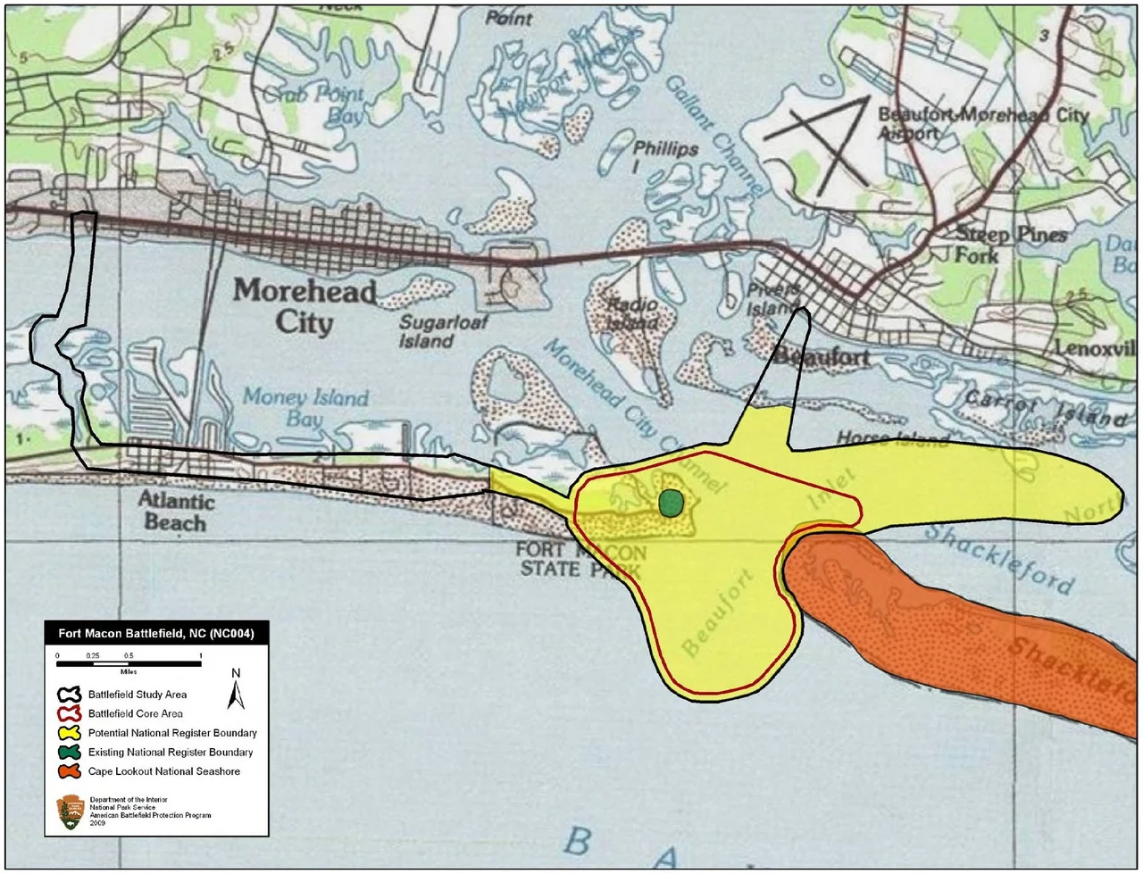
Located at 34.70 N, 76.68 W on the eastern tip of Bogue Banks, now Fort Macon State Park. The fort sits just inside Beaufort Inlet, with the historic battlefield extending west along the dunes where the Union batteries were positioned. Best viewed from 1,500-3,000 feet to see the fort's pentagonal star shape, the dune line, and the inlet geometry that made the position strategic. Nearest airports: KMRH (Beaufort/Michael J. Smith Field) 4nm north, KNKT (MCAS Cherry Point) 18nm north. Fort Macon State Park is North Carolina's second most-visited state park; watch for low-altitude sightseeing traffic on clear weekends.
Nearby Stories
- Lejeune High School 1.3 km away
- Jones County, North Carolina 4.1 km away
- Arapahoe, North Carolina 5.2 km away
- Portsmouth, North Carolina 23 km away
- Topsail Beach, North Carolina 28 km away
- HMT Bedfordshire 34 km away
- Ocracoke, North Carolina 53 km away
- Mercury-Redstone 4 771 km away