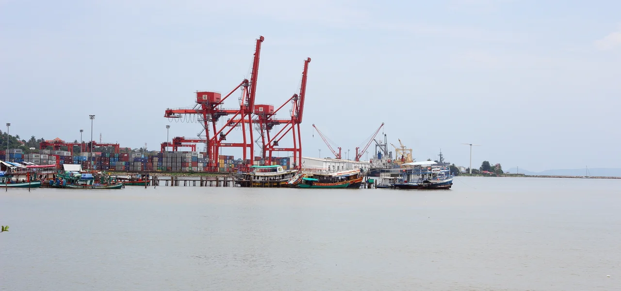

Sihanoukville Autonomous Port
In April 1960, Louis Jacquinot, a minister of state in the French government, stood on a raw concrete quay at the edge of the Bay of Kampong Som and declared Cambodia's first deep-water port open. France had paid for it — twelve million US dollars — and the entire point of the enterprise was to loosen France's grip. Until that year, nearly everything Cambodia sold to the world went out through Saigon. The berths behind Jacquinot changed the arithmetic of an independent country's trade in a way that no treaty had managed to.
A Coastline With Nowhere to Dock
Cambodia had a coast. What it did not have was anywhere an ocean-going ship could tie up. Kampot, the country's only marine port, sat roughly five kilometres up the Tuk Chhou River, too shallow for deep-draught vessels. The river port at Phnom Penh, on the Tonle Sap, could take ships of up to 3,000 tons in the dry season and 4,000 in the wet — adequate for regional traffic, hopeless for a freighter. Under the French protectorate this was never treated as a problem worth solving. The colonial administration sent international cargo through Saigon and distributed it inland along the Mekong, and that arrangement worked perfectly well so long as one government held both ends of it. Then, in 1953, France granted independence to Cambodia and Vietnam in the same season, and Cambodia's access to the open sea abruptly ran through somebody else's country.
One Hundred and Thirty-Seven Beams
Work began in 1955 on four berths at what became known as the Old Jetty. The hardest part was the decking. When the original pier was laid in 1958, it rested on 137 pre-stressed concrete beams, each 35 metres long and weighing around 90 tons. They were cast on site — nothing that heavy was going to arrive by ship — and once cast they proved almost impossible to manoeuvre. The engineers' answer was to build a small railway whose only job in the world was to carry beams from the casting yard to the water's edge. A city grew up around the work. Sihanoukville was founded in the same period and named in honour of Norodom Sihanouk, and for decades the town and the port were effectively the same project wearing different clothes.
Nine Berths and a Metre of Tide
The port that exists today reads, on paper, as a set of unglamorous numbers: nine berths, 1,330 metres of total quay length, a maximum draught of 8.5 metres. The tidal variation is just 1.4 metres, which is the sort of detail that never makes a brochure and quietly governs everything — a small tide means a berthing schedule that barely has to bend around the moon. Extensions arrived in layers over sixty years. A tanker terminal. An industrial effluent treatment plant. A container terminal finished in March 2007, 400 metres of quay dredged to 10.5 metres and backed by a container yard of six and a half hectares. Each addition was a bet that more of Cambodia's trade would arrive by sea, and each bet paid.
The Only Deep Water in the Country
It remains Cambodia's sole deep-water port, which is a strange kind of responsibility for a single organisation to carry. The state corporation that runs it, known simply as PAS, employs more than a thousand people and answers to a board appointed across several government ministries. In 2003 it bought the remaining 70 percent of the CWT dry port outside Phnom Penh, making it the sole owner of the inland terminal that receives much of what it unloads. In June 2017 it listed on the Cambodia Securities Exchange. The traffic curve tells the rest: 255,378 twenty-foot containers handled in 2012, and 641,842 in 2020. In 2018 alone the port cleared US$8.7 million in profit, up 43 percent on the year before, on 5.2 million tonnes of cargo. Jacquinot cut a ribbon on four berths. What he opened was the country's front door.
From the Air
The port occupies the eastern shore of the Bay of Kampong Som at 10.6455°N, 103.497°E, on Cambodia's south-west coast. From 4,000 to 6,000 feet the layout is unmistakable: a long straight quay line with container stacks in blocked colour behind it, oil tanks to the south, and the wooded hump of Sihanoukville Mountain rising immediately west between the port and the beaches. Sihanouk International Airport (VDSV / KOS) lies about 18 km east-south-east; Phnom Penh International (VDPP) is roughly 200 km north-east. Best light is mid-morning before the sea breeze builds haze. From May to October the monsoon can bury the whole coastline under low cloud, and the offshore islands — Koh Rong to the west, Koh Puos just off the city beaches — make better visual anchors than the port itself in poor visibility.
Nearby Stories
- Kampot 12 km away
- Koh Ach Seh 28 km away
- Cambodian campaign 33 km away
- Tatai Wildlife Sanctuary 33 km away
- Mayaguez Incident 45 km away
- Koh Kong Island 48 km away
- Koh Poulo Wai 52 km away
- Koh Kong 110 km away